 |
|||
Suggested Flies for South Fork Kern: | |||
|
Other Local Favorites: Dry Flies: |
Nymph Flies: |
Streamer Flies: |
|
|
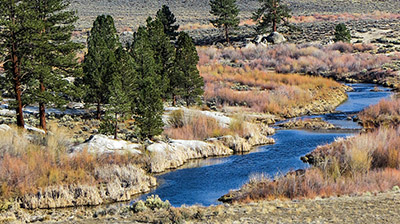
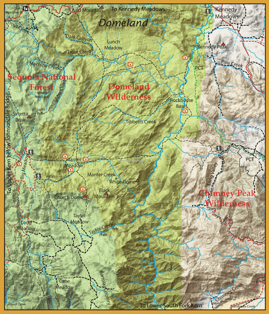
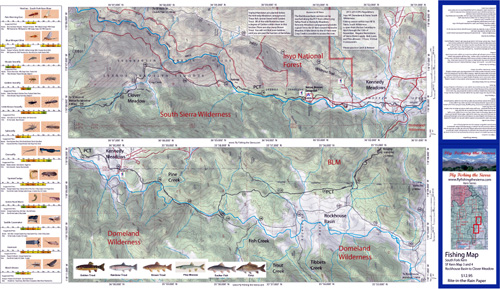
Directions: 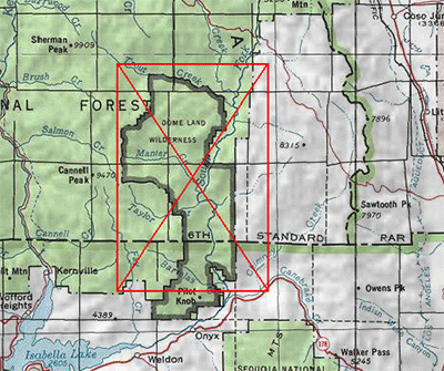 Domeland Wilderness is located northeast of Lake Isabella about 70 miles northeast of Bakersfield. Trailheads on the east side are near Rockhouse Meadow and at the Long Valley Campground (BLM). Access is via Nine Mile Canyon Road from US Highway 395 or Chimney Peak Road via State Highway 178. West side trailheads are at Big Meadow and Taylor Meadow. Two trails from Big Meadow can be reached from Kernville via Mountain Road 99, Sherman Pass, and Cherry Hill Roads. Leading to Manter Meadow, the upper Big Meadow Trail is a rugged hike while the lower Big Meadow Trail follows more gentle terrain. The trail from Taylor Meadow (southeast of Big Meadow) also leads to Manter Meadow as well as Taylor and Church Domes. Northside access is available from the Blackrock/Sherman Pass Road via the Dark Canyon and Woodpecker Trails. | |||
|
| |||
|
Notes: | |||
Fishing Regulations (Effective March 1st, 2021)South Fork Kern River: From the last Saturday in April through November 15, 5 trout daily bag limit, 10 trout in possession; and, from November 16 through the Friday preceding the last Saturday in April, 0 trout bag limit, artificial lures with barbless hooks only and trout must be released unharmed and not removed from the water. Other Rivers and Streams: From the last Saturday in April through November 15, 5 trout daily bag limit, 10 trout in possession; and, from November 16 through the Friday preceding the last Saturday in April, 0 trout bag limit, artificial lures with barbless hooks only and trout must be released unharmed and not removed from the water. All other Lakes: Open all year. No restrictions. 5 trout per day. 10 trout in possession.
| |||
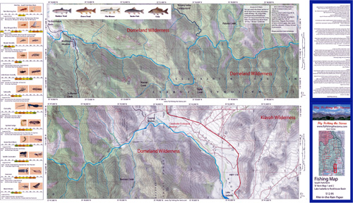
Fishing Maps AvailableSouth Fork Kern 1 & 2, Lake Isabella to Rockhouse Basin Covers the water between Lake Isabella and Rockhouse basin. Shows camping areas, trails, and creeks. Special Features are the Hatch Chart, Fishing Season and Regulations, and Stream Etiquette guidelines. |
 |
$12.95 ea |
|
|
South Fork Kern 3 & 4, Rockhouse Basin to Clover Meadow Covers the water between Rockhouse Basin to Clover Meadow. Shows camping areas, trails, and creeks. Special Features are the Hatch Chart, Fishing Season and Regulations, and Stream Etiquette guidelines. |
 |
$12.95 ea |