|
Notes: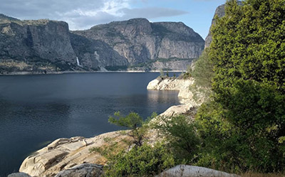
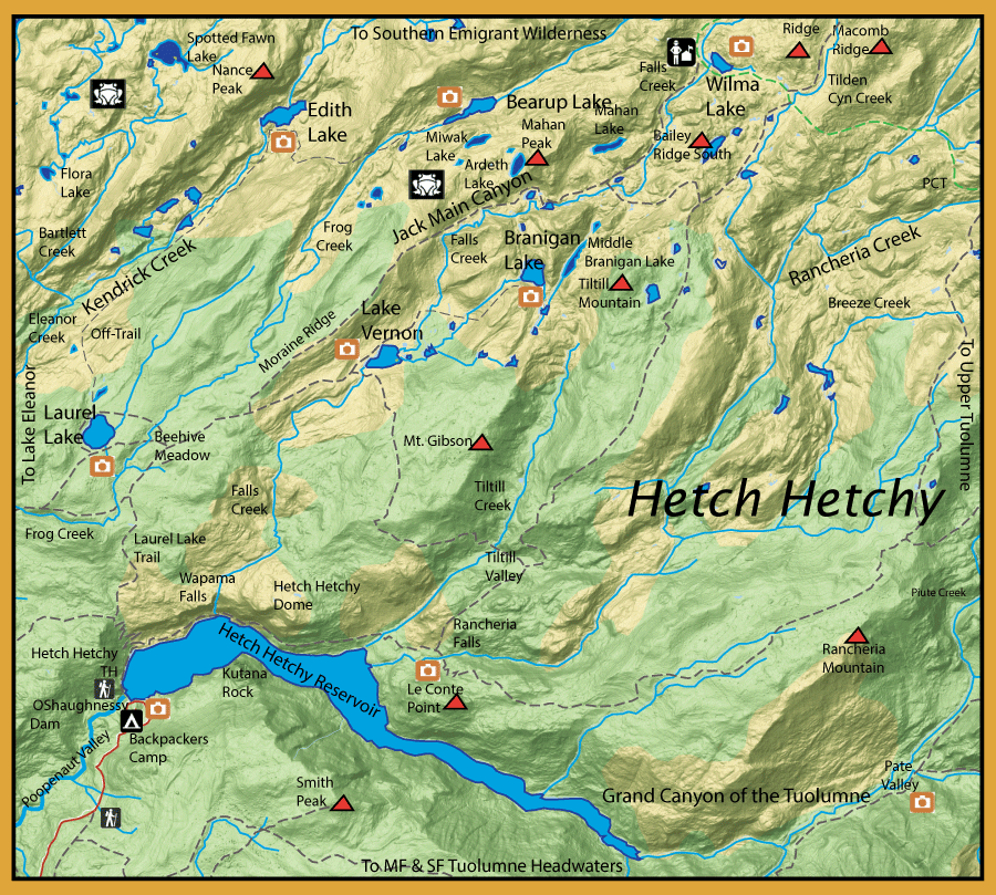
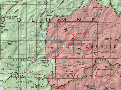
John Muir once described Hetch Hetchy valley as “a wonderfully exact counterpart of the great Yosemite.” Located within the northwest potion of the park, it has changed since Muir's time when it was dammed in 1923 and a large blue reservoir now covers the valley. Muir opposed the dam, and fellow conservationists lost a long battle to preserve the valley. An effort persists to return the valley to its natural state by removing the dam. Residents of San Francisco and outlying areas use water held in Hetch Hetchy Valley. It is argued today, as it was a century ago, that a dam placed farther downstream could deliver the water more efficiently while preserving the beautiful valley. The trailhead at Hetch Hetchy provides access to a number of lakes within northwest Yosemite National Park.
From the Hetch Hetchy trailhead, take the Laurel Lake trail north.
Laurel Lake: (70 acres) at 6,490 ft. ele. 7.6 miles from the trailhead. As early as 1877, this lake has been planted with Rainbow trout. The lake resides within Yosemite National Park and the park discontinued fish stocking in 1991. Laurel has good spawning, despite the granitic nature of the streambeds and high runoff scouring, to maintain a stable popuation of rainbows. Some of these rainbows reach a decent size, up to 16 inches.
Going off-trail from the north shoreline of Laurel Lake, you can follow Kendrick Creek up to Edith Lake and onto Bearup Lake..
Edith Lake: (60 acres) at 6297' elevation. 12.5 miles from the trailhead. Must go off-trail from Laurel Lake. Named after Edith Nance, daughter of Col. John T. Nance, in 1910. Sometimes spelled with a "y" since the official lake name was changed to Edyth in 1932 but this was changed back to an "i" again in 1990. Nance Peak towers above the north side of the lake. Contains Rainbows. Difficult to get to due to brush within the Kendrick Canyon.
Bearup Lake: (50 acres) at 7540' elevation. 15 miles from the trailhead. Must go off-trail from Edith Lake to the southeast. It has had a solid reputation for consistent population of rainbows, some in the 14-15" range. Nearby Miwak and Ardeth are fishless.
Taking the Laurel Lake trail from Beehive Meadows you can take the Lake Vernon trail to reach the following:
Lake Vernon: (55 acres) at 6,564 feet elevation. 8.8 miles from trailhead. As early as 1877, this lake has been planted with Rainbow trout. The lake resides within Yosemite National Park and the park discontinued fish stocking in 1991. Vernon has a shallow shoreline and the fish stay within the central areas of the lake. Concentrate on the inlets and outlet. Contains Rainbows, up to 16".
Beyond Lake Vernon you can hike off-trail up the outlet stream of Branigan Lake, passing Branigan Falls on the eastern side.
Branigan Lake: (50 acres) at 7348' elevation. Contains Rainbows. Middle and Upper Branigan Lakes are fishless.
From Beehive Meadows, a spur trail goes above Lake Vernon, known as the Moraine Ridge trail. This trail will continue through Jack Main Canyon and meets with the Pacific Crest Trail at Wilma Lake. A backcounty ranger station is located there as well.
Jack Main Canyon: Consists of a number of unnamed lakes, interconnected by Falls Creek which empties into Lake Vernon. The waters contain Rainbows under 10 inches.
Wilma Lake: (30 acres) at 7946' elevation. 17 miles from the trailhead. Wilma Lake got it's name as "Wilmer" Lake from John Muir in 1912, after the daughter of Clyde L Seavey, an influential Calif. Assemblyman. It was finally changed to "Wilma" by 1956 when the daughter, Wilma Seavey Ogden, made the effort to get the mispelling corrected. The lake is fairly warm and shallow. Consists of small (8-10") Rainbows and lots of mosquitoes.
|
| Fishing Regulations (Effective March 1st, 2021)
Hetch Hetchy Reservoir:
Open all year. No restrictions. 5 trout per day. 10 trout in possession.
Rivers and Streams within Hetch Hetchy Backcountry:
From the last Saturday in April through November 15, five trout daily bag limit, 10 trout in possession; and, from November 16 through the Friday preceding the last Saturday in April, 0 trout bag limit, artificial lures with barbless hooks only and trout must be released unharmed and not removed from the water.
Lakes within Hetch Hetchy Backcountry:
Open all year. No restrictions. 5 trout per day. 10 trout in possession.
|