|
Directions: 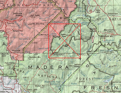 From Oakhurst, CA, drive north on CA 41 for 3-4 miles until you reach a prominently signposted junction with Bass Lake Road. Follow Bass Lake Road around the north side of Bass Lake for another 3-4 miles until you reach a turn for Beasore Meadow on your left, signposted for Clover Meadow.
Head north along the long and winding Beasore Road (a mixture of pavement and graded dirt, passable to all passenger cars), to Jackass Meadow and Jackass Meadow Trailhead. To reach Norris Trailhead, go 3/4 mile further on Beasore Road and you will take the spur road, 5S86, to the trailhead. Fernandez Trailhead is from the next spur road, 5S05, proceeds to a location just 3/4 miles east of Norris TH. The Isberg Pass trailhead is from Granite Peak Road, 3 miles east of Jackass Meadows. Shortly after passing the Clover Meadow Ranger Station, the road forks. Follow the left fork, signed at that junction for the Isberg Pass trail (the right fork heads to Granite Creek campground), until it crosses the West Fork of Granite Creek via a bridge. (Several unsigned spur roads are encountered along here, keep to the main, most-traveled road).
An unsigned junction is encountered immediately after the creek crossing; turn right here and drive another mile or so to the trailhead. Parking is found on the south side of the road, a short way east of the trailhead. |
|
Notes: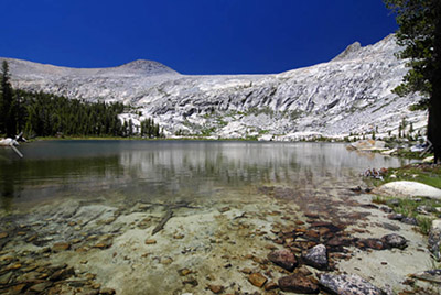
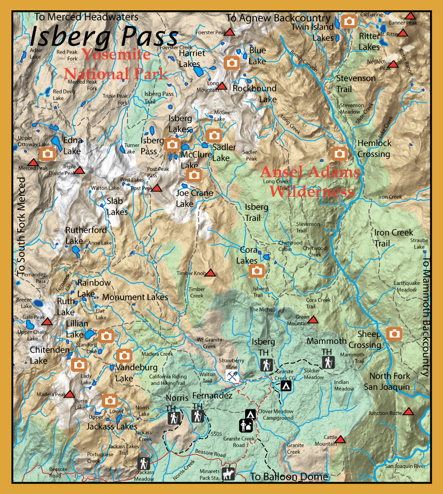
Isberg Pass separates Yosemite National Park from the Ansel Adams Wilderness. The pass was discovered by a soldier named, Isberg, who was under the command of Lt. Nathaniel McClure in 1895. Isberg found this pass as he was looking for old sheepherder trails that usually followed even older Indian trails.The calvary utilized these trails to gain access to the Yosemite region. The lakes below the pass were also named for him later. This region has a number of lakes and streams holding rainbows, brookies, browns, and goldens. There are a number of trailheads available to reach different sections of this region.
From the Jackass Meadow Trailhead or the Norris Lake Trailhead you can reach a group of three lakes known as the Jackass Lakes. Lower
Jackass Lake (12 acres) with a 30' depth at 8506’ ele. has both rainbows and brookies in the 11-12” range. Middle Jackass Lake (3 acres) with 15' depth at 8917’ ele has
rainbows 8-12” and Upper Jackass Lake (9 acres) with a 25' depth at 9150’ ele contains just brookies, 8-10 “. Nearby Burro Lake (1 acre) at 9564’ is fishless. The
trail also goes to Norris Lake (2 acres) at 8388’ which continues to be planted with hatchery trout.
From the Fernandez Trailhead you can reach the following lakes: Vanderburg Lake (10 acres) at 8650’ ele stocked with Rainbows and
Brookies 10-14”. Lady Lake (10 acres) at 8908’ ele with Brookies. Staniford Lakes; Lower Staniford Lake (8 acres) with a 20' depth at 8708’ ele with Rainbows, 8-12” , Lillian Lake (35 acres) with a 50' depth
at 8868’ ele with stocked Rainbows and Brookies 10-14” , Chittenden Lake (9 acres) at 9182’ ele with Brookies, and Shirley Lake (5
acres) with a 15' depth at 9170‘ ele with Brookies. A trail proceeds northeast from Lillian Lake to a junction that will take you northwest on the California
Riding and Hiking Trail to another group of lakes. The Rainbow Lake Trail will take you close to Flat Lake (4 acres) with a 15' depth at 8968’ which is fishless,
but above Flat Lake are the Monument Lakes (1 acre) 20' depth at 9078‘ ele which contain Brookies. The trail terminates at Rainbow Lake (7 acres) 50' depth at 9258’ ele with Rainbows 12-13”. Going off-trail, nearby Ruth Lake (5 acres) can be reached from Rainbow with Brookies 10-13“ . North of Rainbow
is a group called the Fernandez Lakes. These lakes were named for Sgt. Joseph Fernandez of the U. S. Calvary who explored this area in 1895-97. He was instrumental in planting fish within this area after the National Park was established and the Superintendent of the Park recommended his name as a tribute. Lower Fernandez (3 acres) with a 10' depth at 9323’ ele has Brookies at 11” and Middle Fernandez (4 acres) at 9372’ is
stocked with hatchery trout, Upper Fernandez (1 acre) at 15' depth and 9410' elevation is fishless. Continuing on the California Riding and Hiking Trail towards Fernandez Pass is another group of lakes: Rutherford Lake (28 acres) with a 50' depth at 9730’ ele has both Rainbows and Brookies at 11-12“, reportedly some Goldens might also reside here. This lake was named for Lt. Lemual Rutherford of the U.S. Calvary who was on duty here in 1896. A spur trail goes on up to Anne Lake (4 acres) 25' depth at 9503’ also
with both Brookies and Rainbows 11-12” . Another spur trail off the California trail east of Rutherford Lake is the Slab Lake trail taking you to
Slab Lakes (10 acres) at 9800’ ele, these two lakes contain Brookies up to 11“. The Post Peak Trail junctions off the California trail and the Post
Lakes at 10,000' elevation can be accessed off-trail to the west near the pass. Lower Post Lake (3 acres) with a 25' depth and Upper Post Lake (4 acres) with a 50' depth. Both of these lakes have Brookies up to 11” .
The Isberg Trailhead off Granite Creek Road will take you to another section of the Ansel Adams Wilderness following the Isberg Trail up to
Isberg Pass. This trail follows the East Fork of Granite Creek and reaches, in 4 miles, a group of three lakes called Cora Lakes. Upper Cora (7
acres) with a 15' depth at 8369’ , Middle Cora Lake (16 acres) with a 11' depth at 8348’ ele, and Lower Cora Lake (6 acres) at 8306’ ele each contain Rainbows. The Isberg Trail
continues to follow the East Fork of Granite Creek , 7 miles from the trailhead a spur trail goes to Joe Crane Lake. Joe Crane Lake (9 acres) at
9623’ ele. has Rainbows up to 11”. About 8.7 miles from the trailhead is another group of lakes, Sadler Lake (14 acres) witha 25' depth at 9362’ ele has
Rainbows 8-9” and Brookies 10-11”, McClure Lake (20 acres) with a 50' depth at 9594’ ele has Brookies and Rainbows 8-9”, and the Isberg Lakes. McClure Lake was named for Lt. Nathaniel McClure of the U.S. Calvary who was stationed here in 1894-95, Lt. McClure named Sadler Lake after his corporal. Lower
Isberg (5 acres) with a 15' depth at 9834’ ele. has Rainbows 8-9”. North Isberg (2 acres) with a 10' depth at 10,320' elevation was planted with Goldens in 1966 but is fishless. Upper Isberg (2 acres) with a 10' depth at 10,100' elevation has Rainbows, 8-9".
Going over Isberg Pass into Yosemite National Park, you can reach Triple Peak Fork, just to the west, with
brookies up to 9 inches.. You can reach Upper Edna Lake by way of the trail that goes from Triple Peak Fork to Red Peak Pass. Follow the Merced Peak Fork up to the lakes. Upper Edna Lake (46 acres) at 10,153’ ele. has rainbows 13-15 inches with some up to 18 inches.
Lower Edna Lake (6 acres) at 9875’ ele has rainbows 6-9 inches but large numbers of fish. Following the Isberg trail north from the Isberg Pass will bring you to
the five Harriet Lakes. The largest, Harriet Lake (39 acres) at 10,272’ ele. contains rainbows 6-12 inches but there are some 15-18 inches as well. Harriet #2 (5 acres) is south of Harriet with rainbows 8-12 inches.
Harriet #3 (10 acres) also has rainbows 8-12 inches and is easier to reach from Harriet than Harriet #2. Harriet Lakes #1 and #4 are fishless.
Below Cora Lakes, the Stevenson trail branches off the Isberg trail to follow the North Fork
of the San Joaquin. It passes Iron Creek, Dike Creek, and Slide Creek reaching the headwaters terminating at Twin Island Lakes. Twin Island
Lake 2 (17 acres) at 9659’ ele. is the southern most and will have Brookies. Twin Island Lake 1 (14 acres) at 9829’ ele. contains Goldens as
well as the outlet stream. Going off-trail from Twin Lakes to Bench Canyon, there are a couple of unnamed lakes with Golden Trout and the
headwater lakes of Blue Lakes (18 acres) at 10,524’ ele. has Goldens as well. To the south of Blue Lakes, over a saddle, are the Rockbound
Lakes which also have Goldens. Very little is known of the Ritter Lakes, presumably fishless.
|
| Fishing Regulations (Effective March 1st, 2021)
North Fork San Joaquin River:
From the last Saturday in April through November 15, five trout daily bag limit, 10 trout in possession; and, from November 16 through the Friday preceding the last Saturday in April, 0 trout bag limit, artificial lures with barbless hooks only and trout must be released unharmed and not removed from the water.
Portuguese Creek, West Fork (Madera Co.) from headwaters downstream to confluence with the East Fork Portuguese Creek.:
From the last Saturday in April through November 15, five trout daily bag limit, 10 trout in possession; and, from November 16 through the Friday preceding the last Saturday in April, 0 trout bag limit, artificial lures with barbless hooks only and trout must be released unharmed and not removed from the water.
Other Rivers and Streams within Isberg Pass:
From the last Saturday in April through November 15, five trout daily bag limit, 10 trout in possession; and, from November 16 through the Friday preceding the last Saturday in April, 0 trout bag limit, artificial lures with barbless hooks only and trout must be released unharmed and not removed from the water.
Lakes within Isberg Pass:
Open all year. No restrictions. 5 trout per day. 10 trout in possession.
|