|
Notes: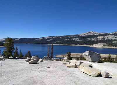
Courtright is a reservoir owned by PG&E, constructed in 1958 using rock filled dams. Courtright is at an elevation of 8,192 feet and has a capacity for 123,000 acre feet. The primary need for the reservoir is to supply hydroelectric power. Since power needs fluctuate from night to day, PG&E has found it economically feasible to use the two reservoirs, Courtright and Wishon, in unison so that they allow water to flow to the lower Wishon reservoir during the day and create higher priced electricity. Then they use the lower cost of electricity at night to pump the water back up into the higher Courtright Reservoir. Thus the levels of the two reservoirs fluctuate greatly on a daily basis. Needless to say, this creates great havoc for the resident fish. Courtright is stocked with about 20,000 10-12 inch Rainbows each year. Holdovers can range from 16 to 18 inches with the Lake Record being 7 Lbs. 3 oz. at Courtright. There are Browns in the lake but the numbers caught have greatly reduced over the years. Float tubing on Courtright has access at the ramp near Marmot CG and near the dam on Wishon. Try the dropoffs along the eastern shoreline and along the dam. Courtright has access into the Red Mountain Basin of the John Muir Wilderness from the Maxson Trailhead or Voyager CG on the northeast side.
Taking the Dusy Ershim 4 WD road from the Maxson Trailhead you can follow the Dusy Ershim road for 1.5 miles to reach the Blackcap Trail.There is a log across the trail to keep 4WD vehicles out.The trail proceeds past a camp called, Chamberlain's Camp. From there, it is a hiking trail. Going 0.5 miles from Chamberlain Camp the trail switchbacks and reaches a junction. The left spur takes you to Hobler Lake (ele. 9000') about 4.5 miles from the trailhead. Hobler has rainbows up to 12". There is no spawning waters at the lake, so the lake depends upon aerial drops of fingerlings from CDFW. Back at the junction if you continue on the Blackcap Trail going east, you can reach Post Corral Meadow in 7.5 miles. Post Corral Creek has many small rainbows and brookies, 4-6 inches. As you hike south along the Blackcap Trail, the Hell for Sure trail spurs to the east at the 8.25 mile mark from the trailhead and will take you to the Red Mountain Basin. The first lake is Fleming Lake, a 1500' climb over the next 4 miles. Fleming has brookies and rainbows. Most of the brookies are in the 8-9 inch class but some of the rainbows can reach 12". Continuing on the Hell for Sure trail, following Fleming Creek upstream, the trail splits and Hell for Sure trail goes to the east toward Hell for Sure Pass while the left spur goes to Mosquito Pass at the 11.75 mile mark from the trailhead. Going towards Mosquito Pass, the next lake is Rae Lake. Rae Lake is 12.25 miles from the trailhead at 9,889' elevation. Contains Rainbows, 8-9". Continuing north, the next lake is Lower Indian Lake (elevation 10045'), 12.75 miles from the trailhead. Contains mostly Brookies, 8-9" but some larger rainbows. The trail ends at Upper Indian Lake (10,500' elevation), just below Mosquito Pass, 14.5 miles from the trailhead. Upper Indian contains Brookies 9-11".
Going back to the Hell for Sure Trail junction below Rae Lake, take the trail east. Going 1.6 miles, you reach a junction where the right trail heads south to Devils Punchbowl and the Hell for Sure trail continues east. Staying on the Hell for Sure trail, in about 1/2 mile you reach Disappointment Lake (10,342' elevation). Contains Brookies 8-10 inches. Going back to the junction take the southerly trail to Devil's Punchbowl (elevation 10,096 feet). This is about 3 miles from the junction or 9.5 miles from the trailhead. Contains Brookies, 8-10 inches. Proceeding down the Meadow Brook trail, you can reach the North Fork Kings River. The river has rainbows and browns, 9-12".
|
| Fishing Regulations (Effective March 1st, 2021)
Courtright Lake:
Open all year. No restrictions. 5 trout per day. 10 trout in possession.
Other Rivers and Streams:
From the last Saturday in April through November 15, five trout daily bag limit, 10 trout in possession; and, from November 16 through the Friday preceding the last Saturday in April, 0 trout bag limit, artificial lures with barbless hooks only and trout must be released unharmed and not removed from the water.
Lakes within this area:
Open all year. No restrictions. 5 trout per day. 10 trout in possession.
|