Carson River Drainage of the Eastern Sierra Region 1
Carson River Drainage
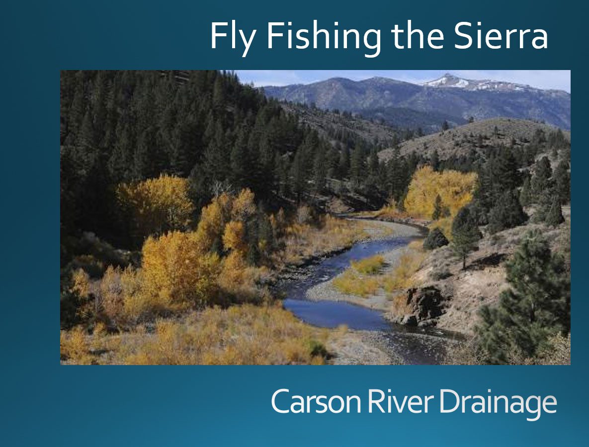
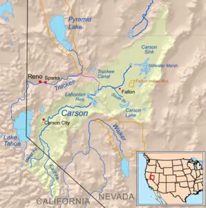
The Carson River Drainage starts within the Sierra Nevada and flows for 131 miles through Nevada emptying into the Carson Sink.
This article will only cover the area of the drainage within the Sierra Nevada, it's headwaters in Alpine County.
The headwaters are the ancestral home of the Lahontan Cutthroat and a smaller distinct subspecies of cutthroat known a Paiute Cutthroats within Silver King Creek. The area is named after Kit Carson, who was a scout for John C. Fremont, and guided Fremont over the Sierra at Carson Pass in 1844. Hwy 88 follows the Carson Trail as did the Pony Express which used the trail in 1860-61. Mining and Lumber had great impacts on the watershed area in the 1860’s to 1940’s.
Markleeville - County Seat of Alpine County
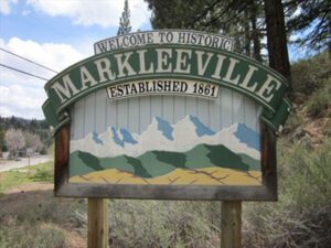
Jacob J. Marklee founded a toll bridge crossing the Carson River in 1861. He aimed to tap into the traffic from the silver mining boom at Silver Mountain City. On June 23, 1862, he recorded a land claim of 160 acres in Douglas County, Nevada. A boundary survey took place, and the property ended up being in California. In 1863, Marklee died after being involved in a gunfight. When the Comstock Lode discovery took place, the town of Markleeville was founded on the Marklee property. Today, the Alpine County Courthouse sits on the former property, which is listed as a California Historical Landmark.
A post office opened in Markleeville in 1863.
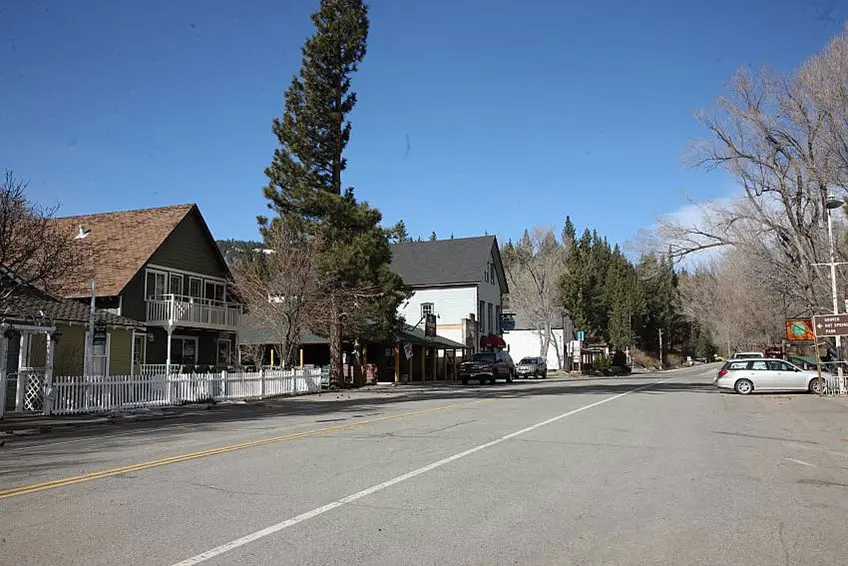
Markleeville is considered to have a warm-summer Mediterranean climate. At an elevation of 5,530 feet., the Summers are usually 75-85 degrees with nightime lows of around 40, Winters can be cold and snowy. Most of the precipitation comes as snow with an average level of 82 inches. The actual precipitation is under 19 inches.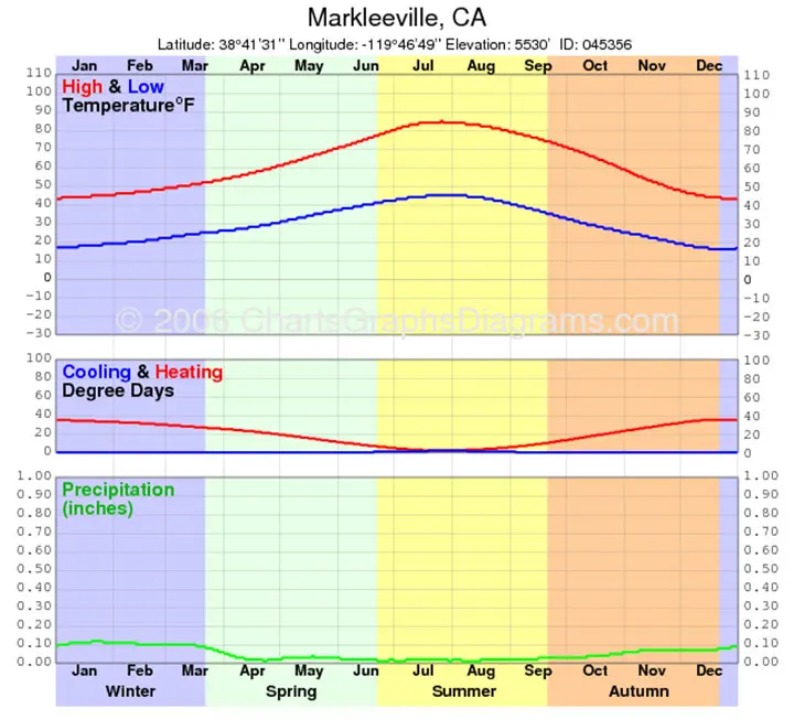
Woodford - Oldest Town in the region
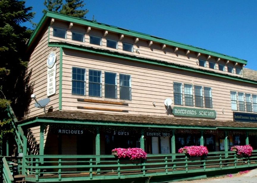
Woodfords holds title as the oldest non-native settlement in the entire region. After a brief period during which the settlement was known as Carey's Mills, the Woodfords name came into common usage following the establishment of an official post office near a hotel by Daniel Woodford in 1849. Today, Woodfords continues to serve highway travelers, and is home to about 150 full time residents, while the Southern band of the Washoe tribe has a small community in nearby Diamond Valley.
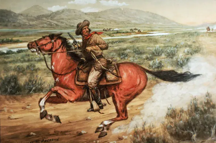
Pony Express
Woodfords became a remount station of the Pony Express on April 4, 1860, when Warren Upson scaled the mountains in a blinding snowstorm, reached Woodfords from Lake Tahoe via Luther Pass, and made his way down the eastern slope of the Sierra on his way to Carson City. Five weeks later the Pony Express was rerouted by way of Echo Summit and the Kingsbury Grade.
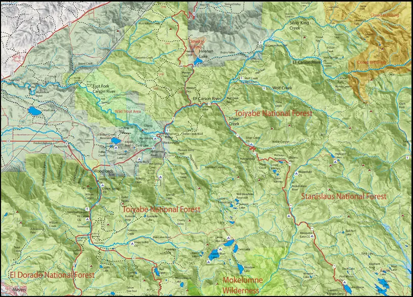
East Fork Carson River - Wild and Scenic Portion
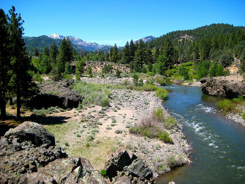
The Wild and Scenic river section of the East Fork Carson river was designated in 1989 but decommissioned in 2021. The stretch of river between Hangman's Bridge on California State Route 89 and Ruhenstroth Dam near U.S. Highway 395 runs 19.3 miles through alpine forests on its way to the high desert of western Nevada. The Wild Trout Section of the East Fork was from Hangman’s Bridge to the Nevada state line. Only artificial lures with barbless hooks could be used with a zero limit. Latest surveys indicate that Rainbows make up almost 85% of the fish. Lahontan cutthroat and German browns used to reside in this stretch of river but are no longer found. Mountain Whitefish make up about 8% of the total, mostly in the 12-16 inch range. This section is open to fishing all year. Regulations are now a 2 fish limit and a 14" minimum size.
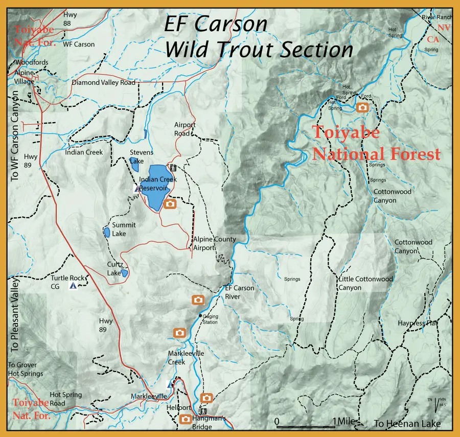
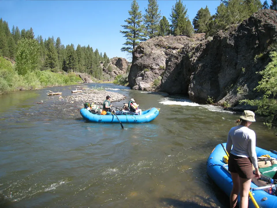
The East Fork of the Carson River is one of the few rivers along the steep east side of the Sierra Nevada mountains suitable for commercial and private white water rafting. This occurs in the Spring after runoff when the flows are still above 400 cfs. The distance from Hangman's Bridge to the take-out at Ruhenstroth Dam is about 20 miles. Many will make a 2-day trip with camping at the Carson River Hot Springs.
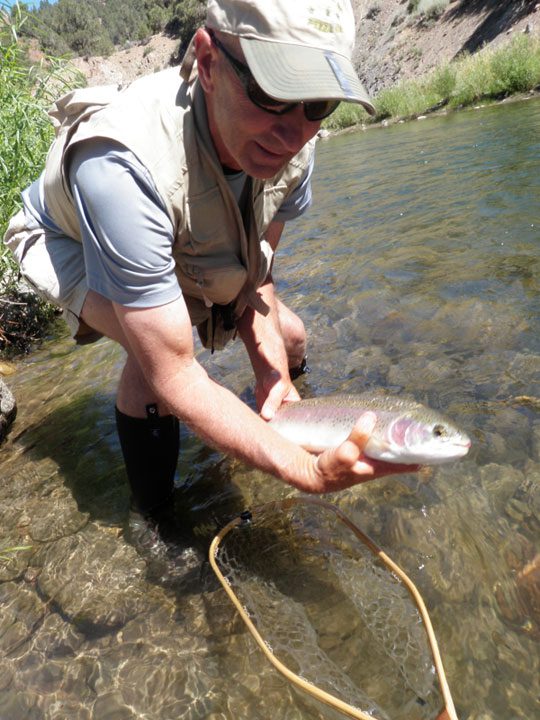
Once the river gets down below 300 cfs, it is safely wadable. A trailhead exists at Hangmen's Bridge and the river trail follows the river for about 7 miles. The EF Carson was a popular Wild Trout stream with wild Rainbows below Hangman's Bridge. The last fish planted within this section was 1988. There are hatchery plants above this section and surveys have been conducted to see how many hatchery fish have moved into this section.
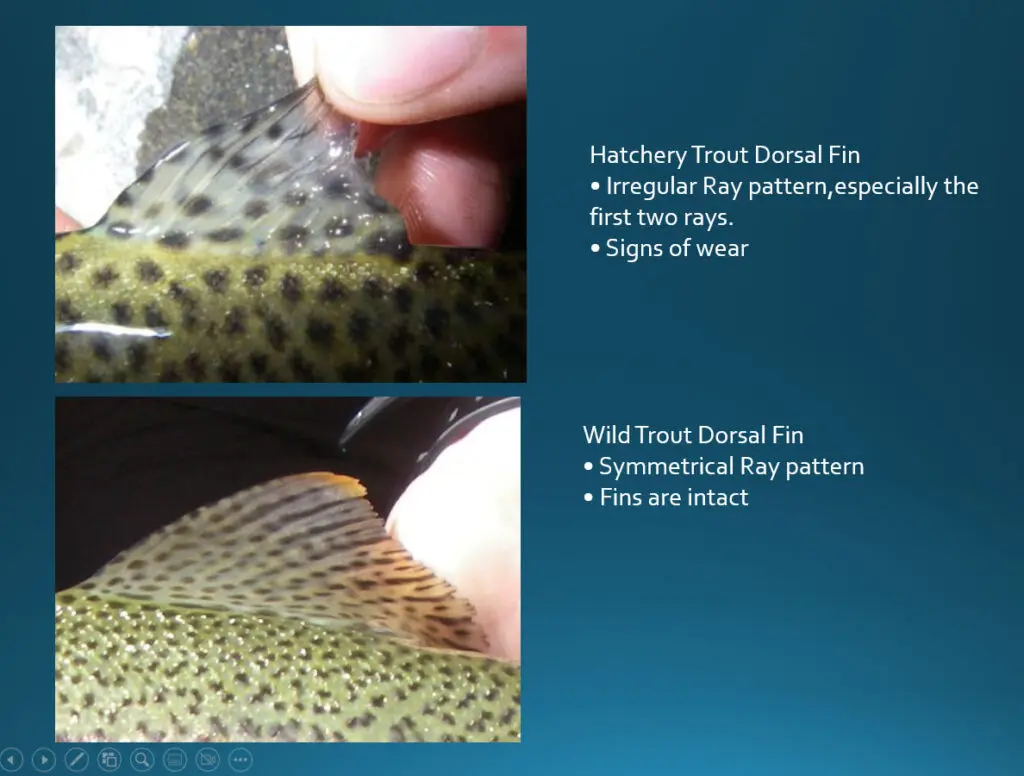
Hatchery Trout can look very similar to wild trout. Inspect the dorsal fin for wear and irregularities on the ray pattern.
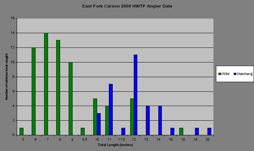
Hatchery Trout were present throughout all of the Wild Trout section. The over-winter ability of the hatchery trout was unknown at this time. The 2019 Snorkel Survey found no evidence of hatchery trout within the section. However, the opinion of CDFW was that the stocked Rainbows above Hangmen's Bridge greatly impacted the fish found below the bridge. In Spring of 2021, this section was decommissioned as a "Wild Trout" stream and regulations were changed to allow a 2 fish limit on fish over 14" only.
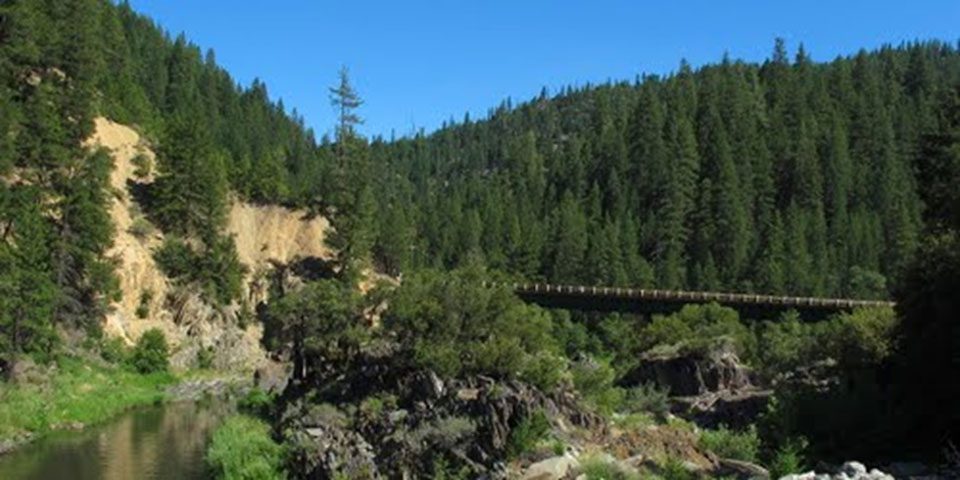
Starting at Hangman’s Bridge, the "Wild Trout" section is 10.2 miles long and can be fished by raft during the Early Summer determined by water clarity and flow or by wading once the flows get below 300 cfs.
One interesting historic site in the river canyon is Hangman’s Bridge. According to local lore, in 1874 a man named Ernst Reusch was accused of murder in Alpine County. In order to spare the financially-strapped county the expense of a jury trial or change of venue (sought because it was thought that Reusch could not get a fair trial in Alpine County), some local vigilantes took justice into their own hands while the prisoner was being transported to neighboring Mono County for trial. The armed men stopped the escort at a point near Markleeville on the East Fork Carson River, and ordered the prisoner out. They then put a noose around Reusch’s neck and dropped him over the side of the bridge.
The old bridge was replaced by a new bridge about one mile downstream.
Downstream from Hangman's Bridge
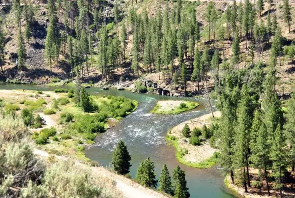
June can be an excellent month to float the EF Carson. The water clears up and flows are between 400-600 cfs. A trail follows the river about 3 miles downstream from Hangman’s Bridge. The salmonflys become active in June and a Clark’s Stonefly or Stimulator size #6-8 works well. Fish these salmonflys in the moderately fast water particularly near bank vegetation. June is also a good month for Green Drake nymphs (Green Drake Poxyback, Black A.P. , Prince Nymph) with a caddis pupa dropper. You will also encounter a Green Drake spinner fall in the evening. PMD’s will show up around midday and the late afternoon brings on a flight of Yellow Sallies.
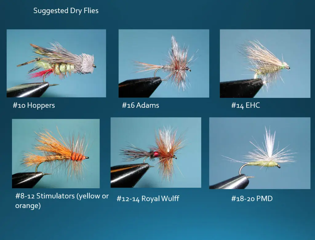
In mid-summer, flows will drop below 300 cfs, allowing suitable wading. The East Fork River trailhead is at Hangman's Bridge and continues along the river for 7 miles. A combination that works well here is a dropper from a Chernobyl Ant. Caddis patterns work well throughout the season, especially during the evening, as caddis flies are quite prolific. The most common colorations are yellow to tan. A yellow Elk Hair Caddis pattern in size 12-16 is a good pick. Some Brown Sedge and slate sledge caddis emerge in late spring to mid-July. Try using a Goddard Caddis #14-16 to match this fly. As an Attractor Dry, the Royal Wulff #14-16 is the most popular on the river. A good October Caddis hatch occurs for excellent dry fly opportunities.
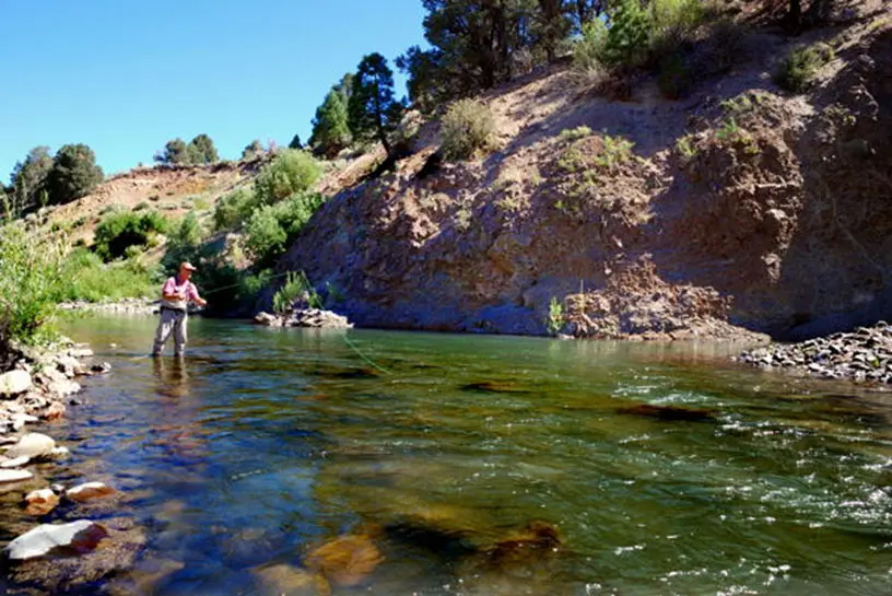
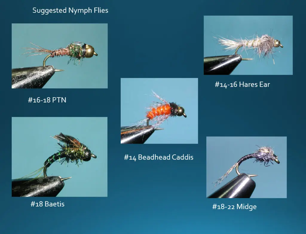
Nymphing is the primary method of fishing the EF Carson Wild Trout section. Euro Nymphing works well on this section, particularly in the morning. Some will switch to a dry-dropper setup in the afternoon. The preferred rigging is:
- 4-5 weight Floating Fly Line
- 9 ft. Medium Fast to Fast Action Rod
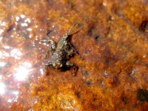
Large Golden Stoneflies abound in the water year-round and emerge anywhere from July through September. The nymphs are up to 2" long and mottled brown-tan-yellow.
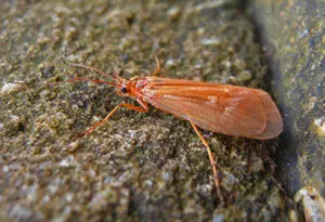
Giant October Caddis: The huge Discosmoecus Caddisfly inhabits the river, hence a #8 Burnt-Orange Sparkle Pupae nymph, or a #8-#10 Orange Elk Hair Caddis or #8-#10 Stimulator will interest the fish during early October. Ralph Cutter's Tangerine Dream #8 works too!
Nymphing the Runs
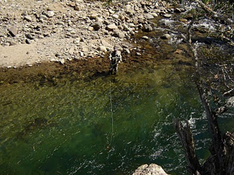
When nymphing use a 7.5 foot, 3x or 4x Leader with a 3X or 4X tippet. Using #4 weighted nymphs in fast-water riffles just before sunrise can produce violent strikes, so use heavy tippet. An hour after the sun hits the water, fish stop taking these nymphs, and it's time to switch to another pattern.
Pools and Tailouts
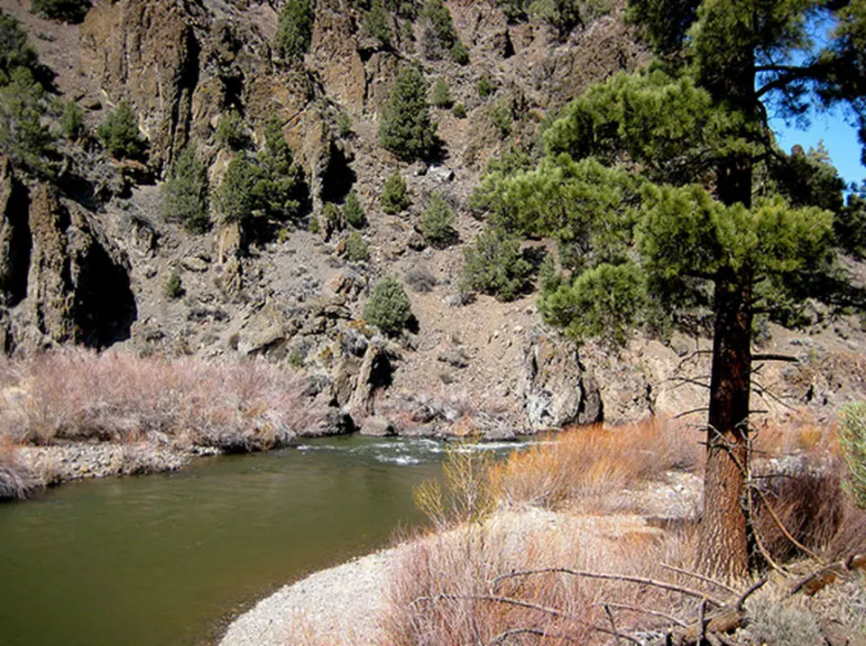
Within the Pools and Tail outs are wild Rainbows and Browns. Most of the rainbows are in the 10-16 inch range but there are some up to 20 inches.
Riffles and Runs
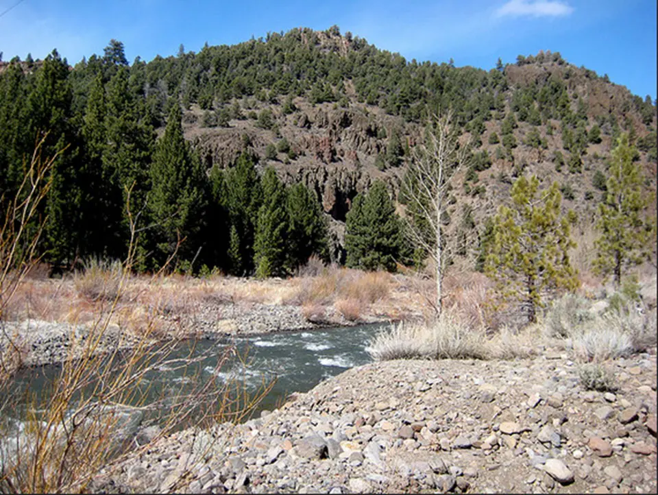
Riffles are a great section to catch fish during the late summer and early fall. Fish will be looking up for hoppers. The October Caddis is a preferred pattern that the fish will aggressively take when skated in the riffles.
Hot Springs
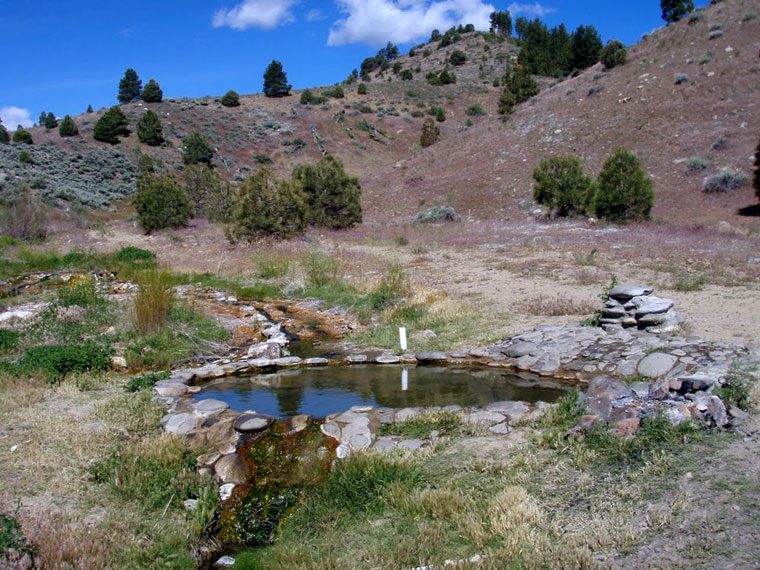
Hot Springs are along the river about 8 miles downstream of Hangman’s Bridge. You can access this area by vehicle on Barney Riley Road. It is also a preferred camping area for river rafters during the early Spring.
Ruhenstroth Dam Take-out
 Take out occurs just above the remains of Ruhenstroth Dam.
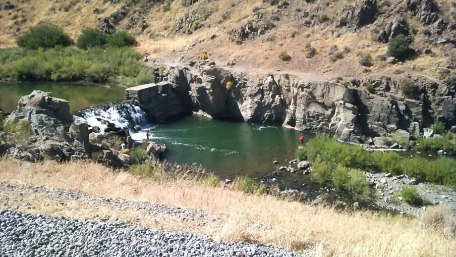
Ruhenstroth Dam. Constructed in 1912 to provide electrical power to Gardnerville, NV. Damaged in 1937 by floods, it was ultimately destroyed by another flood in 1997.
Indian Creek Reservoir
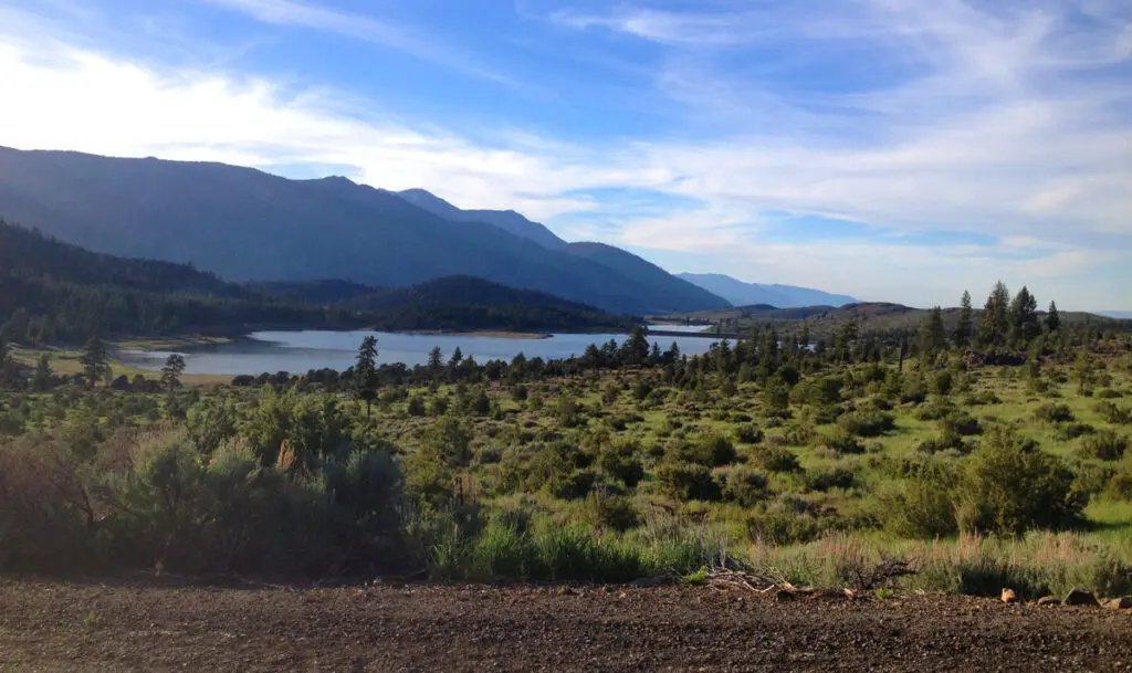
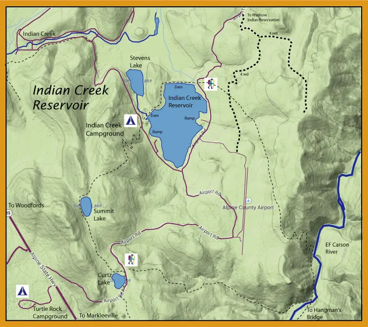
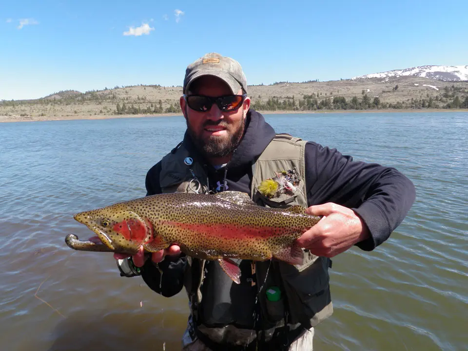
Indian Creek Reservoir (elev. 5,600 feet) is a trophy fishery between Markleeville and Woodfords. The lake contains large Rainbows (up to 5-7 lbs.), Lahontan cutthroats, Brookies, and Kamloop Trout. The trout are actively planted along with many holdovers. The 160 acre lake can be fished from either boat, float tube, or shore. The reservoir is open year-round. Spring and Fall months are popular for fishing. Summers can get quite weedy due to the shallow nature of the lake. Winter Ice Fishing is often good. The lake has a high growth rate due to the rich forage base. Snails are especially prevalent. A damsel hatch in July can be quite good around the weedbeds that are starting to develop. There is even a good Blood Midge hatch that will allow for some dry fly action at times with a majority of the hatch being #14 or #16.
The west side of the lake from the boat ramp to the southernmost dam has a steep drop off allowing shore anglers access to deeper water. The south end of the lake is shallow and weedy for good damsel nymphing by float tube. Chironomid midging picks up just after ice off in 8-15 feet of water. Most will fish the northwest side of the boat ramp since it offers wind protection. About a month after ice off, the fish will become more aggressive and take balanced leeches.
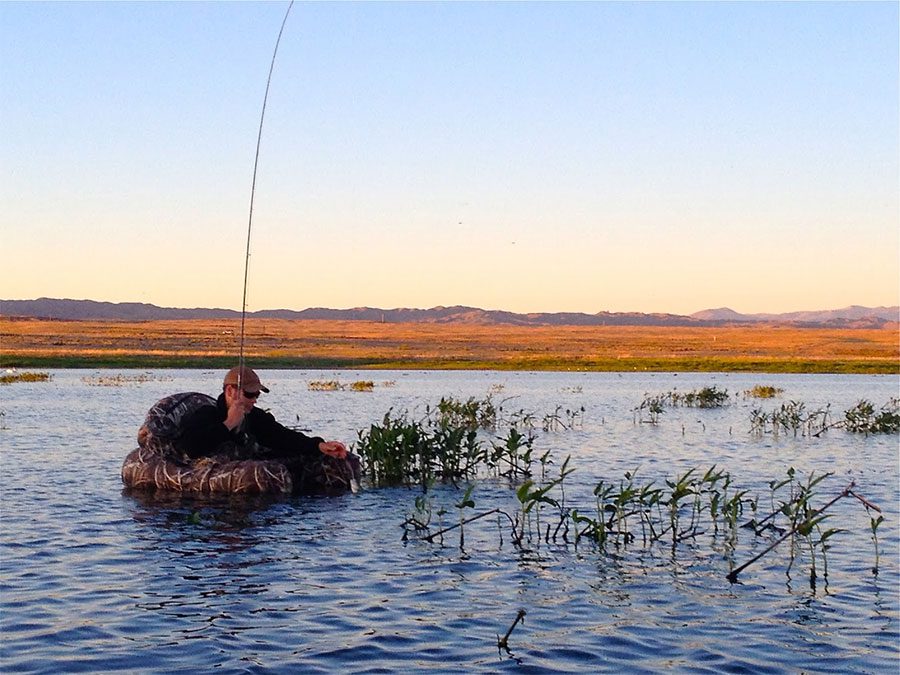
During the summer months of June and July, damsel nymphs will be swimming among the weedbeds. This is a good time to float tube the shallow southern end of the lake in the early morning hours. The depth will be about 3 feet and stripping a damsel nymph along the edges of the weedbeds will produce strikes. Once the sun is up, the warmer water pushes the fish to deeper water and you can continue to fish 6-12 feet with a sinking line.
Heenan Lake
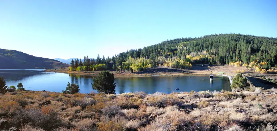
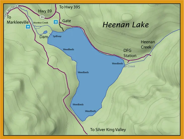
The 135 acre Heenan Lake has been renowned for producing huge Lahonton Cutthroats up to 30" with the average being 16 to 20". The Department of Fish and Game have a station there that take some spawners from the lake for egg collections. These eggs are distributed to a number of other state hatcheries including the Hot Creek Hatchery and Nevada Dept of Wildlife. The hatchlings are restocked into Heenan and over 30 additional Eastern Sierra lakes. The Heenan Lake Lahontons are actually a hybridized strain of the original Lahonton Cutthroats that inhabited Lake Lahonton in prehistoric days. The regulations to Heenan Lake is a strict catch and release on barbless hooks on flies or artificial lures. The season opens on the Friday before Labor Day and continues until the last Sunday of October. You can only fish Friday, Saturday, and Sunday. Monday through Thursday are not allowed. The tributaries to Heenan are also off-limit year round.
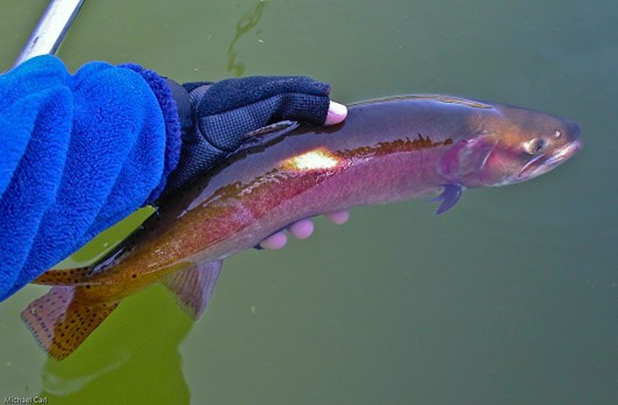
Lahontan cutthroat trout, photographed at Heenan Lake, California in October 2006. Photo by Michael Carl.
Heenan is ideal for float tubing but has recieved heavy fishing pressure recently due to its reputation for big trout. Algea can be a big problem as well. Trolling streamer patterns of Woolly Buggers, Leeches and Matukas in Black, Purple, or Olive from a float tube has been the favored method to fish Heenan. No gas-powered craft are allowed. It's shallow so an intermediate sinking line is sufficient. Dark colored nymphs in sizes 12-14 such as Pheasant Tails, Bird's Nests, and Prince Nymphs with an indicator also work well. Use a slow retrieve. Recently, using a chironomid pattern has become quite popular when used as a dropper below the nymph from 2 to 6 feet in depth. Allow the rig to sit with an occasional twitch. Generally, an intermediate sinking line is the best bet with a 7-8 foot leader. The Lahontans do not put up as rigorous fight as a similar-sized Rainbow so a leader of 4x to 5X should suffice.
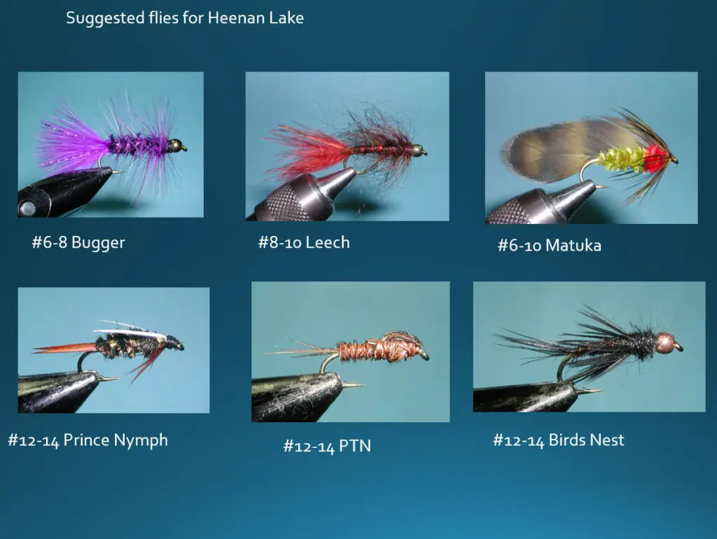
Trolling streamer patterns of Woolly Buggers, Leeches and Matukas in Black, Purple, or Olive from a float tube has been the favored method to fish Heenan. Dark colored nymphs in sizes 12-14 such as Pheasant Tails, Bird's Nests, and Prince Nymphs with an indicator also work well. Use a slow retrieve. Recently, using a chironomid pattern has become quite popular when used as a dropper below the nymph from 2 to 6 feet in depth.
Hangman's Bridge to Wolf Creek
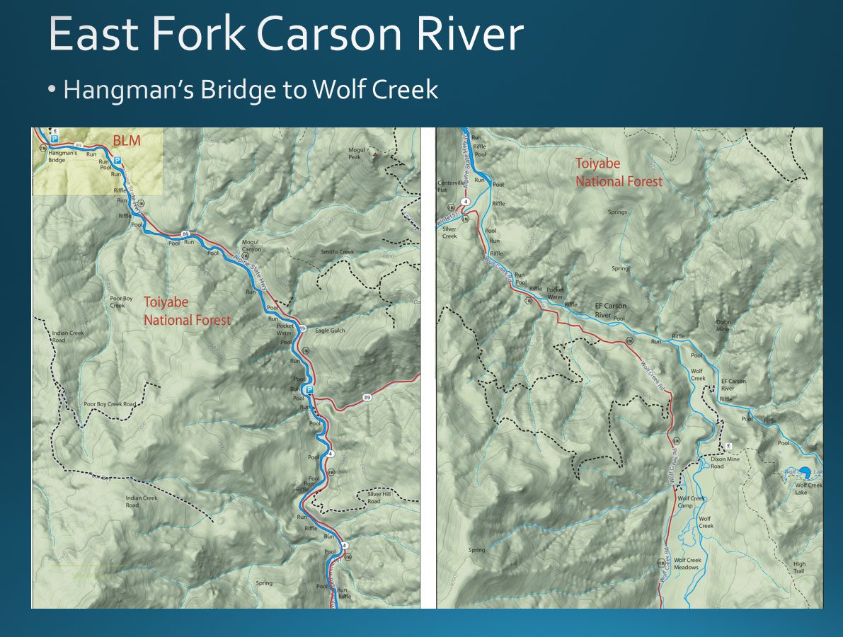
This 8.3 mile section is a put and take area of the EF Carson. It is heavily planted with road access up to the confluence with Wolf Creek. Fisheries in the area are maintained primarily by stocking catchable-size rainbow trout. CAF&G stocks rainbow trout from CAF&G hatcheries and Alpine County supplements this stocking program with larger, robust trout purchased from private hatcheries.
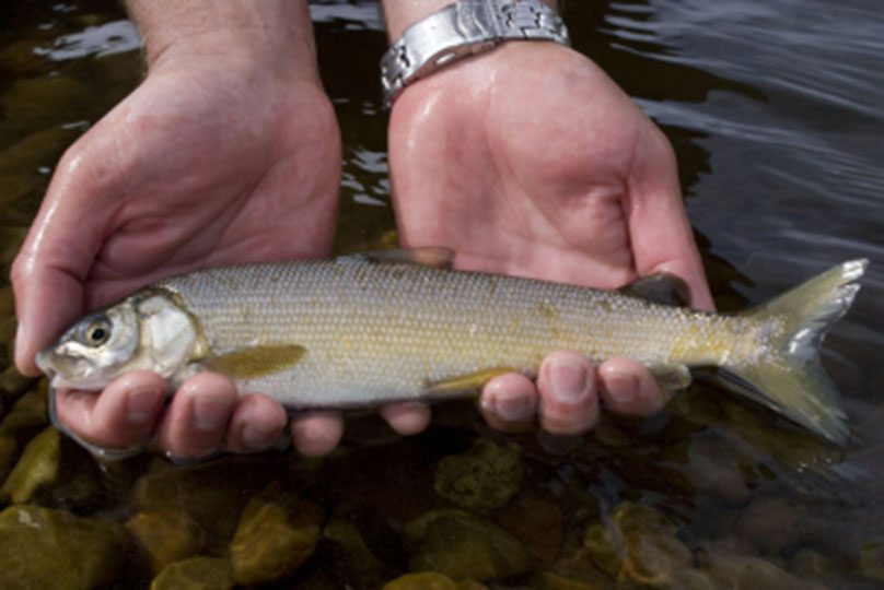
Most of the fish here are Rainbows but it is also the ancestral home of the Mountain Whitefish that can get up to 1.5 pounds. The California record for Mountain Whitefish was caught here in 1994. The section also has some large Brown trout during the Fall.
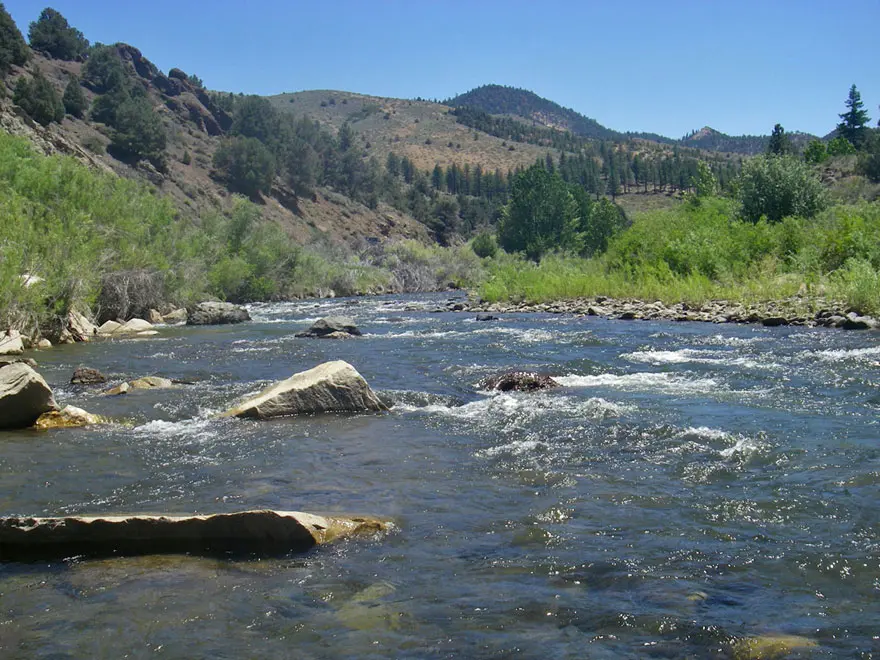
This section is a good option when levels are too high on the lower section of EF Carson. Pulling a Bugger streamer will often fool the hatchery trout. An attractor dry such as a #14 Royal Wulff or a Hopper pattern is a good mid Summer selection.
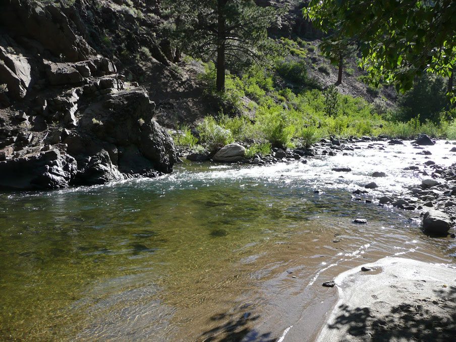
Confluence of EF Carson and Wolf Creek
Wolf Creek Confluence to Carson Falls
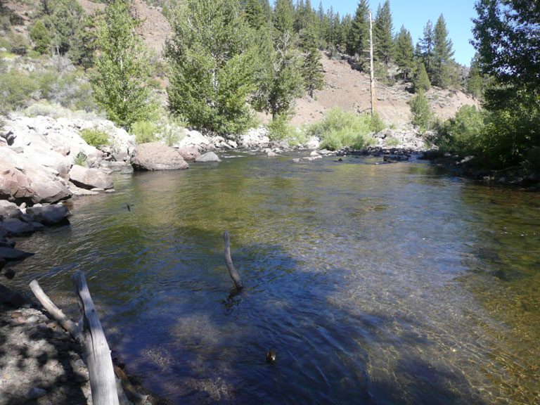
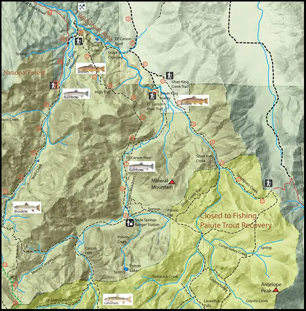
1 mile above Wolf Creek. Above the confluence of Wolf Creek, you get back into a designated "Wild Trout" area which is not planted. This section extends for about 27 miles up to Carson Falls, accessible by the East Carson River Trail. This segment was in the original group of Wild Trout Streams designated by the California Fish and Game Commission in 1972. This section of stream has a strong population of wild Rainbows in the 6-10 inch class, some Browns, and a few Lahontan Cutthroats.
Grays Crossing
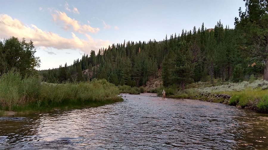
Grays Crossing
A jeep road goes to the east of Grays Crossing and reaches Silver King Valley in 2 miles. The road ends at the East Fork River Trailhead with the trail follows the river southerly to Carson Falls.
Carson Falls
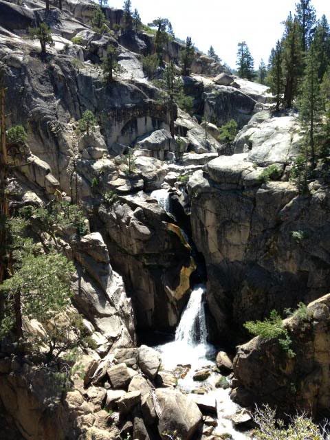
The wild trout section above the confluence of Wolf creek ends at Carson Falls. Above Carson Falls are the last remaining pure strains of Lahontan Cutthroats. The section has been closed to fishing.
Wolf Creek
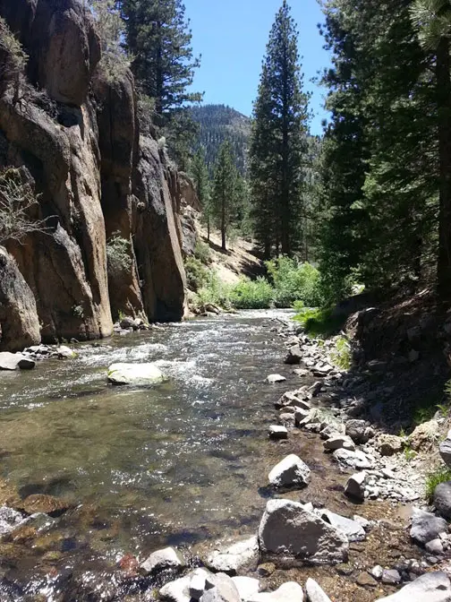
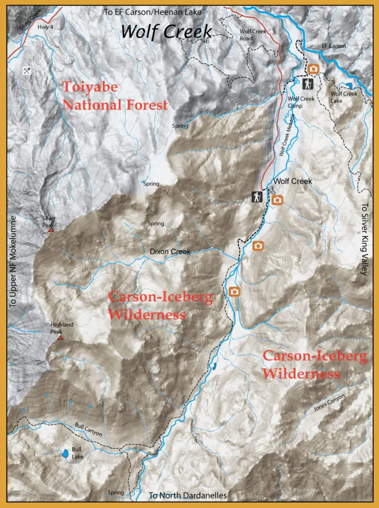
Wolf Creek is a a fast moving small stream with plenty of runs and riffles in the upper sections. Expect to find brookies in the upper regions and rainbows in the 8-11 inch class.
Wolf Creek, Upper Meadow
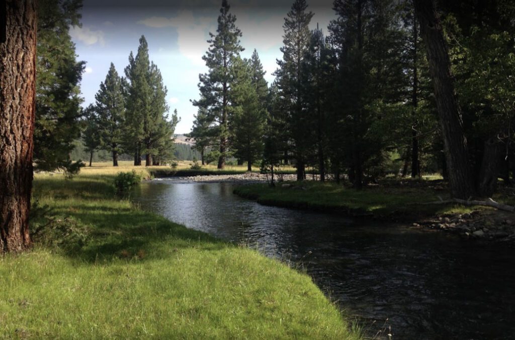
Wolf Creek, Upper Meadow. Wolf Creek then flows into a lower meadow which slows and flattens the stream out before entering a short, narrow canyon to reach the East Fork. This meadow section will have Browns in the undercuts about 9-12 inches.
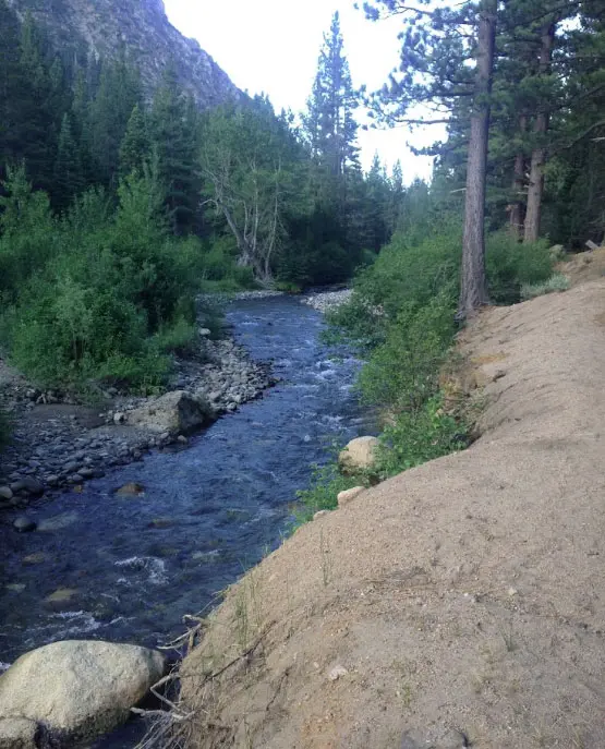
Wolf Creek
Silver King Creek and EF Carson, Silver King Valley
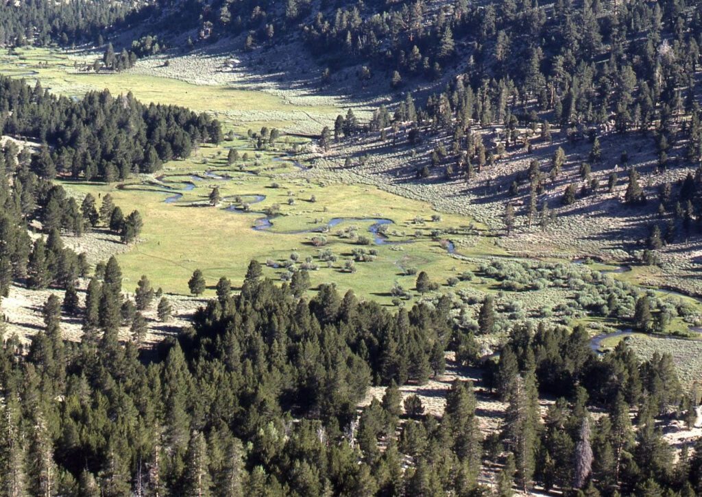
Silver King Valley
To reach Silver King Creek, turn right onto a dirt road just south of Heenan Lake. This road will take you into Bagley Valley and reach Grays Crossing in 5.2 miles. Continuing southeast another 1.6 miles you reach Vaquero Camp and the trailhead to the Silver King Creek starts from there. Through the valley, the EF Carson contains Browns within the undercut banks. About midpoint in the valley, the Silver King Creek has a confluence with the EF Carson river. Following the Silver King Creek up the meadow, the creek enters a canyon section that contains numerous brookies and rainbows up to 14 inches in the small pools and runs of the stream. This is fishable water up to the confluence of Snodgrass creek where all fishing is prohibited upstream for protection of the Paiute Cutthroat. The EF Carson is fishable up to Carson Falls with rainbows. Above Carson Falls, fishing is prohibited for protection of the Lahontan Cutthroats.
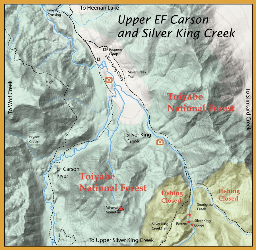
Silver King Creek is the home waters of the Paiute Cutthroat Trout (PCT) . Historically, they occupied 11 miles of the river and the tributaries within this canyon up to Llewellyn Falls. In 1912, Basque sheep herders transferred populations of the Paiute Cutthroats above Llewellyn Falls which were fishless at the time.
During the early 1900's, non-native trout were introduced into the historic range of the Paiute Cutthroats below Llewellyn Falls and was a major cause of the PCT decline. Lahontan Cutthroats, California Golden Trout, Rainbow Trout, and Brook Trout were introduced into these waters. By 1934, the Paiute Cutthroats were no longer present within their historical waters and recreational fishing for PCT was closed in the Silver King Creek drainage. Restoration efforts for the next 60 years included transplanting PCT into other headwater tributaries within the Silver King Creek watershed, as well as four streams outside of that basin that had fish passage barriers. However, a pack train carrying Rainbow fingerlings took a “wrong turn” in 1949 and dumped Rainbow fingerlings into the upper reached of Silver King, Corral Valley, and Coyote Valley creeks. Hybridization took hold. By 1964, all of the Paiutes within the creeks both above and below Llewellyn Falls were hybridized.
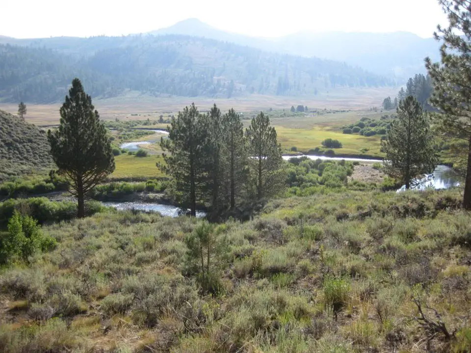
Silver King Valley
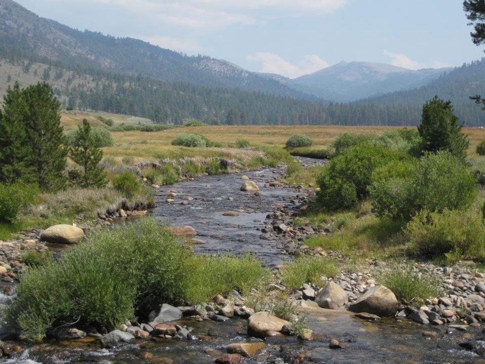
Upper end of Silver King Valley Meadow
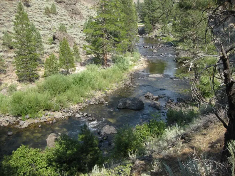
Silver King Creek out of the canyon
Paiute Cutthroat Restoration Program
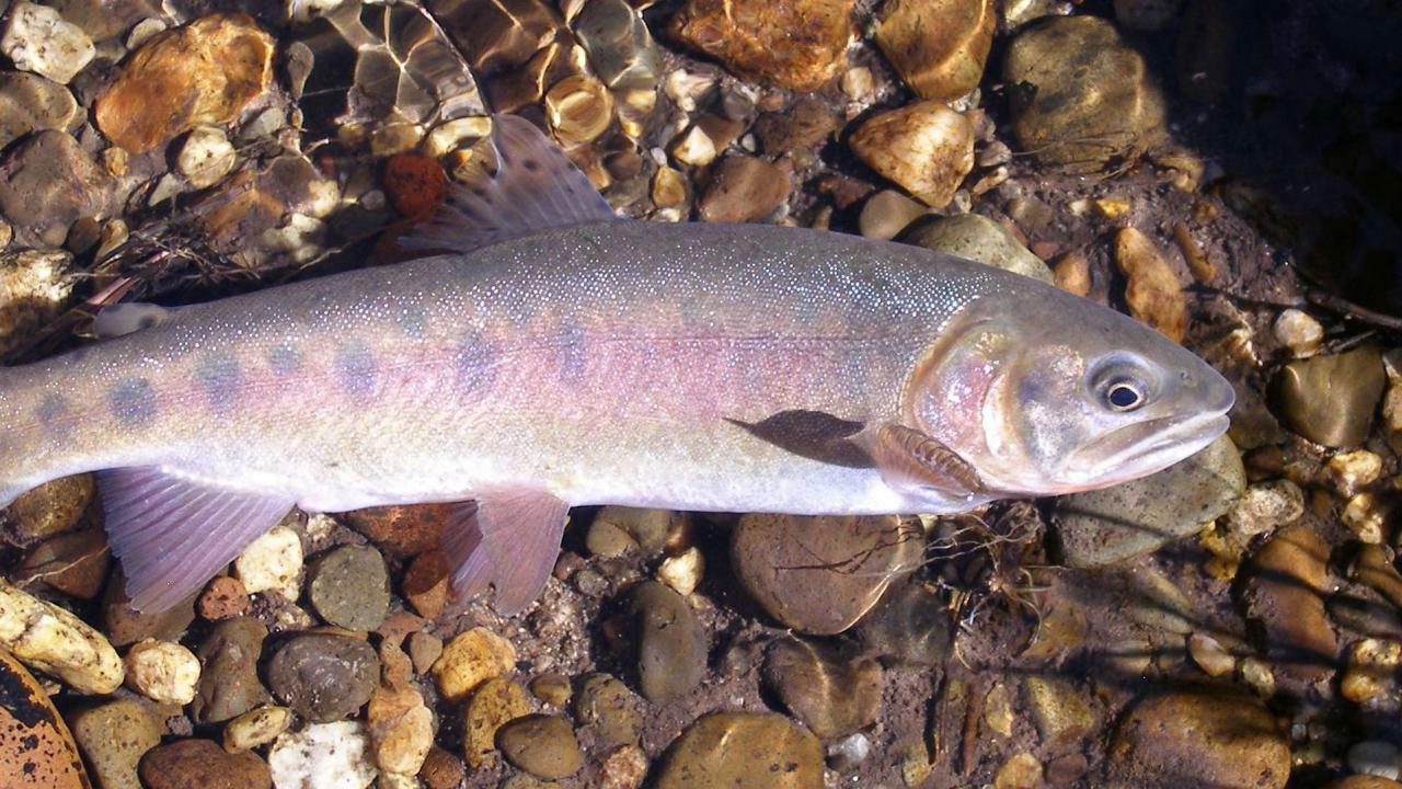
Paiute Cutthroat Trout
Paiute Cutthroat Trout (PCT) were one of the first animals in the nation to be listed as Endangered in 1967 under the Federal Endangered Species Preservation Act of 1966. To facilitate recovery actions, in 1975 they were downgraded to Threatened under the Endangered Species Act of 1973. Paiute Cutthroat Trout only spawn once in a life time. Maximum expected age for PCT is 3 years. The actions of fragmenting the Paiute Cutthroats into small fishless streams actually has imperiled the subspecies to a great extent due to the loss of genetic diversity. The current populations are small and isolated. This puts the trout at risk to the harmful effects of wildfires, drought, and climate change. The small sections of stream available to them with a small population size and lack of habitat diversity may be inadequate for the PCT to survive long term.
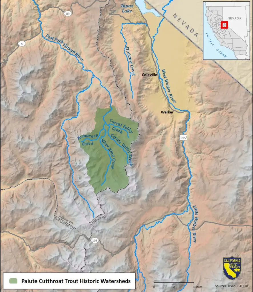
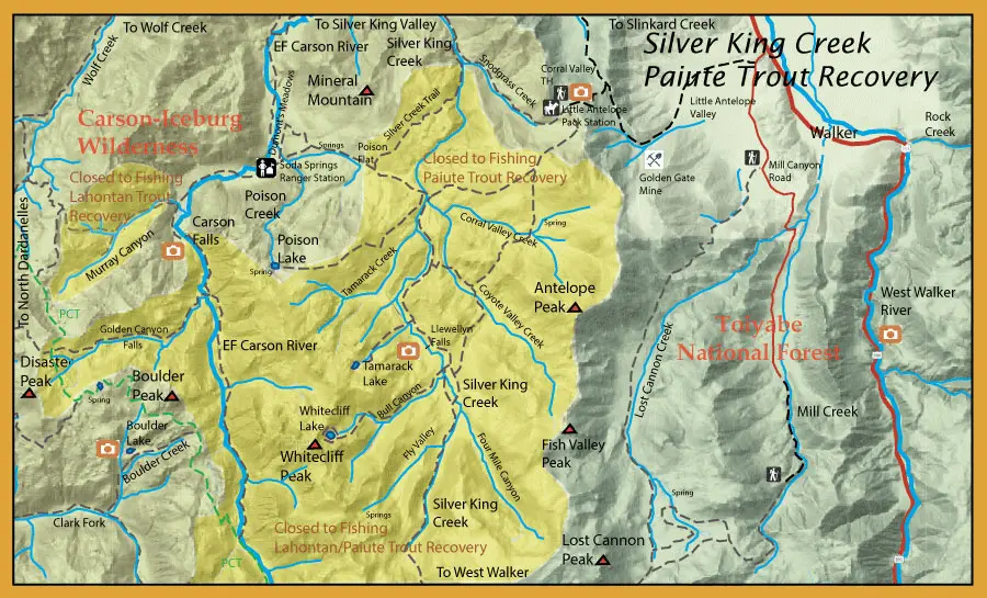
Past habitat degradation caused by sheep and cattle grazing was a significant threat to the PCT. Cattle grazing was ceased by the U.S. Forest Service (USFS) in 1994. To protect this subspecies and its habitat, grazing is no longer allowed in the upper Silver King Creek basin above Snodgrass Creek. Starting in 1964, Rotenone (a piscicide) treatments were used above Llewellyn Falls to eliminate the hybrids and reestablish the Paiute natives. This had mixed results as hybrids seem to always appear years later.
The Paiute Cutthroat Trout Restoration Project was developed to address the recovery concerns of the fish in 2004. In 2013 to 2015, a plan was implemented to remove non-native fish below Llewellyn Falls. During this phase of restoration project, the stream was treated with rotenone to remove non-native trout from Silver King Creek and associated tributaries between Snodgrass Creek and Llewellyn Falls. Following the chemical treatment, CDFW and others conducted a three year evaluation (2016 through 2018) to ensure that the treatment was successful.
In 2019, CDFW and US Fish and Wildlife returned 30 Paiute cutthroat trout from Coyote Valley Creek to Silver King Creek. In 2020, another 44 Paiute cutthroats were moved from Corral Valley Creek to Silver King Creek. A genetically pure population of Paiute cutthroat trout was established in Corral Valley Creek and other suitable waters decades ago to ensure survival of the species. At the same time, restoration work took place within Silver King Creek to remove nonnative trout that displaced and hybridized with native Paiute cutthroat trout.
This restoration project will expand the population’s protected stream habitat by approximately 11 miles and serve as a buffer against extinction from threats such as wildfire, drought, and disease. Since the amount of habitat for the fish will almost double, a much larger population of PCT is expected to exist in the future. A larger population will be more resistant to the genetic threats that small, isolated populations face over time. When the species is restored to its historic range, CDFW anticipates that a stream segment could be opened to a special regulation fishery for anglers to catch and release PCT.
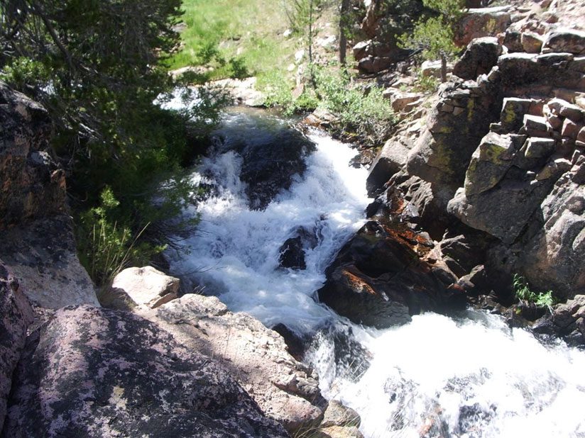
Llewellyn Falls
Pleasant Valley Creek
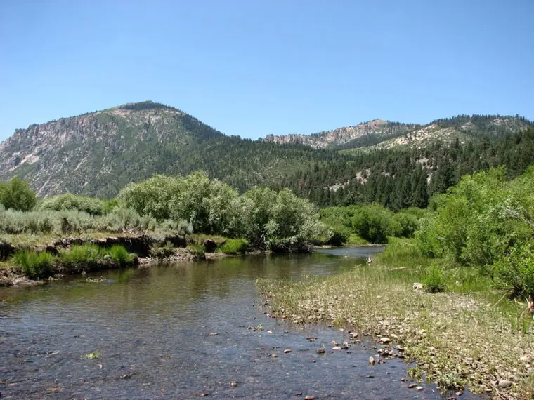
Pleasant Valley Creek
West Fork Carson River
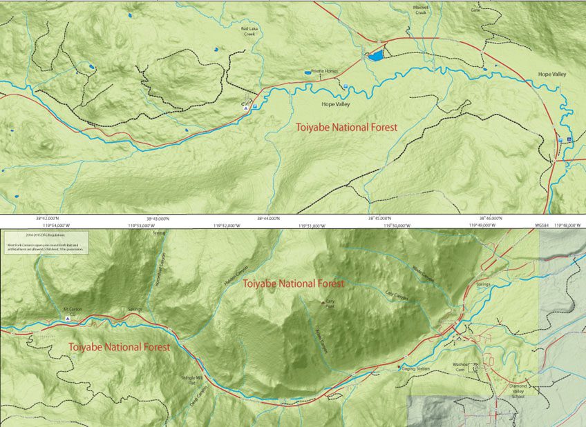
West Fork Carson
The West Fork of the Carson River starts as a small tributary near Upper Blue Lake and flows northward through the Hope Valley for 26 miles until it hits Nevada. You can first access the river out of Hope Valley through Blue Lake Road from Hwy 88. The river is a pool and riffle stream with additional flows from Red Lake Creek. Most of the fish in this section are rainbows in the 8-10 inch class with some large Browns located within the undercuts, 9-16 inches. Below Hope Valley, the river becomes larger and more heavily fished for the 7 miles leading to the town of Woodfords. This section of the river is heavily stocked and flows through the West Carson Canyon with riffles, runs, and pocket water. The large pools tend to hold the planted trout while the runs and pocket waters will hold the wild rainbows and browns.
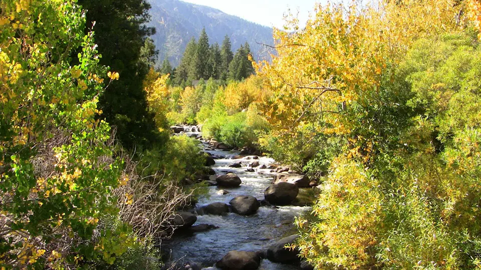
West Fork Carson near Woodford
Near Woodford. The Carson River West Fork is both shorter and significantly smaller than the East Fork, having only about one-third the average discharge of the East Fork.(79) Even so, the West Fork tends to have a richer and earlier history than the East Fork due to its strategic location along the major transportation route for the Carson Pass and Luther Pass, which were used by early explorers, miners, and emigrants. These passes through the Sierra Nevada Mountains provided early access to Placerville, California and the placer gold fields (via Luther Pass), as well as providing a direct route to the rich farmlands of California's Central Valley (via Carson Pass).
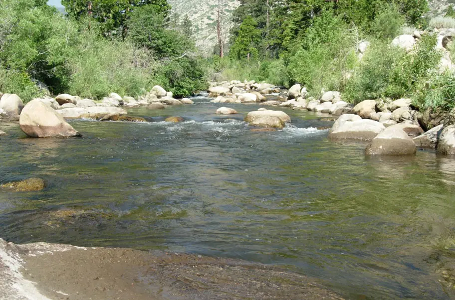
WF Carson near Sorensons.
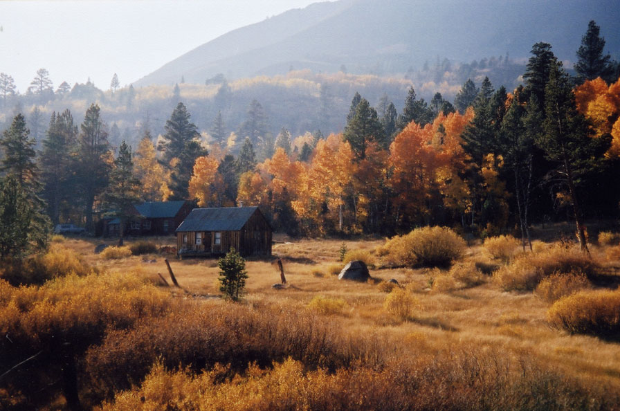
Hope Valley Fall Colors
West Fork Carson, Hope Valley
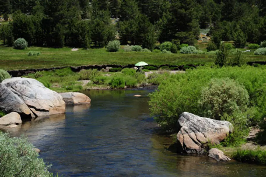
Excellent Dry Fly water
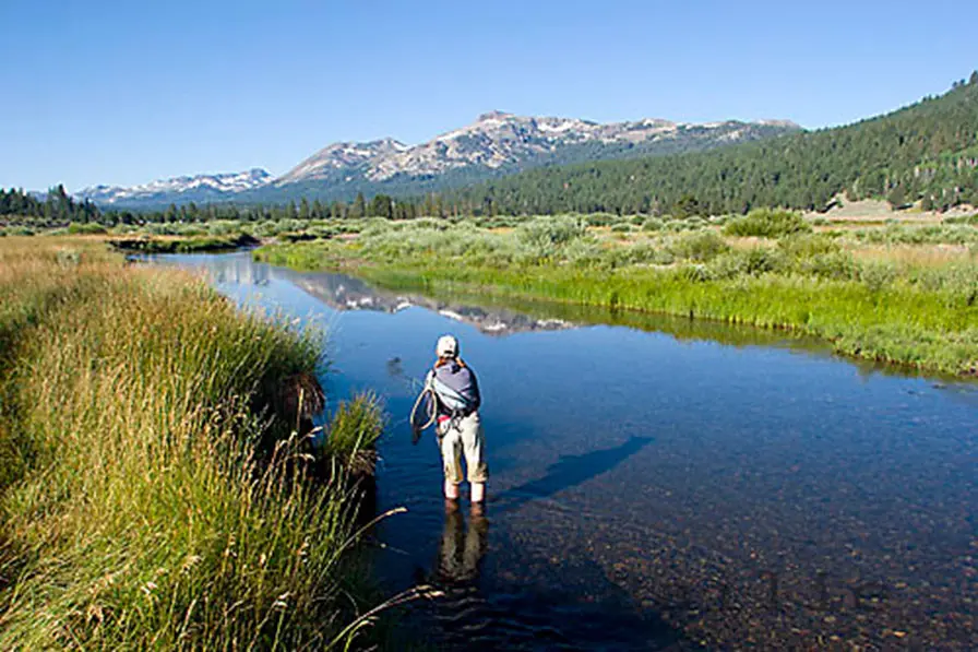
Especially for beginners.
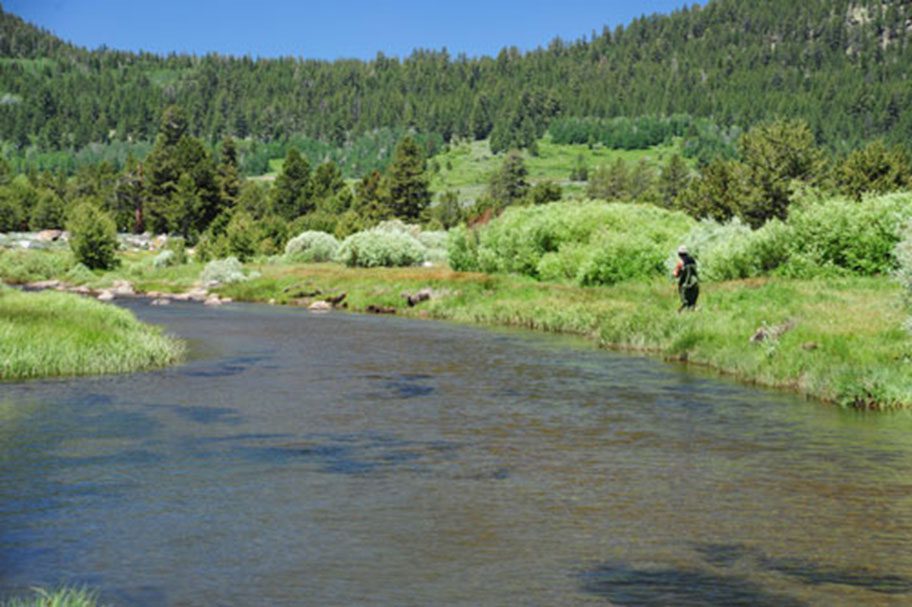
WF Carson Hope Valley, Sandy Bottoms. Lots of water in the Spring or early Summer.
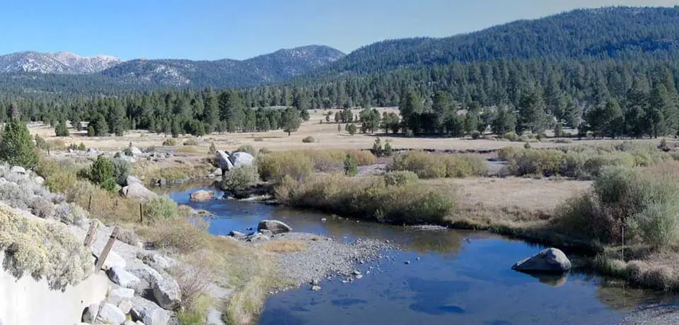
Water gets quite thin in late Summer.
Red Lake
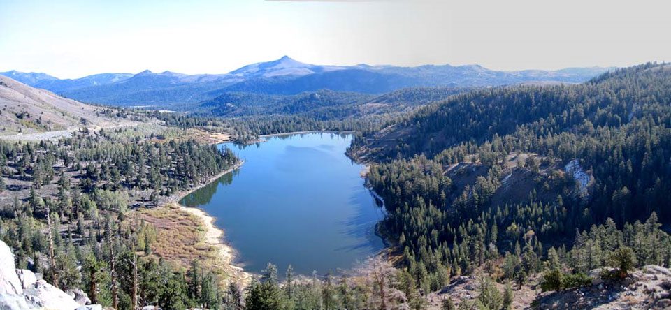
This lake is well-known for it's excellent brookies as well as some big Rainbows. There are also some Lahonton Cutthroats from Heenan Lake that have been transferred here. The Lahonton's may evenually overtake the brookies as the prevalent species. Some Browns exist due to an error in planting during 2002 . The lake is along Highway 88 at 8,200 feet. It is a fairly shallow lake with 25 feet being it's deepest near the dam. The lake contains plenty of nutrients for good fish growth. It is within the Mosquito zone, so bring plenty of bug spray
The upper or western end of the lake is considered the best water, particularly for float tubers, but you have to walk to get there. This area is relatively shallow with defined channels that the 6-10 inch brookies prefer. The eastern end, near the dam, actually has larger trout but they remain much deeper and are difficult to access. During the evening, however, caddis and mayfly hatches often bring these fish to the surface. Spring ice-out and Fall are the best times to fish Red Lake for the larger trout. Try Woolly Buggers in Black and Brown. As well as some scud patterns. During the summer months, however, the brookies will always be ready for almost any fly. A PMD or Light Cahill #12-16 dry is a good choice during dawn and dusk. Try the dropoffs during late morning and afternoon with nymphs such as Pheasant Tails and Caddis Pupas. You can use a slow retrieve with an intermediate line with the nymphs or suspend them under an indicator with a floating line.
