| Notes:
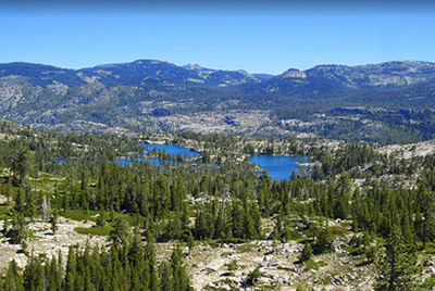
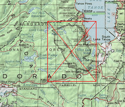
The Desolation Wilderness consists of 63,000 acres with over one hundred small- to
medium-sized lakes within a subalpine environment of granitic peaks and glacially formed valleys. The area
became a designated Wilderness in 1969 and is probably one of the most heavily used "Wilderness"
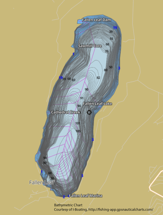
areas within the U.S. Originally, the native fish were Lahonton Cutthroats found within the Fallen Leaf
area from Lake Tahoe. Most of the waters within the Desolation area were barren. Trout planting, starting
in the late 1800's, brought Rainbows, Browns, Brookies, and Goldens to the area.Today, Brookies are the
most prevalent since they can spawn within non-moving waters. Rainbows represent the second most numerous
fish. The area can be accessed after snow-melt from June through September. All air drops of trout were ended in the year 2000. Many of the smaller lakes have gone fishless. Some lakes are actively being gill-netted for the MYLF restoration program.
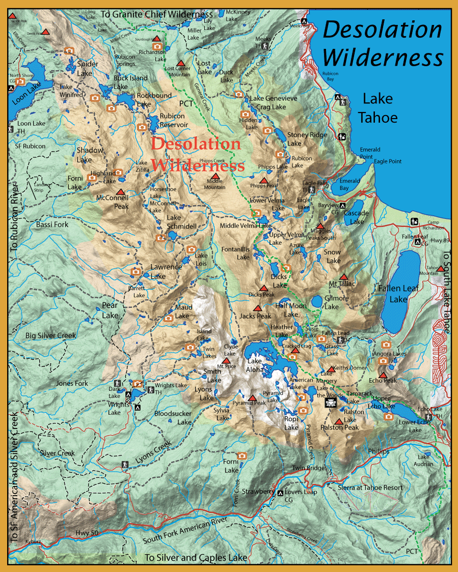
Meek's Creek Trail: There are six lakes to consider along this trail. Trailhead starts at 6200 feet.
Genevieve Lake: 4.5 miles from Trailhead, 7350 feet. Mostly Brookies, some Browns. Shallow shoreline.
Crag Lake: 5.0 miles from Trailhead, 7400 feet. Brookies, Rainbows, and Browns. Some Browns up to 17".
Hidden Lake: 5.5 miles from Trailhead, 7300 feet. Brookies, Rainbows, some Lahonton Cuts. Rocky Points.
Stony Ridge Lake: 6.5 miles from Trailhead, 7820 feet. Brookies, Browns, and Rainbows. Deep Lake.
Rubicon Lake: 7.5 miles from Trailhead, 8500 feet. Brookies and Rainbows.
Phipps Lake: 9 miles from Trailhead, 8500 feet. Brookies, some Goldens.
Eagle Falls Trail: There are seven lakes to consider on this trail. Trailhead starts at 6600 feet.
Eagle Lake: 1 mile from Trailhead, 7200 feet. Browns, Rainbows and Brookies.
Azure Lake: 2 miles from Trailhead, 7625 feet. Brookies and Rainbows.
Upper Velma Lake: 3 miles from Trailhead, 7840 feet. Brookies and Rainbows.
Lower Velma Lake: 4 miles from Trailhead, 7760 feet. Brookies, Rainbows, and Browns.
Middle Velma Lake 4 miles from Trailhead, 7800 feet. Rainbows, up to 15".
Fontanilis Lake: 4.5 miles from Trailhead, 8400 feet. Brookies, some Rainbows.
Dick's Lake: 4 miles from Trailhead, 8420 feet. Brookies, some Rainbows.
Fallen Leaf Lake Trail: There are five lakes and one creek to consider on this trail. Trailhead starts at 6600 feet.
Grass Lake: 2 miles from Trailhead, 7200 feet. Brookies, Browns, and Rainbows.
Gilmore Lake: 4 miles from Trailhead, 8300 feet. Mostly Lake Trout. Some Brookies, Browns, and Rainbows.
Susie Lake: 4 miles from Trailhead, 7800 feet. Brookies up to 17", Rainbows, some Browns. Rocky Points.
Heather Lake: 5 miles from Trailhead, 7900 feet. Brookies and Browns up to 17", some Rainbows.
Half Moon Lake: 5 miles from Trailhead, 8150 feet. Brookies and Rainbows. Shallow Shoreline.
Glen Alpine Creek: 2 miles of Freestone Creek from Trailhead. Brookies and Rainbows.
Echo Lake and Ralston Trails: There are five lakes and one creek to consider. These areas can be accessed by either trailhead. If you take the Echo Lake trailhead you can take the water taxi and save 3 miles. Echo Trailhead starts at 7400 feet.
Tamarack Lake: 3.5 miles from Trailhead, 7820 feet. Brookies up to 17". This lake is planned to be gillnetted by DFG under the Yellow-legged Frog Restoration Program.
Ralston Lake: 4 miles from Trailhead, 7800 feet. Brookies.This lake is planned to be gillnetted by DFG under the Yellow-legged Frog Restoration Program.
Lake of the Woods: 5 miles from Trailhead, 8060 feet. Brookies and Rainbows up to 17".
Ropi Lake: 7 miles from Trailhead, 7600 feet. Brookies.
Lake Aloha: 6 miles from Trailhead, 8100 feet. Brookies and Rainbows.
Clyde Lake: 9 miles from Trailhead, 8200 feet. Headwaters of Rubicon River. Used to have Goldens. Fishless due to cessation of air drops in 2000
Pyramid Creek: 5 miles of Freestone Creek below Lake of the Woods. Rainbows and Brookies.
Wright's Lake Trailhead: There are seven lakes to consider. Trailhead starts at 7000 feet.
Maud Lake: 4 miles from Trailhead, 7700 feet. Browns, Rainbows, and Brookies. Inlet stream for spawning. Maud Lake is the headwaters for the Jones Fork.
Lake Lois: 6.5 miles from Trailhead, 8300 feet. Brookies. Rocky Points.
Lake Schmidell: 7.5 miles from Trailhead, 7900 feet. Brookies. Deep Lake.
Lawrence Lake: 5.5 miles from Trailhead, 7800 feet. Brookies up to 17".
Twin Lakes: 2.5 miles from Trailhead, 8000 feet. Brookies, some Rainbows.
Island Lake: 3 miles from Trailhead, 8200 feet. Used to have Brookies and Goldens. Fish removed by gill netting.
Smith Lake: 2.5 miles from Trailhead, 8700 feet. Brookies.
From Wright's Lake, a cutoff trail goes to Lyons Creek and connects with the Lyon's Creek Trail.
Lyons Lake: 5.25 miles from Trailhead, 8400 feet. The lake has a small rock dam at the southern end with a plunge pool below, opening into a wide shallow pond. Midges work great as well as Ants and Beetles. Contains Brookies.
Sylvia Lake: 5.25 miles from Trailhead, 8100 feet. Marshy edges surround the lake. Contains Brookies.
Rockbound Valley:There are six lakes to consider as well as the Rubicon River. Trailhead starts at Loon Lake, 6400 feet.
Buck Island Lake: 6.0 miles from Trailhead, 6430 feet. Just outside the Desolation Boundary. A rocky, shallow lake often fishless due to cessation of air drops.
Rockbound Lake: 6.5 miles from Trailhead, 6400 feet. Brookies, Browns, and Rainbows.
Rubicon Reservoir: 8 miles from Trailhead, 6500 feet. Brookies, Browns, and Rainbows.
Highland Lake: 18 miles from Trailhead, 7820 feet. Rainbows up to 17".
McConnell Lakes: 18 miles from Trailhead, 7750 feet. Used to have Goldens. Fish removed by gill netting.
Horseshoe Lake: 16.5 miles from Trailhead, 7600 feet. Fishless due to cessation of air drops.
Zitella Lake: 17 miles from Trailhead, 7700 feet. Fishless due to cessation of air drops.
Rubicon River: 9 miles from Trailhead. 10 miles of wild river. Rainbows in lower section, Goldens in upper section.
|