Sub-Total: $0.00
Eastern Sierra Region 3 – research fishing opportunities

 Click the map or the link for a detailed map of the area: |
||||
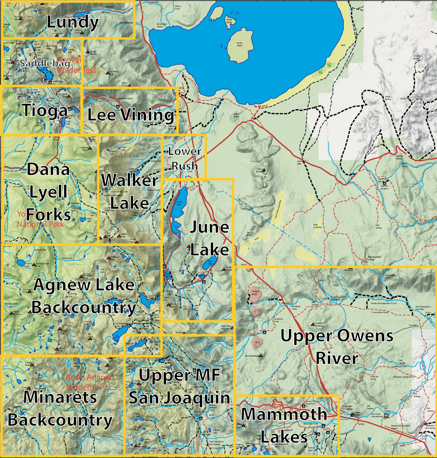
| 1. Lundy Lake |
6. Walker Lake |
11. Minarets 12. Upper MF San Joaquin River 13. Upper Owens |
||
|
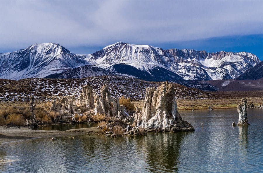
This region contains the Mono Basin which has no outlet to the ocean and developed Mono Lake. The lake reached 7,200 feet in elevation in the Pleistocene period and would overflow into the Owens River. Water diversions, mainly to the LA aqueduct, reduced the lake levels to 6,374 feet. Litigation in 1994 forced LADWP to replenish the lake to 6,392 feet. Currently, the lake sits at 6,383 feet. The lake levels are critical to bird nesting on the two islands by keeping predators from access. The brine shrimp that thrive within the waters are an important food source for the approximately two million migratory birds and was an important food source for the indigenous people that inhabited the area. The Tufa Towers shown on the photo were created by freshwater springs beneath the surface of the lake. These springs created a calcium carbonate (limestone) structures that are present along the shoreline.
|
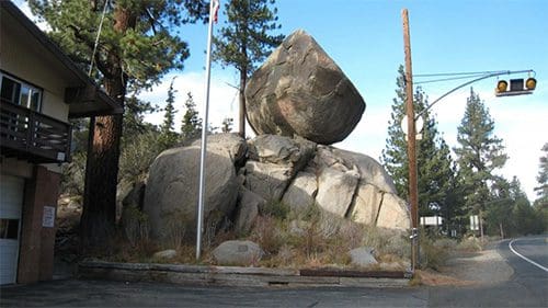 Glaciers also played an important role in developing this region. Lateral moraines are very evident along Lee Vining creek. The June Lakes area was the result of glacial scouring. Reverse Creek within the loop flows in the opposite direction one would expect and this is due to glacial damming of material forcing the creek to flow in a different direction than expected. Balanced Rock next to the June Lake Fire Station is an example of the material left by glaciers.
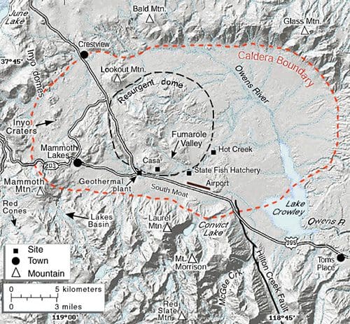 Another major feature of this region is the Long Valley Caldera. The center of this caldera is the resurgent dome where Little Hot Creek originates just northeast of the Geo Power Plant for Mammoth. The Long Valley Caldera is one of the largest calderas in the world being 20 miles long (east-west) and 11 miles wide (north-south). It is over 3000 feet deep. The caldera was formed about 760,000 years ago releasing a hot ash known as the Bishop Tuff. The Owens River Gorge was created when the caldera filled with water and overflowed its rim.
|
|
|||
Fishing Map AvailableCovers the Dana and Lyell Fork of Tuolumne River, Saddlebag Lake, June Lake Loop, Upper MF San Joaquin River, and the Agnew Lake Backcountry. Shows topographic relief, GPS Long./Lat., camping areas, road access, and trailheads. Special Features are Suggested Flies, Hatch Chart, Fishing Season and Regulations, Fish Identification, Catch & Release Procedures, and Stream Etiquette guidelines. |
Eastern Sierra Region 3
|
$12.95 eachPurchase Here |
|
