Sub-Total: $0.00
Eastern Sierra Region 4 – a fly fisher’s paradise
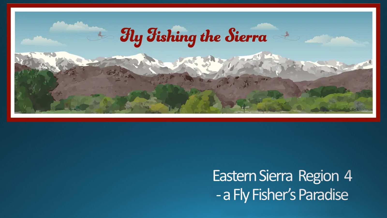
Eastern Sierra Region 4 is an area that we have fished often. It is one of the premier regions to fish. It is a Fly Fisher's Paradise.
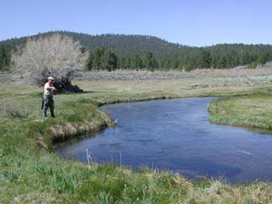
Eastern Sierra Region 4
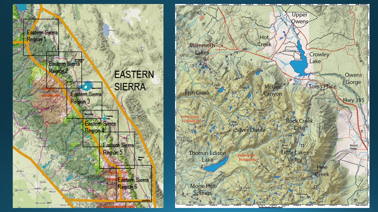
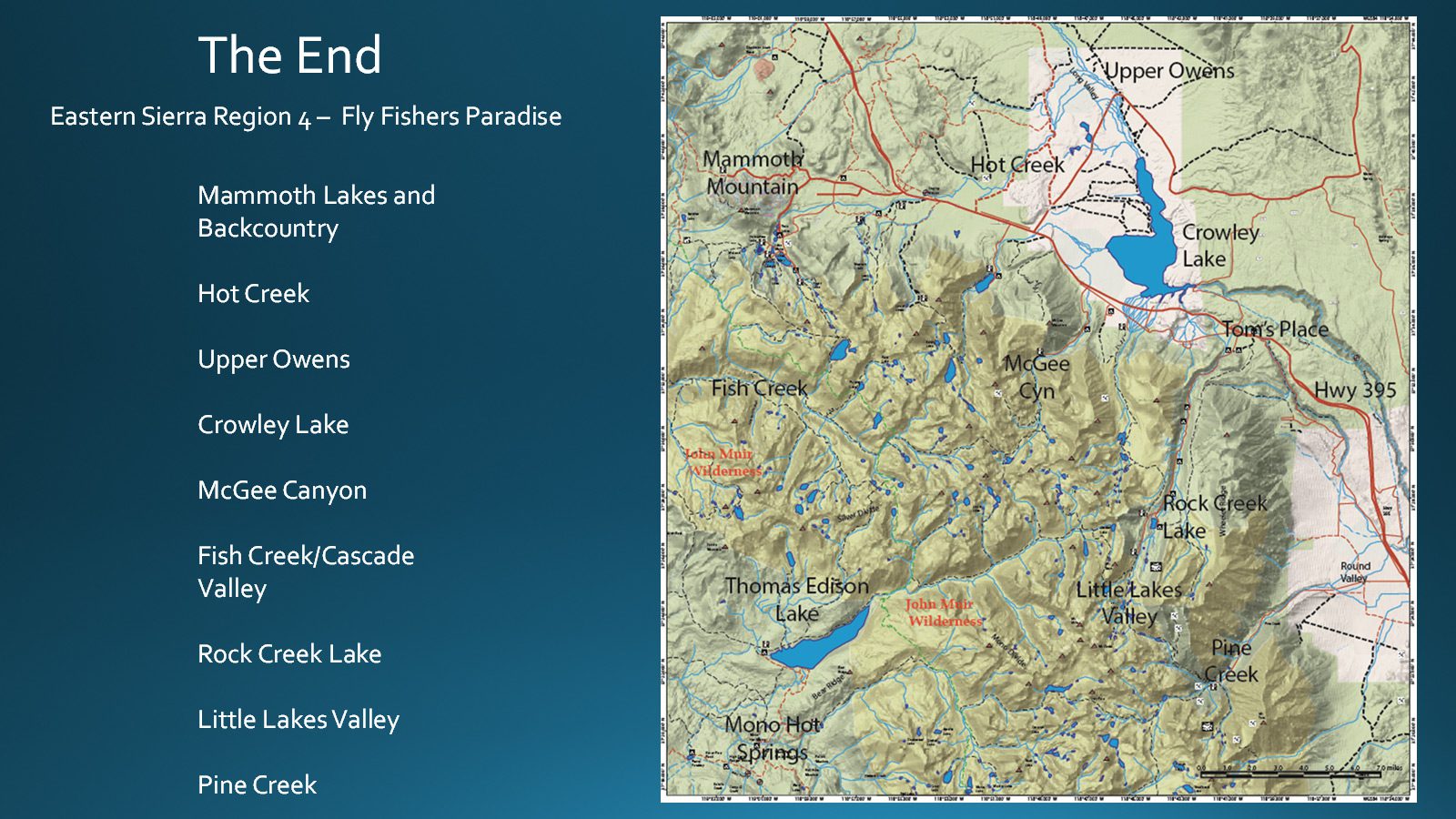
I’ve divided the Eastern Sierra into six regions, Eastern Sierra Region 4 is the area we will look at today. This area covers the Upper Owens River starting at Big Springs and goes through the Owens Gorge below Crowley Lake. Other main areas are Mammoth Lakes, Hot Creek, McGee Canyon, Rock Creek Lake and the Little Lakes Valley, Fish Creek and the Cascade Valley, and Pine Creek. You notice that Thomas Edison Lake and Mono Hot Springs are within this region but they overlap into the West Sierra region and are usually accessed from the west side. Mountain passes such as Duck Pass, McGee Pass, Mono Pass, and Pine Creek Pass provide access over the Sierra Crest. Explorer John C. Fremont christened the Owen’s Valley, Owens River, and Owens Lake in 1845. He named them after Richard Owens, one of his guides.
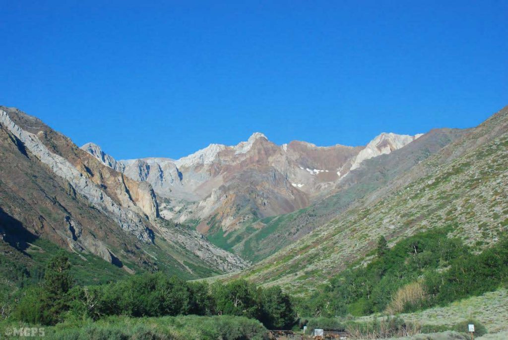
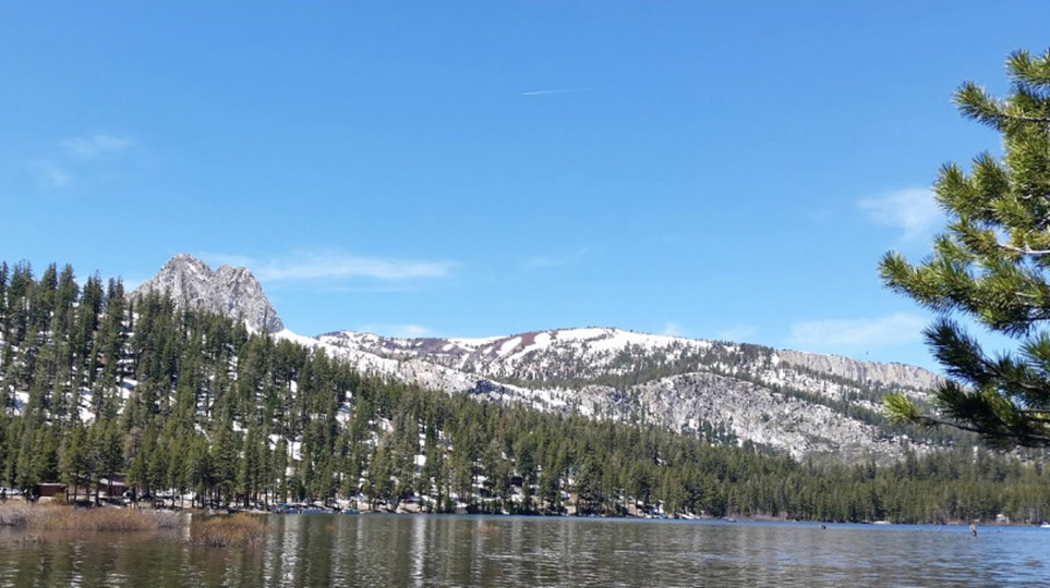
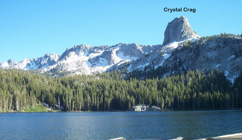
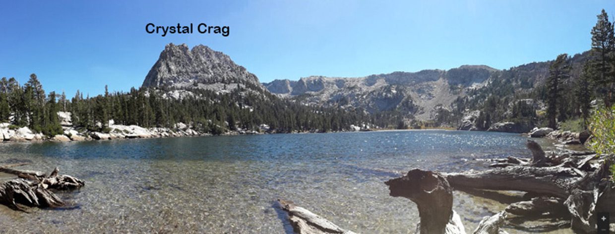
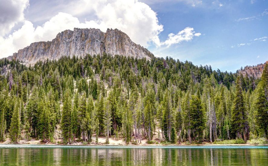
The Sevehah Cliff
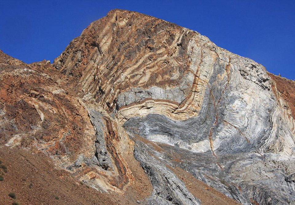
The region has some of the oldest rock formations within the Sierra. California was an ancient shallow seabed 500 million years ago. Over 12,000 feet of sand, silt, and mud were deposited. The weight of this material created sedimentary layers. Forces within the earth pushed these layers above ground where they were exposed to erosion. The land sunk and rose at least three times, where the last land push above water was about 100 million years ago. The Metasedimentary formations were pushed up about 40 Million years ago.
Glacial Moraines
The McGee till within the McGee Canyon is one of the oldest Glacial deposits in the Sierra. These deposits occurred about 2.0 – 2.6 million years ago.
Long Valley Caldera
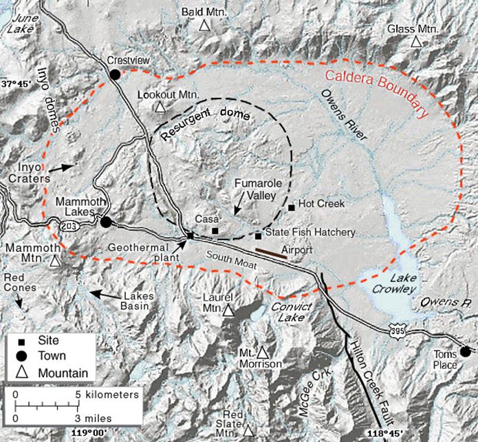
Long Valley was formed 760,000 years ago when a very large eruption released hot ash that later cooled to form the Bishop tuff that is common to the area. The eruption emptied the magma chamber under the area to the point of collapse. One of the largest calderas in the world. 20 miles long and 11 miles wide.
Bishop Tuff
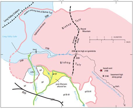
The welded ash that erupted covered 850 sq. miles and deposited 500-660 feet deep. 760,000 years ago.
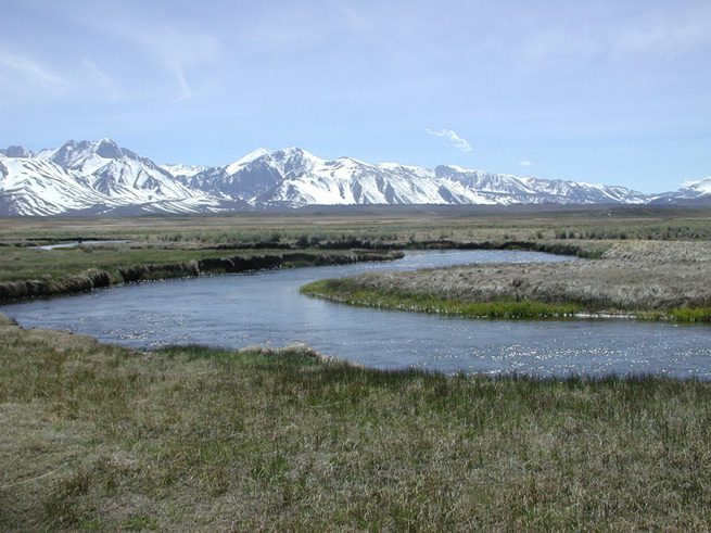
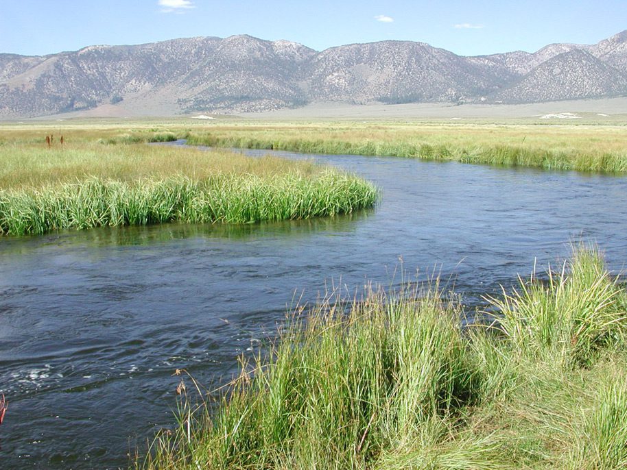
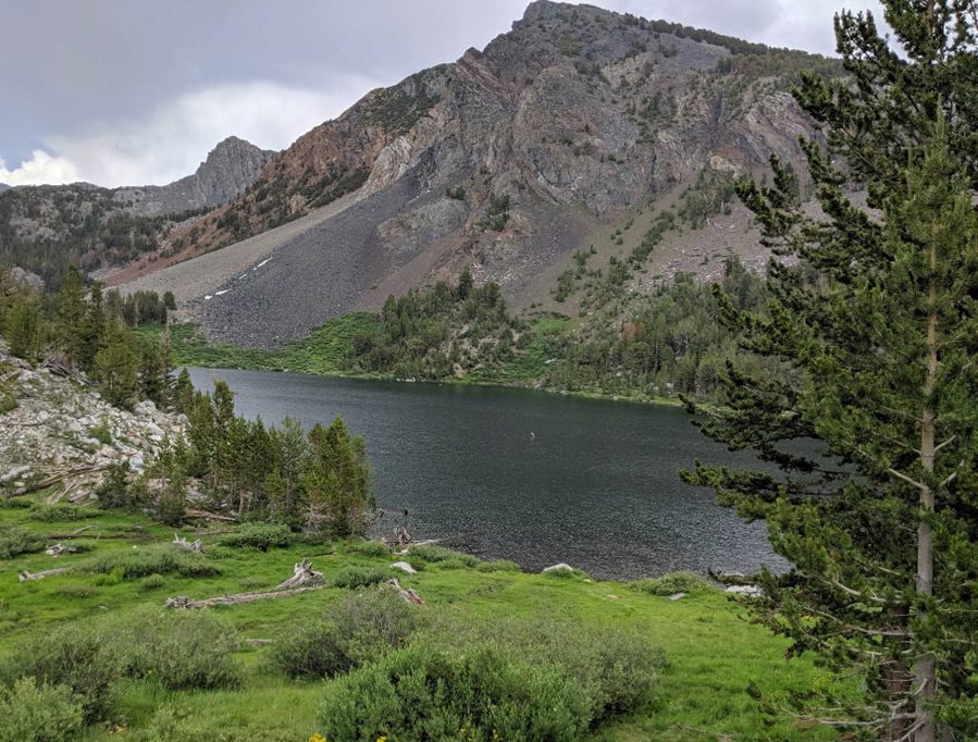
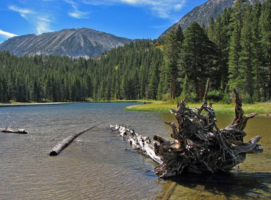
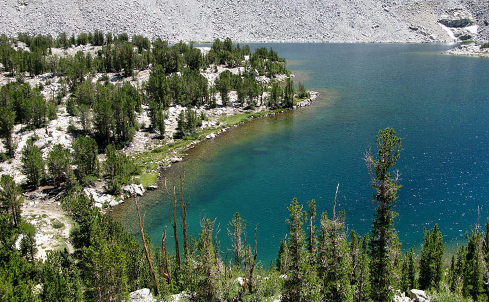
Upper Owens
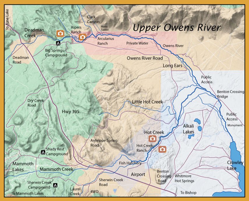
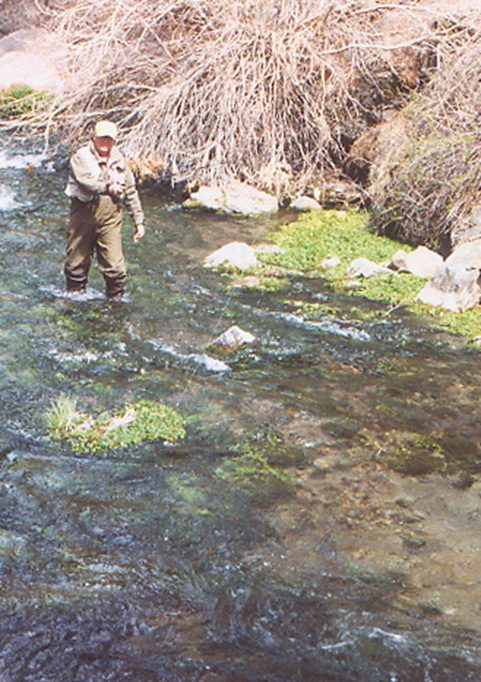
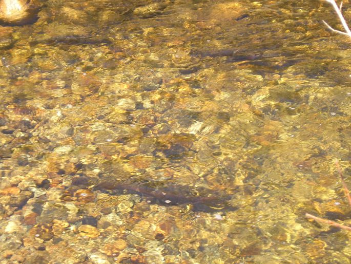
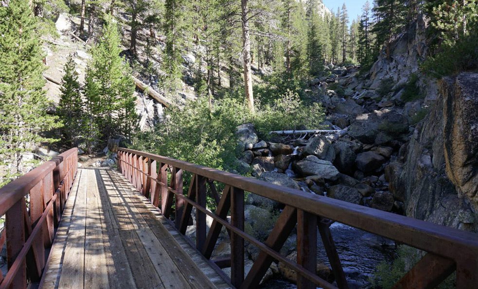
The Upper Owens starts at the northwest portion of the caldera in Big Springs and flows down the eastern side of the resurgent dome. It empties into Lake Crowley which only existed 80 years ago in 1941 and travels through the Owens Gorge. Deadman Creek is above Big Springs and goes underground just prior to the springs. The Upper Owens is one of the finest Spring-fed streams in the Sierra. It is best in the Spring when Rainbows come upriver from Crowley to spawn and in the Fall when the Browns make their migration. There is a one mile section below Big Springs campground which presents itself like a freestone stream with plenty of deep pools, eddies, and runs. The river then reaches a meadowland environment within Alper’s and Arcularius Ranch. The public water starts at the Frank Arcularius fenceline and travels 5 miles to Crowley Lake as the bird flies and about 18 miles of river.
Big Springs
Big Spring is the origin of the Owens River where the water percolates out of the lava rock and is fed by both Deadman and Glass Creek. Over 100 seeps and springs bring water to this river. Rainbows and Lahontans make their way from Crowley Lake to spawn within these upper waters and do not make it further than Big Springs.
Alpers Ranch
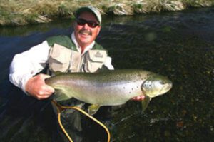
Alpers Ranch was an 1860 homestead that was sold to Fred Alpers in 1906. Fred passed away in 1946 and his son, Bill, ran the ranch until his death in 1979. Bill’s son, Tim, took over the ranch in 1979 and continued fish farming on the property using Triploid Trout. The demand for these trout developed within the area and by 1985 the demand for 3 to 5 lb. Alpers Trout grew from hundreds to over 35,000 trout annually by 1995. Tim developed the Alpers Trout from the Coleman (Steelhead) strain, a cross between steelhead and coastal rainbow. The ranch was sold to the Gottwald Family in 2007 and continues to be private water.
Benton Crossing Bridge
Benton Crossing is where Benton Road crosses the Owens River. Named after Sen. Thomas Benton of Missouri. The town of Benton is a small mining town that prospered between 1862 and 1890.
Upper Owens
Owens River is open all year, 0 trout limit. Barbless Artificial lures only from Big Springs Culvert to Benton Bridge. Below the bridge, it is a 2 trout limit with minimum size 18” from August 1st to Nov 15th. From last Saturday of April through July 31st, it is open regs with a 5 trout limit.
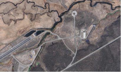
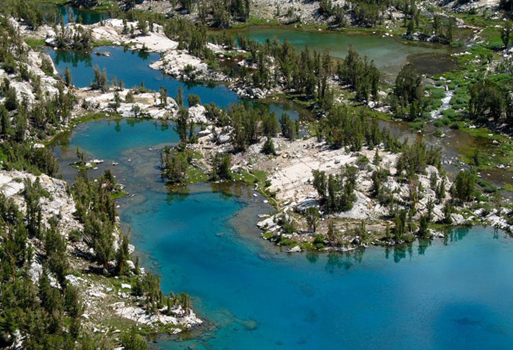
Aerial Photo of Upper Owens
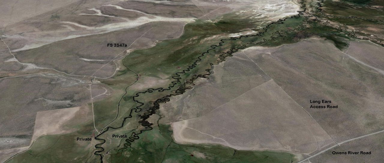
This aerial shows access to Long Years and the end of the FS3S47a at the Frank Arcularius ranch. You can fish the Owens below the fenceline of the Arcularius ranch.
Long Years is an area accessed from the southern side of the river off Owens River road. Look for the Powerlines and a cattle guard at the top of the knoll. Turn onto an unmarked dirt road.
Hatches of the Upper Owens
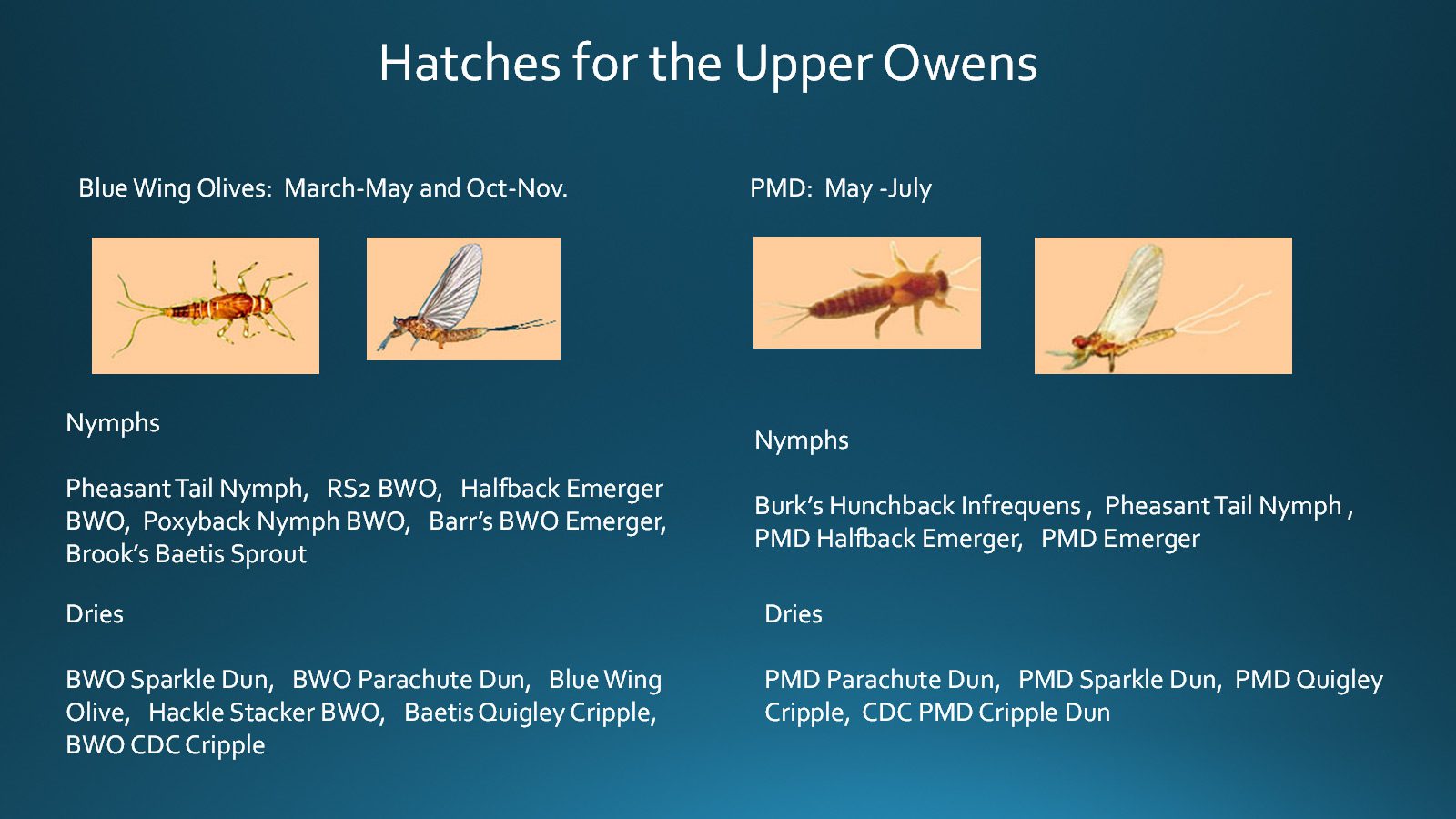
BWO’s and Pale Morning Duns are the two primary mayflies. BWO’s from March-May and Oct-Nov.

Caddis are the other two main hatches. The Little Black Caddis March through May and the Spotted Sedge Caddis May through Oct. There is an October Caddis hatch as well.
Nymphing

Indicator or Dry Dropper rigs are often used for nymphing. The indicator is usually set at twice the depth with a tapered mono leader. The first fly is tied off the leader with 18” 4x tippet and a dropper 6-12” below the first fly.

Euro Nymphing or Straight line nymphing is very popular. A 9 ft. tapered leader has 20” of 1X Fluoro tied off the leader and a 15” sighter is tied off that. From the sighter tie on 20” of 4X or 5X Flouro with an 8-12 inch tag for the top nymph and another 20” of 4X-5X Fluoro for the point fly. Euro nymphs could include the Duracell or Walt’s Worm.
Streamer Fishing
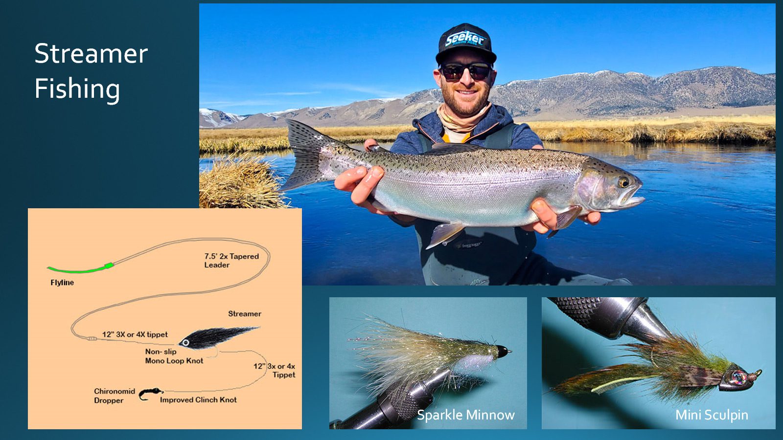
Streamer fishing is also popular on the Upper Owens. The Crowley Steelhead, Fall Run starts late Sept through February. The Spring Run of Lahontan and Rainbows is March through early June. Use a 7.5’ 2X Tapered Mono leader and add 12” of 3X or 4X tippet to the streamer. A midge dropper is often added with 12” of 3X or 4X tippet.
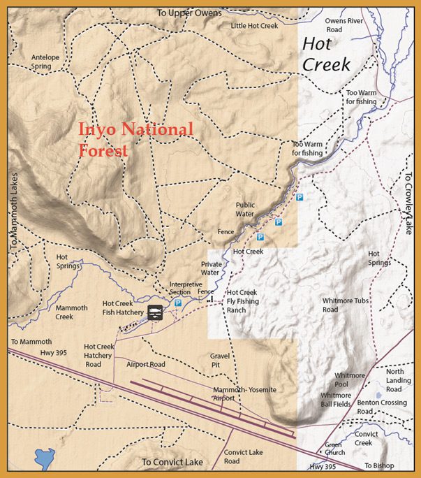
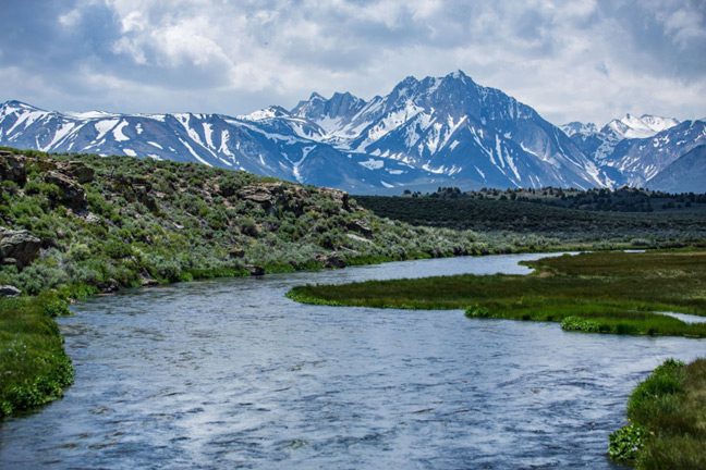
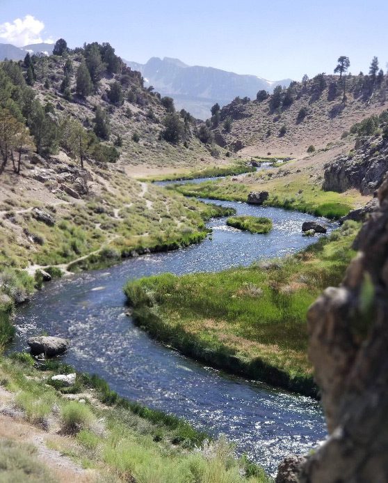
Hot Creek
Hot Creek is a small stretch of Spring Creek water that comes flowing out of volcanic rocks just above the Hot Creek Fish Hatchery. The stream flows at 9,000 gallons per minute with a consistent temperature of 60 to 69 degrees. This consistent supply and water temperature was the reason for building the fish hatchery at this site in 1941. Just below the hatchery, Hot Creek is fed by Mammoth Creek, upstream. Mammoth Creek brings oxygenated and colder snowmelt water to the mix, contributing about 20% of the volume. This blending of water produces the perfect trout water of a slightly high pH, minerals, nutrients, and a consistent water temperature of 50 to 60 degrees year round. There is only about 1 mile of this perfect stream available until the thermal springs occur.
Hatches for Hot Creek
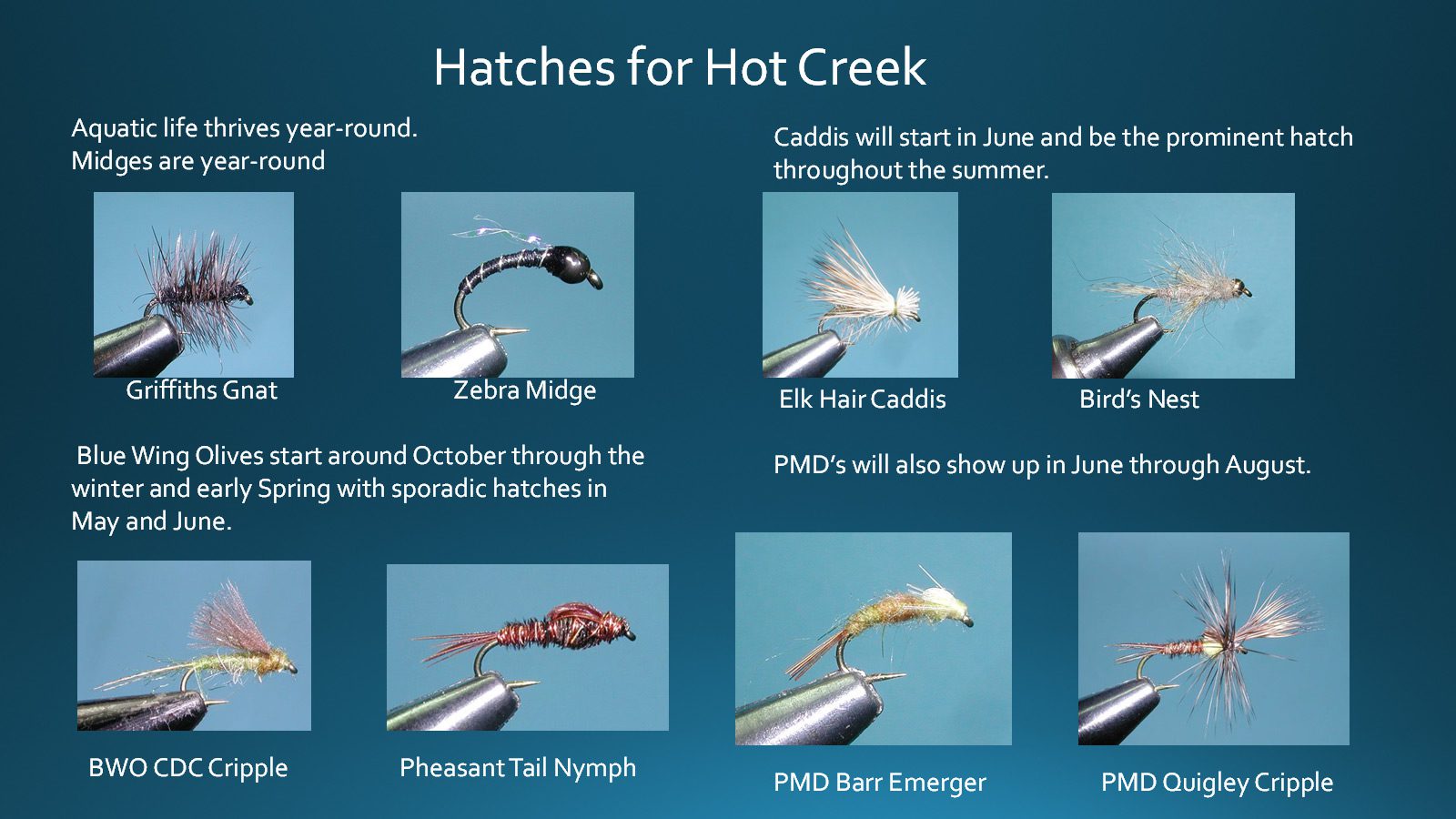
The midges are available year-round. A Griffiths Gnat, and Zebra midge are good fly choices. The caddis start in June and hatch through the summer. EHC and Bird’s Nest are good fly choices. The Blue Wing Olives start to show around Oct and will continue through the winter months ending in May and June. Try a BWO CDC Cripple and a PTN. The PMD’s show up in June and continue through August. The PMD Barr emerger and PMD Quigley Cripple are good choices. The weed beds start to congest the creek in August and September and the Tricos may appear for a spinner fall.
Hot Creek Interpretive Area
The Interpretive area of Hot Creek is just below the hatchery. It’s only about 100 yards of water to the Hot Creek Ranch fenceline. It does contain a lot of wily trout that have seen every fly but you can fool them with the perfect presentation. Tom Loe’s client, Dr. Cary Kutzke, caught a 10 Lb. Brown there in 2006.
Hot Creek Ranch
Hot Creek Ranch is a private fly fishing ranch on Hot Creek between the Fish Hatchery and the public waters downstream. Dry Fly presentation only, Catch & Release, Barbless Hooks. Wild Rainbows and Browns. Nine Cabins. Guide Service available.
Fishing is available only to the cabin guests . Kevin Peterson Owner/Manager.
Open last Saturday of April to Nov 1st. Fall Rod Fee Fishing Nov 1st to 15th.
Public Canyon Section
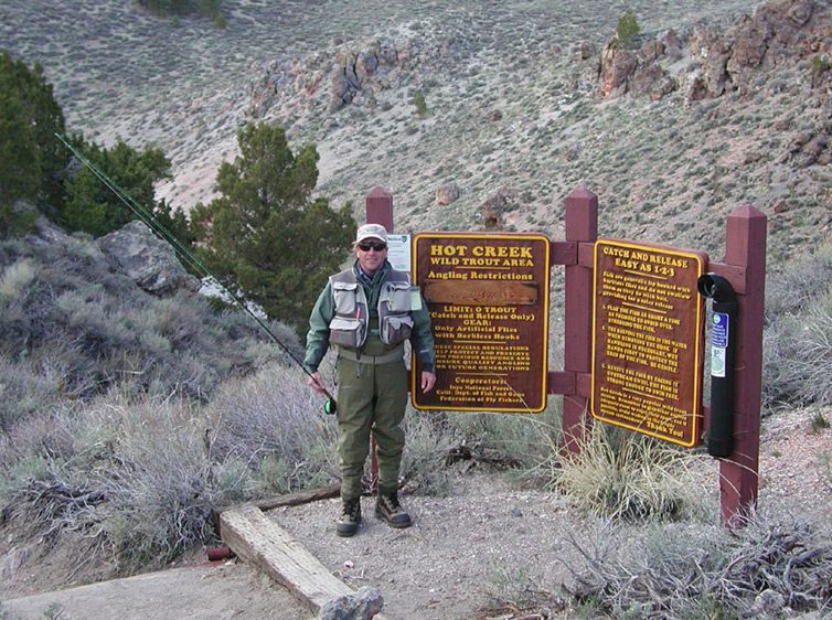
Hot Creek is open year-round, Catch & Release” only. Designated a “Wild Trout” stream in 2007. Consists mostly of 9-12 inch Rainbows and Browns. At one time it was known as having the most fish per mile of any stream in California (12,000 fish per mile). Impacted greatly by the drought of 2012 and 2016 as well as Hatchery closures. Fish survey in 2016 showed only 1,000 fish per mile. After the drought and some hatchery mitigation counts are back up to 8,000 to 10,000 fish per mile. Again, the best fish count anywhere in California.
The Hatches
The best time of the year to fish Hot Creek is the early summer when there is plenty of runoff and the hatches are active. Caddis is your best bet with #16-20 dries, #18-20 emergers, and #18-20 green larvae patterns. Drift a beadhead nymph pattern through the deeper sections or through the lanes between the weeds with a 7.5 foot , 5X leader and a 6X tippet. Blue Wing Olives and Mahogany Duns hatch sporadically in May and June.
Caddis will hatch throughout the Summer and offer great dry fly fishing. Weeds tend to choke off Hot Creek in the later part of summer in August and September for nymphing, so this is a good time to try Trico spinners, size 18-26, in the morning and small Caddis patterns in the afternoon. Small hoppers and terrestrials also work well during late Summer. The dry fly season picks up in October with the onset of the Fall baetis hatch and the winter months will always have both midges and Blue Wing Olives.
Thermal Pools
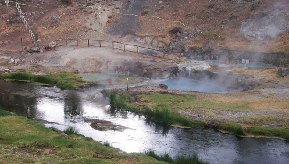
Hot Creek is a place to marvel at geology in action. Boiling water bubbling up from the creek bed, fumaroles and periodic geyser eruptions at Hot Creek attest to the chamber of hot magma which lies about three miles below the surface of the earth in this area.
The steam you see along the Hot Creek drainage is created when water percolates deep into the ground and enters a complex underground plumbing system. The water is heated and pressurized before it rises to the earth's surface. It is believed this journey takes around 1000 years.
Named Flies for Hot Creek
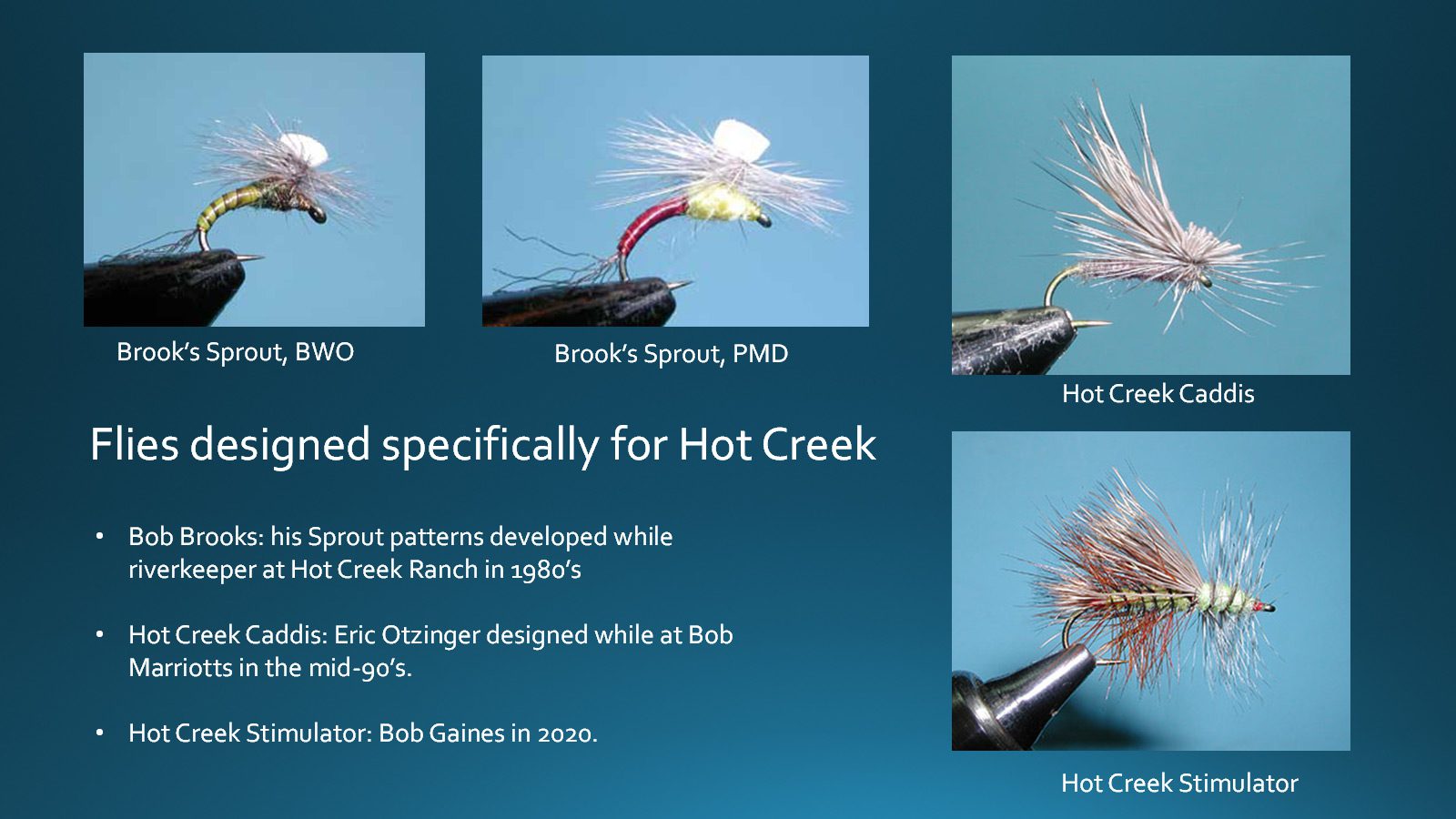
There are a few named fly patterns from Hot Creek. The most well known are the Brooks Sprout patterns of Bob Brooks while he was riverkeeper at Hot Creek Ranch and the Hot Creek Caddis by Eric Otzinger when he worked at Bob Marriotts. The Hot Creek Stimulator was introduced within the March/April 2020 issue of Southwest Fly Fishing by Bob Gaines.
Direct Down Presentation
Spend some time to observe the water.
- The infamous Micro-currents of Hot Creek: a need for stack casts, puddle casts, and aerial mends. Line Handling is critical.
- Use long leaders, 10 to 12 feet with 7X tippets during early season. As weeds grow and water level drops, go with shorter leaders, ie 5’ 5X leader with 24” of 5X or 6X.
- Downstream Presentations are the most successful. Cast upstream of the fish and let the fly swing into the current above the fish. Lift the rod to take out slack and lower slowly to drift the fly directly to the trout.
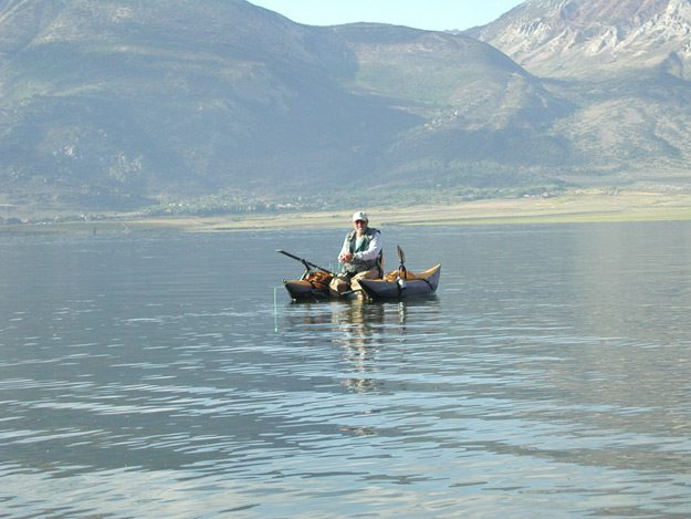
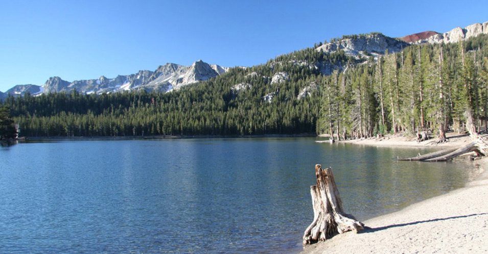
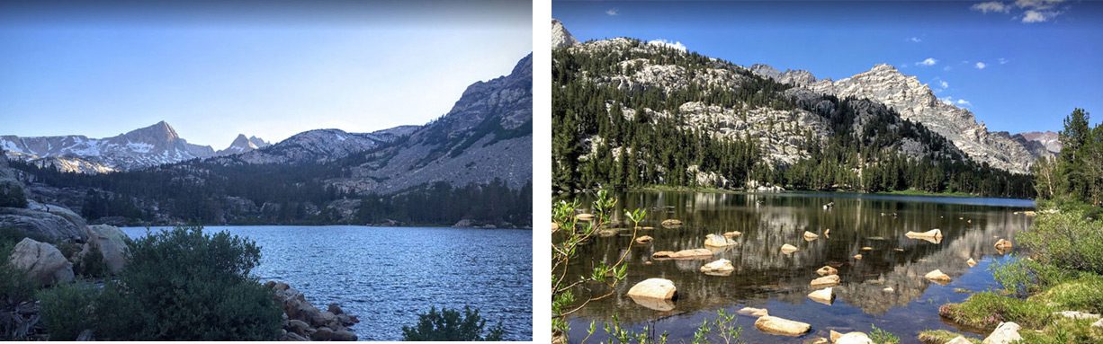
Crowley Lake
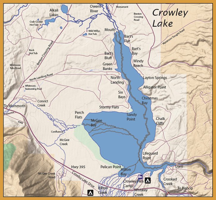
Crowley is best fished from either a boat or float tube. It is a rather large lake at 6,500 acres with plenty of weed beds and shallows holding “trophy-size” trout and perch. The lake was created in 1941 when L.A. Water & Power dammed the Owens River. Best tubing is at Green Banks, Alligator Point, Layton Springs, Sandy Point, and McGee or Hilton Bay. McGee and Hilton Bays are particularly good in the mid-summer months. They are shallow flat feeding areas located within major springs and are nearby the outlets of spring creeks. This keeps these areas high with oxygenated water and extensive weed beds. An afternoon Easterly wind occurs during many afternoons which brings cool water from the deeper Eastern shore to these areas. This wind creates favorable currents that maintain these shallow areas with cooler waters.
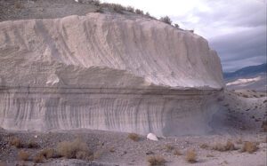
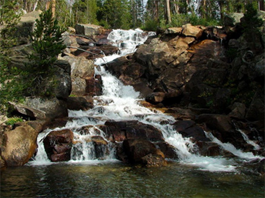
Tuff Columns
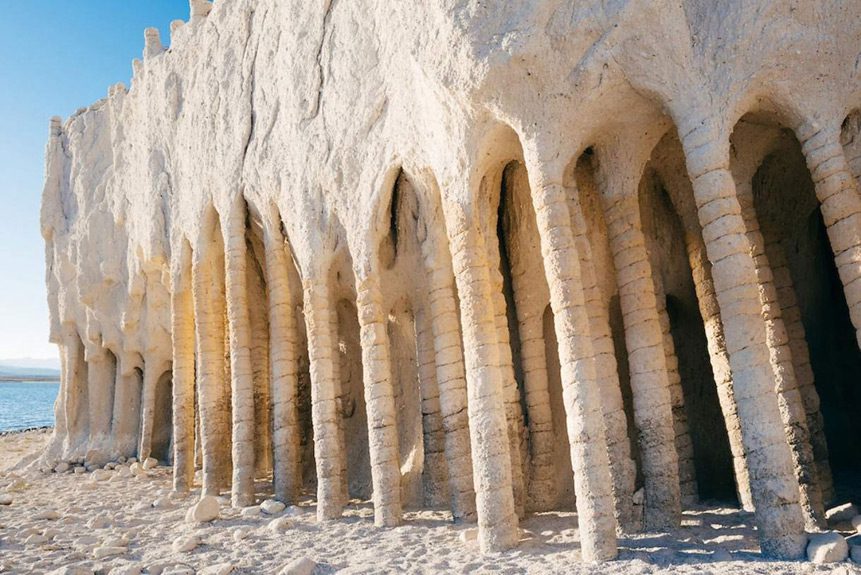
In describing the formation of the columns, researchers believe that falling snow melted on top of the tuff rock deposits left after the eruption. This still-heated porous material caused the melted snow to boil, which created the even spaces between the columns that exist today.
Estimates hold that there are up to 5,000 of the columns within a 2- to 3-square-mile area to the east of Crowley Lake. They appear in clusters of varying shapes and sizes. Some are gray and as straight as poles, while others are reddish-orange and bent or tilting. There are also still-buried columns that would look like fossils to an untrained eye.
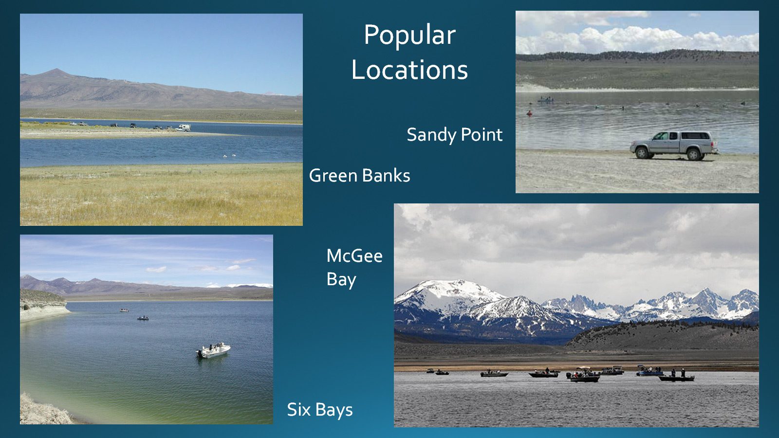
Chironomid Hatches will be the predominant food source. September can be the best month of the year, despite the die-off of the weed beds. The Perch Fry are lacking cover and the trout are after them. Use Hornbergs and Buggers with an intermediate line fishing 5-10 feet. Green Banks has been excellent for years.
Midging
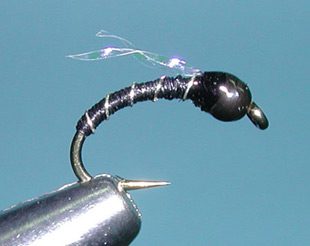
Most of the flyfishing is done by using Chironomid-type midges (ie Zebra midge), with an indicator generally at 8-11 feet depth.
Local Guides, Mike Peters and Harry Blackburn developed a successful midging technique that is being used widely among anglers at Crowley. They use a 2-3 midge rig using Disco, Zebra, or similar midges in sizes 14-22.
The midges were spaced about 6 inches apart and fished about 6 inches from the bottom. You can use a hemostat attached to the dropper fly to ascertain the proper depth. Adjust your indicator accordingly.
New Techniques for midging

These are midging rigs suggested by guide Ernie Gulley. The rig set-up is 3X fluorocarbon with 36” of 4X Fluoro between midges. A static indicator will work for less than 12’ of depth. Change to a Slip-Strike indicator for depths more than 12 feet. An innovation from the conventional anglers is the use of line stoppers. Set the line stopper at the correct depth desired. The indicator is free to move between the split shot and the line stopper.
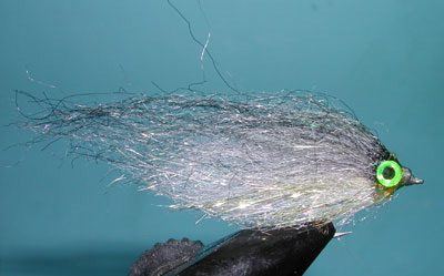
Trolling Streamers
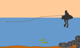
With a float tube you have the ability to move around. This gives you an opportunity to troll the streamer flies without retrieving. Trolling can be very helpful in exploring a new lake , to cover a lot of water, and keep your fly in the water. Keep your rod tip down, even in the water, as this will give you a better direct contact of the fly to your stripping hand without any slack.
Types of Actions
Twitch: Use your index finger from your rod hand and twitch the line in patterns.
3 inch Pull and Release: Here you pull the line about 3 inches and release it
Dead Drift: No retrieve but a slow trolling action with your fins.
The Fish of Crowley Lake
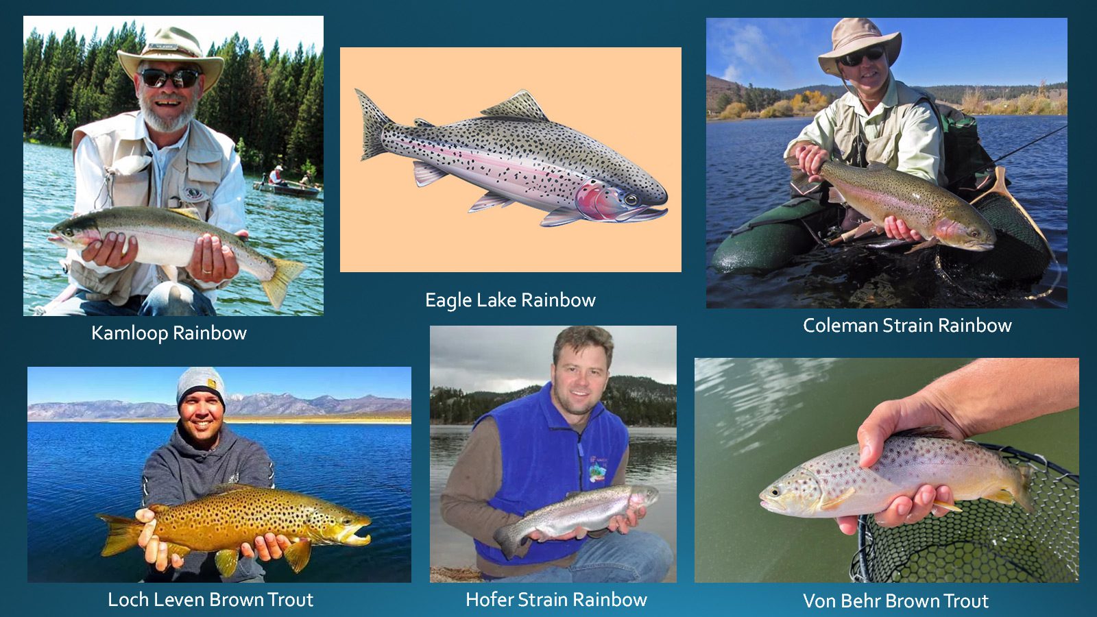
The fish in Crowley include Von Behr and Loch Leven Brown Trout. Eagle Lake, Kamloops, Hofer, and Coleman strain Rainbows. Lahontan Cutthroats..
Only 50 percent of the Eagle Lake–strain rainbows are caught that first year. The rest survive the fishing season and are present in the lake the next year as bigger fish. While the numbers get whittled down each successive year, some trout survive into their third year, and those are the whopper rainbows in the 22-to-24-inch range. They can weigh five pounds or more by late summer, after fattening up on perch minnows.
Kamloop Rainbows have a longer and wider head. The body is relatively short but fat. The tail is somewhat forked. No spots on the belly. Prefer Shallow water. Feisty and love to jump. Spawn during the April opener in the tributaries. Re-enter Crowley in June. 90% are caught the first year. Raised at Hot Creek Hatchery and Fish Springs. Brood Stock at Junction Reservoir. Planted as diploid trout.
Eagle Lake Rainbow trout have finer scales and the snout is frequently rounded. They have numerous small, irregular spots along the back and below the lateral line. Classic “Football” shape. Only 50% are caught the first year. Well-adapted to alkaline lakes. Caudal fin is square. Raised at Fish Springs hatchery.
Coleman Strain Rainbow. Contains Steelhead genetics. Found within the deeper waters of Crowley during the opener. Often caught trolling. Does not spawn but has the instinct to travel upstream in the winter. About 96% are caught in the first year. A triploid trout. Raised at Fish Springs.
Hofer Strain. 100 times more resistant to Whirling disease. Grows quickly but does not respond like a wild trout. Planted as a diploid trout in hopes that it will spawn with other wild rainbows and transfer its Whirling resistant genes.
Von Behr Brown Trout have more red spots mixed with black spots and variable in size. Usually smaller within small streams.
Loch Leven Brown Trout lack the red spots and the Black spots are fewer and larger. There is a bluish hue on the gill plate. A larger size found within lakes.
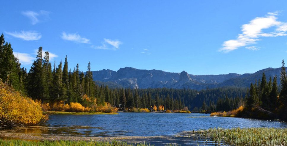
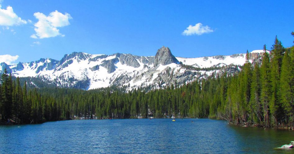
Mammoth Lakes
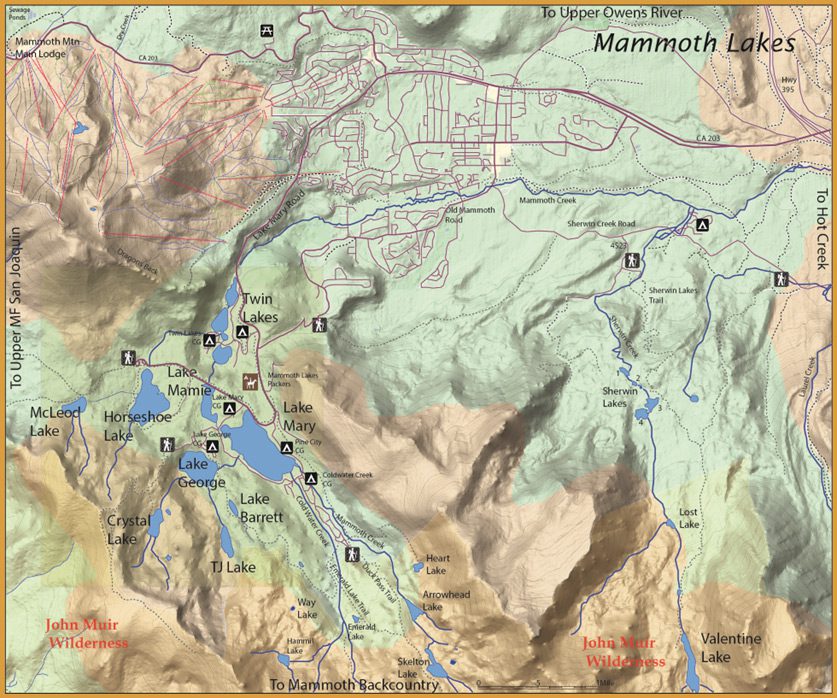
Mammoth Lakes consist of a chain of lakes within close proximity within a glacial cirque. Heavily fished but enough stocking is maintained to keep the trout population healthy. The lakes carry Brook, Brown, and Rainbow, although McLeod Lake is also known for it’s Lahontan Cutthroats. Crystal Lake has Golden-Hybrids. The lakes outlet into Mammoth Creek and then onto the Owens River. The season is the last Saturday of April to November 15th. The lakes are often iced-over until May with access restricted until June.
Twin Lakes
Twin Lakes is 30 acres at 8,480′ with Rainbows, Browns, and Brookies. Don’t know why they call these Twin Lakes as there are three of them, an upper, middle, and lower. Yet, you could consider all three of them as one as the lakes have just a narrowing span of water between them with a footbridge or a roadway bridge separating the waters. Lower Twin is shallow with heavy weed growth. Many fly fishermen use nymphs within this section. A very good Callibaetis hatch occurs from mid-June through July. Use callibaetis dries near shoreline vegetation and aquatic plants during low light periods of the day. There is a footbridge that spans the water between Lower and Middle Twin. Watching your head, you can float between the two in a canoe or float tube. The Middle Twin is deeper and streamers work well within this section. A campground roadway bridge spans between the Middle and Upper Twin. More headroom so you can easily float between the two. Upper Twin has shallow areas around it’s shorelines but has a deeper area at the outlet next to the falls. Streamers are very good within this area. The lakes get a lot of fishing pressure and is planted with about 20,000 Rainbow stockers annually. There are boat rentals, no motors are allowed and a store. The campground has 96 sites and Tamarack Lodge is nearby.
Mamie Lake
Mamie Lake is 19 acres at 8,800′ with 12-14 inch Rainbows and Brookies. A couple of theories exist as to where the name, “Mamie”, came from. One, is that it is a nickname of “Queen Mary” whom the upstream lake is named for. Two, is that the lake is named after a dancehall gal that resided within the area during Mammoth’s mining days. Mamie is a small, shallow lake with heavy weed growth during the summer. At times, good size browns are found in the inlet from Lake Mary. Also work the southern and western shorelines.
Lake Mary
Lake Mary is 140 acres at 8,930′ elevation with Rainbows, Brookies and Browns. It is heavily stocked with about 33,000 rainbow stockers annually and is very popular with family campers having access around the entire lake. Float tubing is the best access for fly fishermen. The lake is shallow so a floating line will suffice for nymphing. The outlet to Lake Mamie is a good area to float tube as well as the areas around both marinas. The lake has a store and boat rentals with motors limited to 10 mph. There are three campgrounds, Lake Mary CG with 50 sites, Pine City with 12 sites, and Coldwater Creek CG with 78 sites. Two marinas available at Pokonobe Store and Lake Mary marina.
Lake George
Lake George is 38 acres at 9,060′ elevation. There is a small turnoff about 1/4 mile southeast of the Lake Mamie outlet. George has Rainbows, Brookies, and some Browns. It is a deep lake so your best bet is surface fishing along the banks during the early morning or evening hours. The DFG plants about 24,000 rainbow stockers annually in the 12-14 inch class and holdovers can reach 18 inches. Some larger Alpers Trout are planted on a weekly schedule. The lake record is 11 lbs. 6 oz. Brookies are usually caught in the 10-12 inch class. The best areas are the inlets off the south shore working the drop-off. About 50 yards off the outlet is another area holding large numbers of trout. It is best fished from a float tube, try launching from the campground area. Boat Rentals with motors limited to 10 mph, Store. Lake George CG with 37 sites.
Crystal Lake
Crystal Lake has a trailhead that starts off the southwest side of Lake George. It is about a one hour hike. Crystal is at 9,600′ elevation, about 12 acres. A fisherman’s trail encircles the lake providing good access. The inlet and outlet of the lake can be productive. The lake has Brookies, Rainbows, and Golden-Hybrids.
McLeod Lake
McLeod Lake (9.5 acres) is at 9,250 feet elevation with Brookies and Lahontan Cutthroats. This lake is Catch & Release only with barbless flies and lures. It was one of the first lakes to be designated as C&R by the State of California. Named after a USFS District Ranger by the name of Malcom McLeod. Fish the west-side of the lake for best results. A drop-off is situated about 10 yards from shore and you must get your nymph or streamer to this area to be successful. The cuts are usually 8-12 inches. Access is from Horseshoe Lake with a one mile hike. Best success is with float tube.
Horseshoe Lake
Horseshoe Lake is 53 acres at 8,880′ elevation with Brookies and Lahontan Cutthroats. In 1989, there was volcanic activity within the area that released toxic levels of Carbon Dioxide. The campground was closed due to the volcanic gas releases and the gas killed many of the area trees. The lake was drained twice during the 1990’s and has not been planted since. The lake is considered too shallow for successful trout stocking. However, some cutthroats and brookies do arrive from McLeod Lake.
Mammoth Backcountry
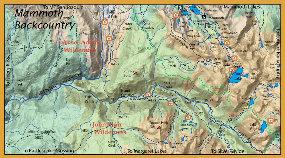
Duck Pass Trail starts at the TH above Lake Mary. It is a 10 mile round-trip hike to Duck Lake with a 2000’ elevation gain. There are four lakes to fish: 1. Arrowhead Lake 2. Skelton Lake 3. Barney Lake and 4. Duck Lake.
Arrowhead Lake
Arrowhead Lake (12 Acres) is about one mile from the trailhead at 9,800′. It is shaped like an arrowhead with a large rock outcropping on the southern end. The preferred areas to fish are the inlet and outlets of this lake. Arrowhead Lake holds Brookies and Kamloop Rainbows of a smaller size, 10-13″.
Skelton Lake
Skelton Lake (9,900′ ele) is about 1/2 mile further or another 15 minute walk. Skelton is a 12 acre lake with Brookies. Fish the inlet side among the reed beds.
Barney Lake

Barney Lake, 9 acres, is another 3/4 mile or 30 minute hike further at 10,100′. Fish the shoreline opposite the trail. Barney contains Brookies. Barney Lake was named after Bridgeport resident, Barney Peeler.
Duck Lake
Duck Lake (222 acres) is about a 2.5 hour (4 mile) hike going up to 10,450′. Duck Lake consists of Rainbows and Brookies. The ‘bows can get up to 2-5 lbs. in this lake. Fish the Duck Lake outlet after snow melt, up to 16” rainbows. The inlet creek on the east shore from Pika Lake is also good.
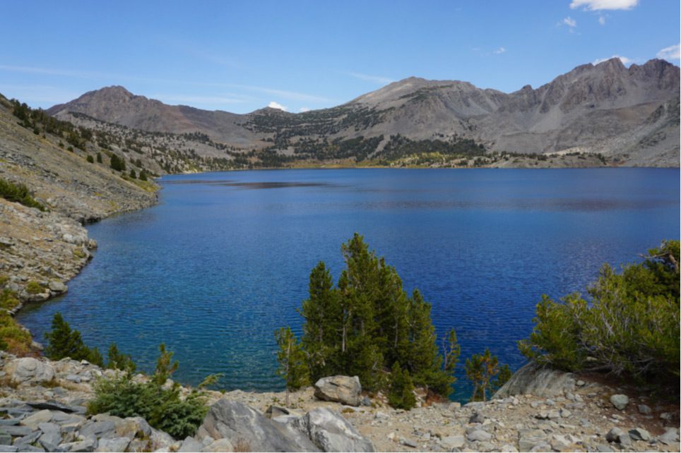
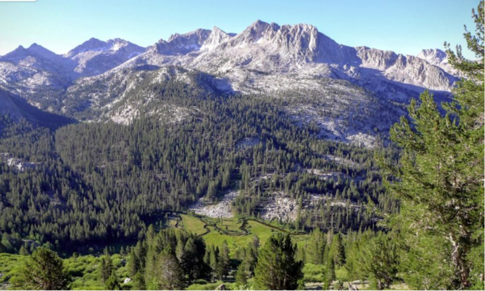
Fish Creek (Cascade Valley)
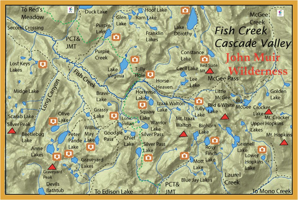
Fish Creek can be accessed by a hike-in from Lake Mary (Duck Pass) or McGee Creek (McGee Pass). Three pack stations are also available: Red’s Meadow, Mammoth Lakes Pack Outfit or McGee Creek Pack Station. Fish Creek begins at the headwaters of Red and White Lake below McGee Pass.
It is a 26 mile point to point trip from Lake Mary to McGee Creek. Trail drops into Fish Creek below Purple Lake and Tully Hole.
Fish Creek flows through Cascade Valley on the way to the Middle Fork of the San Joaquin River for about 19 miles. This area is also known as the northern portion of the John Muir Wilderness. The headwaters consists of a number of pocket pools containing Brookies, Rainbows and Rainbow-Golden hybrids in the 6-8" range at about 10,350 feet.
Tully Hole
Tully Hole. Within a lush meadow is Tully Hole (elevation 9,600 feet), a good location for dry flies. This area has 6-10 inch brookies as well as some Rainbows and Rainbow-Golden hybrids.
Two footbridges that cross the creek, one ¾ mile below Tully Hole and one 1 .75 miles below Tully Hole.
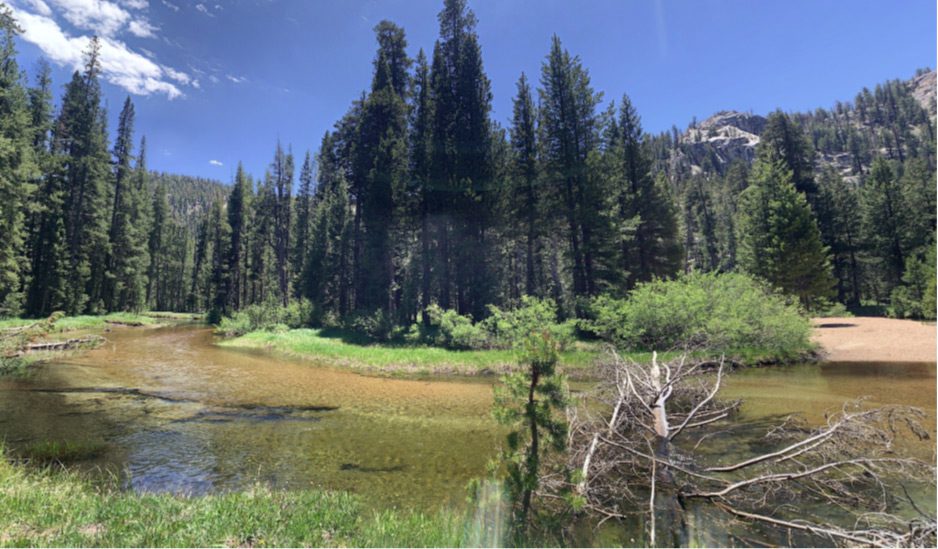
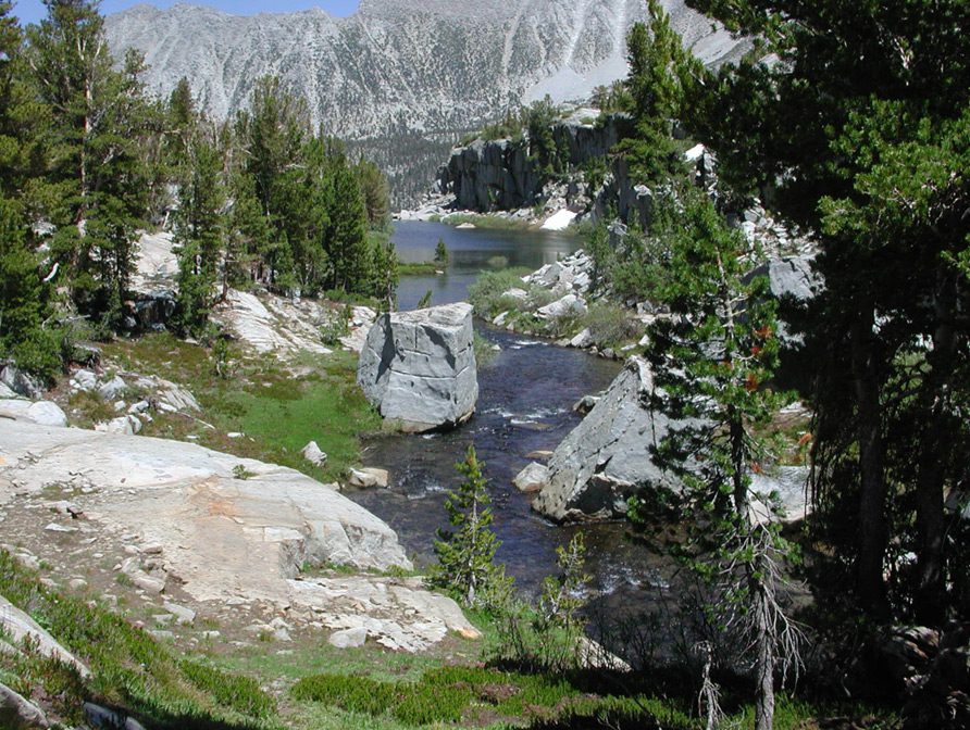
Fish Creek has 5-6 waterfalls as it descends Cascade Valley. Between waterfalls, the creek will be a freestone type creek with pools, runs, and pocket waters. 10-12” Rainbows and Golden Hybrids.
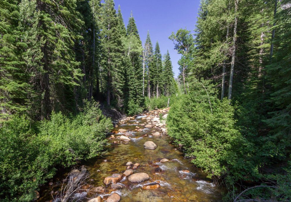
This is a photo from Fish Creek Bridge in Cascade Valley. Trail 26E22 follows Fish Creek through Cascade Valley.
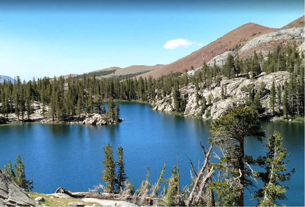
Lake Virginia
Lake Virginia: (98 acres) at an elevation of 10,320 feet known for large Goldens. They have been planted since the 1930’s and the California State record was caught here in August, 1952 at 9 lbs 8 ounces. The lake does not have adequate spawning tributaries to enhance the population but does have a rich source of insect life to allow the few Goldens to get to a size of 11-16 inches. Distance from Duck Pass Trailhead is 12 miles.
Purple Lake
Purple Lake has some large Rainbows, Brookies, and some Golden/Hybrids.
McGee Canyon

McGee Canyon is named after two brothers, Alney and Bart McGee, in 1872 who homesteaded the area. They established livestock trails over McGee Pass accessing Fish Creek on the other side of the Sierran Crest. A Titanium mine (Scheelore Mine) was established in 1944 and a service road was built by the Public Roads Administration up Baldwin Canyon. The mine ceased operation in 1955.
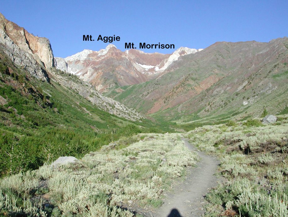
This is a beautiful canyon to explore with the red, white, and gray walls of metamorphic slate exposed from the slopes of Mt. Baldwin, Mt Agee, and Red and White Mountain. Super wildflower displays in the Spring.
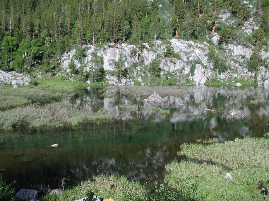
Beavers were introduced into the area in the 1940’s. The beaver activity helps to increase in the number of riparian plants along the banks of the creek as well as improving the clarity of the water downstream. For us fly fishermen, they also provide a great site for using dry flies with the plenty Brookies and Browns that reside within these ponds.
Below Big McGee Lake, the creek is filled with Brookies and Rainbows.

Slide 60: Big McGee Lake. 7.5 Miles from TH at 10,550’ ele. Consists of Brookies and Rainbows. McGee Pass is just 1.3 miles further and will provide entry into upper Fish Creek.
Rock Creek & Rock Creek Lake
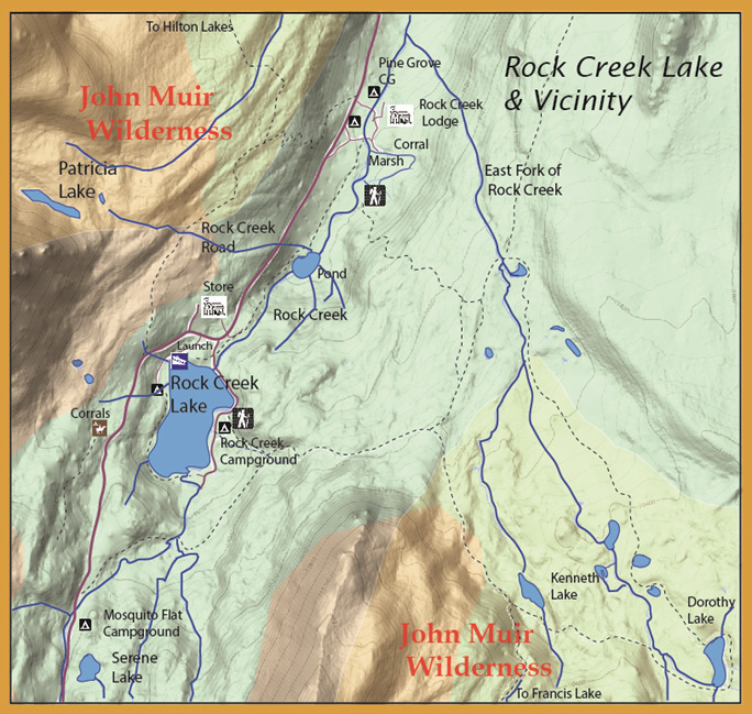
Rock Creek & Rock Creek Lake
Lower Rock Creek
The outlet of Rock Creek is the Owens River near the powerhouse at the end of the Owens Gorge. Rock Creek is a small stream and brushy. 7.6 mile trail along the creek from Hwy 395 to Paradise CG. Stocked with hatchery plants weekly during the summer.
Tom's Place
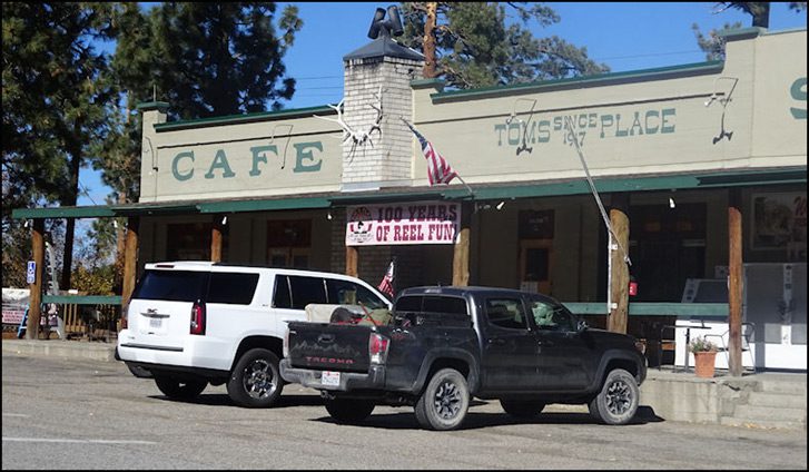
Tom’s Place. This small community on Highway 395 at the opening of Rock Creek Canyon started out as Hans Lof, named for the man who started a resort here in 1919. In 1922, Tom Yernby bought the resort from Hans and renamed it after himself.
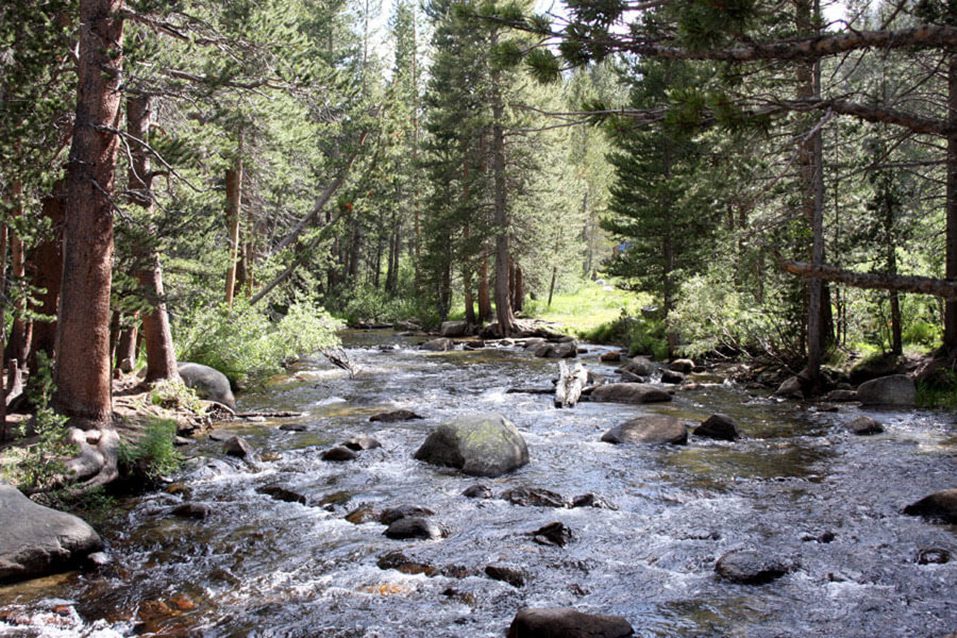
Starting at the Pine Grove Campground area, the creek slowly meanders this area , requiring waders. The section holds many small brookies and browns. Rock Creek is a freestone stream that is mostly steep pocket water but has some areas below the lake that are slow enough for dry flies. The creek has a good supply of Brookies, Browns, and Rainbows while the lake is known for it’s Browns, Rainbows, and Cutthroats.
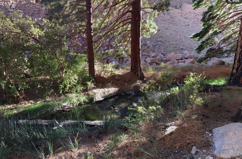
Rock Creek Pond
Rock Creek Pond is located below Rock Creek Lake. .Created by local beavers. Holds plenty of Brookies with a trail access from the parking lot
Rock Creek Lake
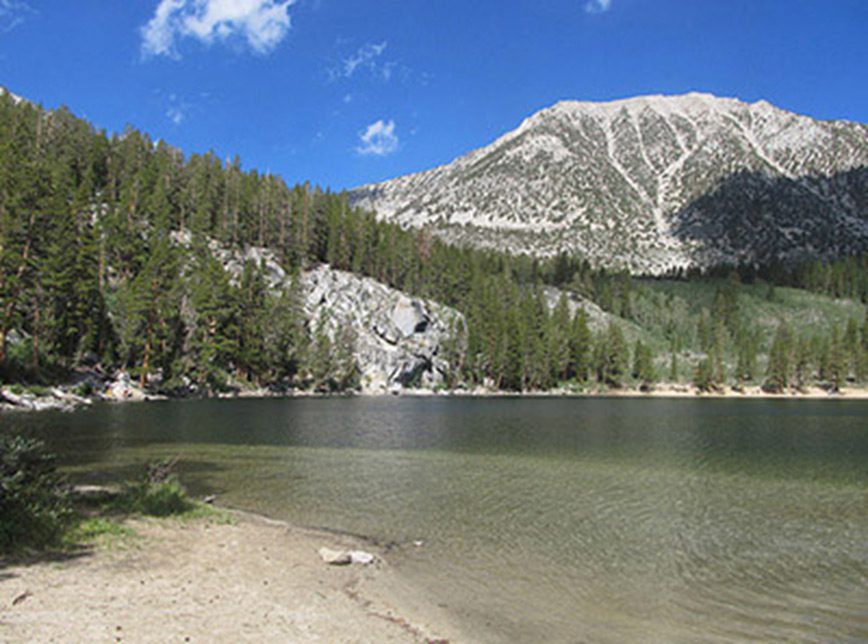
Rock Creek Lake can be fished with waders near the boat launch or, better, with a float tube. Use streamer patterns and sinking lines. Water is clear and cold. Another good spot to float tube is the inlet side of the lake near the creek. The lake is planted heavily with Rainbows in the 12-13 inch class. The trout can holdover to larger sizes and can have some rather large Browns and, perhaps, a few planted Alpers Rainbows. The lake record for Rainbow is 12 Lbs.13 oz. Brookies can also be found within the lake in the 9-12 inch size.
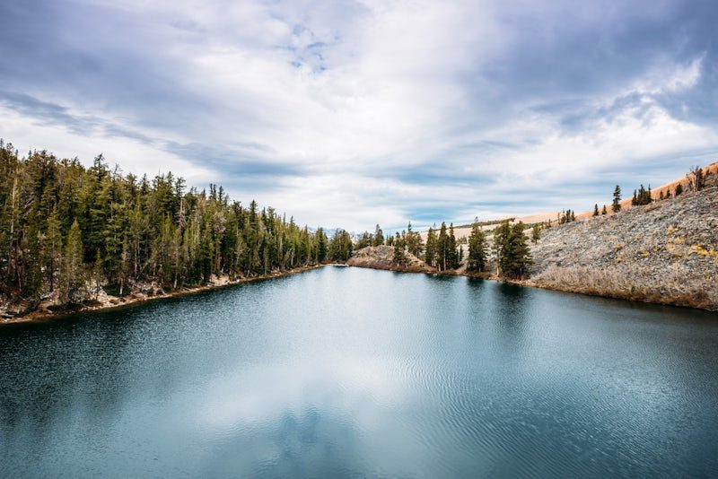
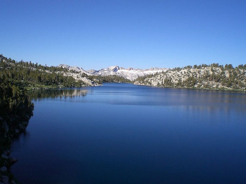
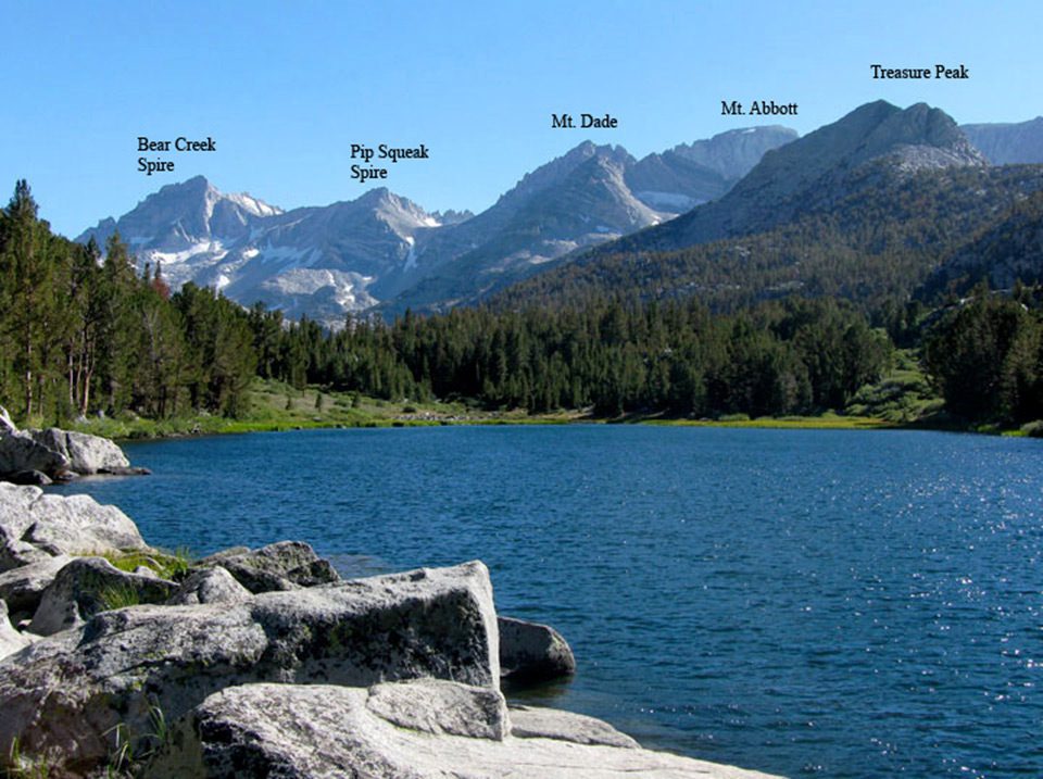
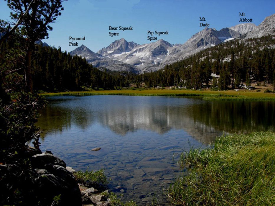
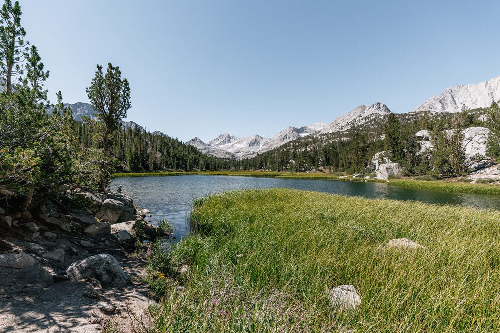
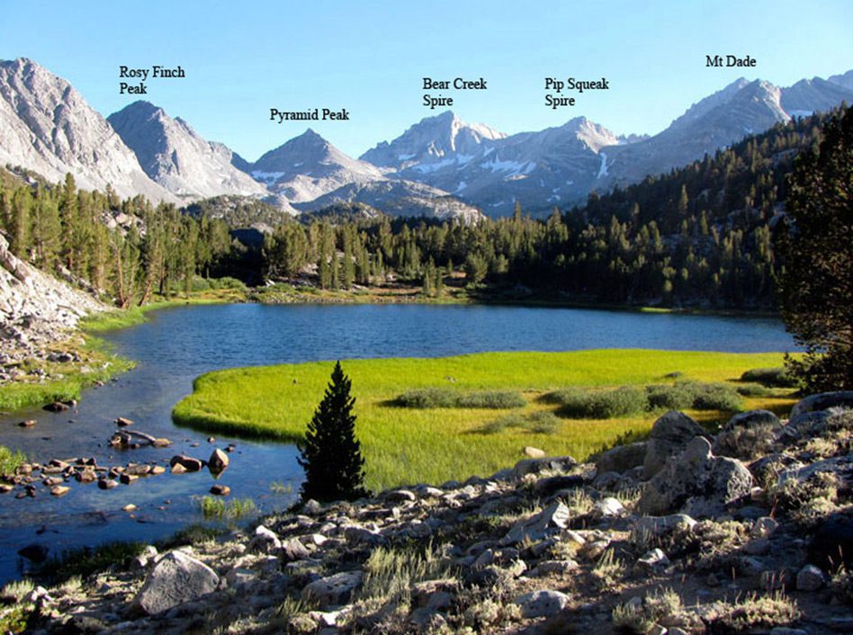
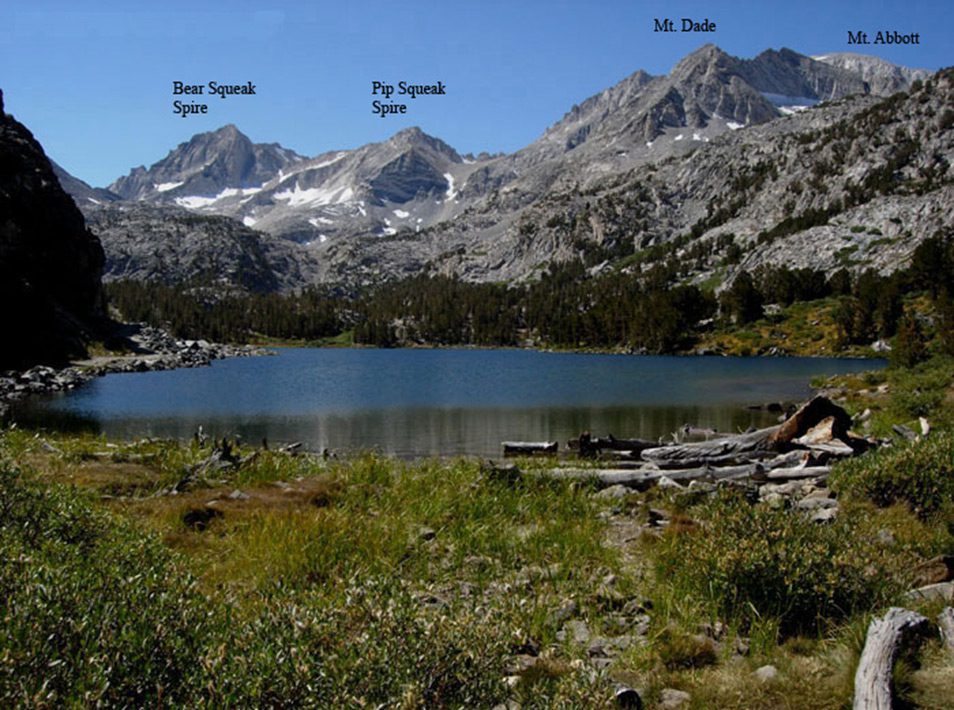
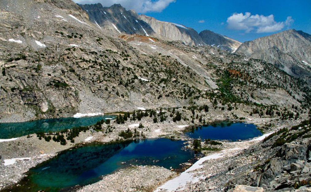
Little Lakes Valley

Little Lakes Valley is a classic glacial cirque with a rim of high, jagged peaks. As the glaciers retreated, it left lateral moraines from which a number of lakes formed. This area has at least two dozen lakes within a day’s walk and climbs of less than 400′.
Ice-out in Little Lakes Valley is in late May or early June. The valley remains very wet until mid-August and is a haven for mosquitos. Summer thunderstorms are also a common occurrence. The main trail used to be the service road for the Pine Creek Tungsten mine and was abandoned in the late 1950’s. The trail forks off to the right going to Mono Pass and PCT. The left fork goes over Morgan Pass to the defunct mine. The area offers the chance to get a Sierra Grand Slam in one day. The streams throughout the area hold numerous brookies 7-10 inches.
Mosquito Flats Trailhead
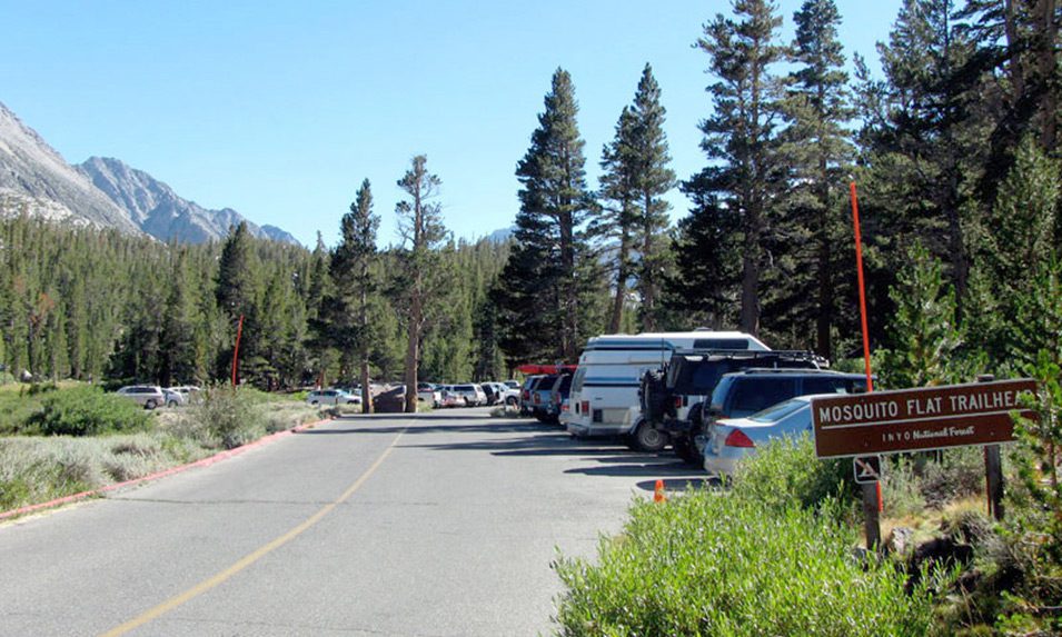
Little Lakes Valley can be accessed from behind Rock Creek Lake at a trailhead, Mosquito Flats . At 10,230 feet elevation, Mosquito Flats is one of the highest places within the Sierra that you can park. The parking area is very crowded during the Summer so that parking may be restricted. Your best bet is to arrive in the early morning or midweek.
Mack Lake
Mack Lake. Starting at 10,300′, a 0.5 mile walk will bring you to 4 acre Mack Lake (ele 10,470) with mostly Brookies and some Browns in the 7-11 inch class. The inlet has a dense growth of reeds so most fish the southern shoreline or the outlet where there is deeper water. The trail runs along the northern shoreline with sheer cliffs to the lake.
Marsh Lake
6 acre Marsh Lake (ele 10,480) is about 1 mile from the trailhead. Contains Brookies and Browns in the 7-10 inch class.
Heart Lake
About 1 mile from the trailhead is Heart Lake (ele 10,500 with Brookies, Rainbows, and Browns in the 7-10 inch class. Heart has two inlets, one from Ruby Lake, the other from Box Lake. A good location to fish is to cross Rock Creek below Heart’s outlet and fish the southern shoreline.
Box Lake
About 1 mile from the trailhead is 13 acre Box Lake (ele 10,600) with Brookies, Rainbows, and Browns in the 7-10 inch class. As with all the lakes, the inlets and outlets are the best locations.
Long Lake
About 2 miles from the trailhead is 25 acre Long Lake (ele 10,550) consist of Rainbows, Browns, and Brookies 7-10 inches.
Chickenfoot Lake
2.75 miles from TH, 22 acre Chickenfoot Lake (ele 10,750) consists of Brookies, some Rainbows , 7-10 inches.
Gem Lakes
Gem Lakes. Three Lakes at 11,000’ elevation. All with Rainbows.
Treasure Lakes
Treasure Lakes. Four Lakes. The northern two (farthest) have Goldens, the southern two (nearest) have Brookies.
Ruby Lake
Ruby Lake. At an elevation of 11,150 feet. This 35 acre lake is 1.5 miles from the trailhead with an 800′ vertical climb. The trail branches off to the right of the main trail at Mack Lake. The lake has a rocky shoreline with better access along the northern shoreline. There are three inlets, one from nearby Mills Lake, and one outlet. Ruby holds Brookies in the 7-10 inch class.
Pine Creek Canyon
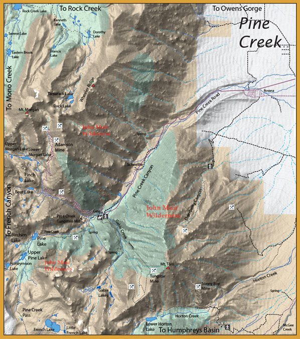
Pine Creek Canyon is an area with a long history of mining during the 1900’s. The mine was closed in 2001 but the area still enjoys a great deal of interest among fly fishers and rock climbers. At the end of Pine Canyon Road is the Pine Creek Pack Station providing horse packing into the interior as well as a trailhead into the French Canyon, Piute Canyon, and Humphries Basin.

Pine Creek flowing through the canyon from the road end to the community of Rovana has a good population of both Browns and Rainbows. It is a freestone stream of heavy riparian overstory with riffles and pools.
Pine Creek Weir is just above Rovana. Fishing under an indicator or with the Euro nymph produces lots of fish for anglers fishing middle of the day.
Pine Creek Mine
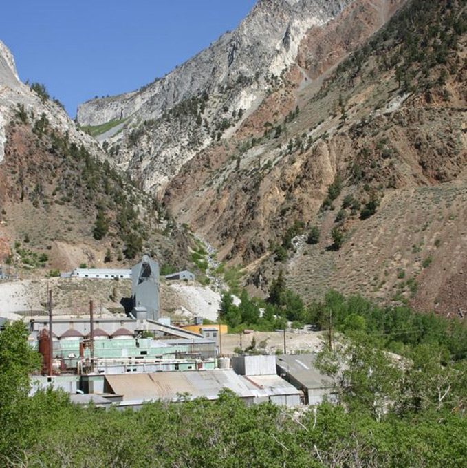
The claims were worked during and shortly after World War I to produce scheelite concentrates, which were packed down the trail on mule back. Tungsten extracted from the scheelite was used to make durable steel alloys, and thus was in high demand. The US Vanadium Corporation acquired the property in 1936 and began developing it into a world-class producer of tungsten. By 1942, the mine had become the largest producer of tungsten in the country. The Pine Creek tungsten mine was a major contributor to the economy of the Eastern Sierra for nearly 54 years before being mothballed in 2001 due to the availability of low-cost imports from China.
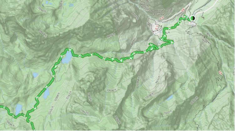
Taking the Pine Creek Trail west from the Pine Creek trailhead through the Pine Creek Pack Station, you start at 7,400 feet elevation and pass through a grove of Aspen, Birch, Juniper, Jeffrey Pine, and Red Fir. In about a mile, the trail merges with a mining road to the defunct Brownstone Mine. The mine is another mile further up the trail at 9100 feet elevation, so you would have climbed over 1700 feet within the first two miles of the trail. You will reach the John Muir Wilderness Boundary at the 2.25 marker and it’s another 1/2 mile before you are along the cascading Pine Creek below Pine Lake at 9800′.
Pine Lake to Honeymoon Lake
Pine Lake: About 3.3 miles from the trailhead at 9,942 feet. The trail wraps around the northern portion of the lake. Pine Lake consists of Brookies. Upper Pine Lake: 4.25 miles from the trailhead at 10,200′. Consists of Brookies and Rainbow Trout.
Honeymoon Lake: At 5 miles from the trailhead the trail forks . The left fork heads up to Pine Creek Pass. To the right fork, you will see Honeymoon Lake (10,440′). Also consists of Brookies and Rainbow Trout.
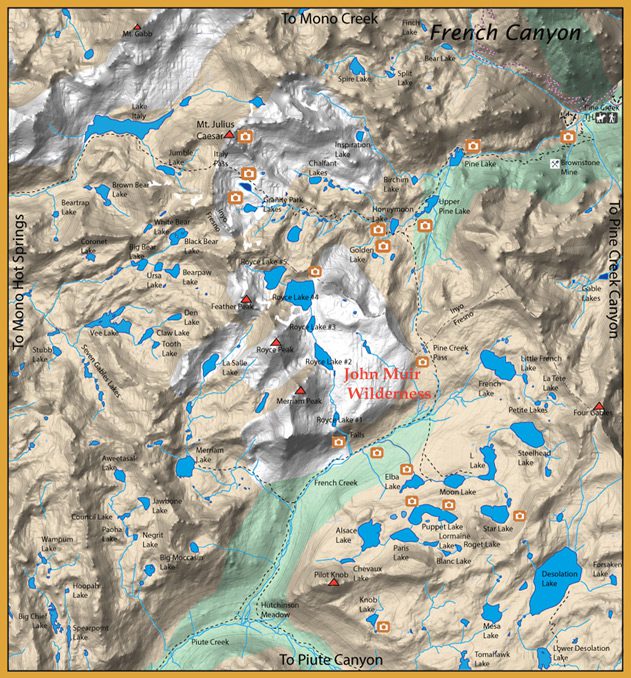
6 miles from TH to French Canyon over Pine Creek Pass. Most of the lakes were named by Ralph Beck (CA Fish & Game) prior to 1950 when he returned from France in WW2. Many lakes are reached off-trail. Big French, Royce Lakes, Puppet, Star, and Paris Lake are known for Goldens up to 18”