Quincy and Indian Valley – tributaries to the NF Feather

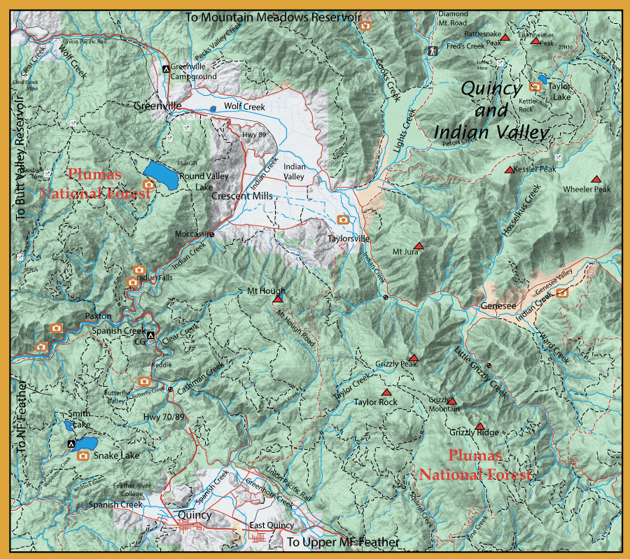
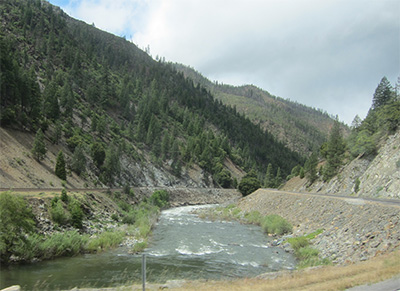
Directions: It’s on Highway 70 in Northern California in the northern end of the Sierra Nevada mountain range. Quincy is located between Oroville, CA and Portola, CA. To the North on Highway 89 is Greenville, CA and then Chester, CA. Quincy is at 3,432 feet elevation which brings snow in the Winter. During snow storms and fog, check for road conditions before traveling there. Highway 70 on the West side of Quincy is the North Fork Feather River in the Feather River Canyon which is over an hour’s drive on windy roads and through some great tunnels and over some great bridges. Coming from the East is around an hour and a half drive from Reno, more or less. | ||
Notes:
Spanish Creek originates from the east side of Spanish Peak and flows through Meadow Valley and Quincy. It flows northwest within a gorge that includes the Union Pacific Railroad line until it meets with Indian Creek. This provides about ten miles of fishable water, including pocket water, runs, riffles, and large pools. Spanish Creek tends to retain cooler water for a longer period of time than Indian Creek and other tributaries due to springs that flow into the creek. Early season is best and usually has good fishing until mid-July when flows become slow and temps get too warm. There is a resident population of Browns and Rainbows. The waters near the campgrounds and parks used to get stocked with hatchery trout but this was discontinued after 2010. Another good stretch is downstream from Oakland Camp, at the end of the paved Oakland Camp Road, a dirt road continues to follow the creek downstream for another two miles. This section can have both resident Rainbows and Browns, usually 8-12 inches, with some Browns up to 18″. Spanish Creek can have hatches of Caddis, Mayflies, and Stoneflies allowing the use of both dries and nymphs. Indian Creek is a good fishable stream for small browns. It tends to be off-color which allows you to stalk up to the fish. The stream is best fished once flows slow down after the Spring run-off until mid-July. The lower portions of the creek below Mocassin has a nice population of spotted and smallmouth bass. The better trout fishing is upstream of Taylorsville, proceeding through the Genesee Valley. There are numerous areas to park and gain access to Indian Creek from Genesee Road. The road continues along Indian Creek to the spillway of Antelope Lake, about ten miles from Genesee Valley. The stream is not deep and can be fished both with dries and nymphs. Good Hatches of Yellow Stones, Caddis, and Pale Morning Duns. Taylor Lake (6803′ ele): Take Road 27N10, a gravel road called Beardsley Grade, about 11 miles from Indian Valley. Take the dirt road spur down to the lake in 3/4 mile. The lake is fairly deep during the early Spring and may require sink-tip lines to reach the fish. The lake level drops during the summer and floating lines will work fine. Use Bugger patterns, damsel nymphs, and small streamers. Contains Brook Trout, some up to 16 inches. Round Valley Reservoir, also called Bidwell Lake, is the recreational paradox of the Feather River region. Lying at a 4,500 foot elevation, this is a 350 acre lake ringed by fragrant conifers. It appears to be an ideal trout water. Ironically, the lake is a warm water fishery, and contains numerous large-mouth bass plus such an abundance of blue gill that almost everyone who tries catches fish. The California record for large-mouth black bass was a 14-pounder taken from Round Valley in 1948. Campgrounds with running water, sanitary and shower facilities, and a boating concession operate here during the vacation season. No swimming is allowed since the lake provides domestic water for Greenville. A bird watcher’s paradise, the lake has over 100 resident species. Lights Creek: Contains small Browns at the lower elevations and Brookies in the higher elevations above 4000 feet. Wolf Creek: Contains small Browns at the lower elevations and Brookies in the higher elevations above 4000 feet. Cooks Creek: Contains small Browns at the lower elevations and Brookies in the higher elevations above 4000 feet. | ||
Fishing RegulationsEast Branch of the North Fork Feather River: Open last Saturday in April to Nov 15th. No restrictions. 5 fish limit. Ten in Possession Indian Creek and Spanish Creek Last Saturday in Apr. through Nov. 15. No restrictions. 5 fish limit. Ten in Possession Round Valley Reservoir: Open all Year. 5 fish limit.
| ||


