 |
|||
Suggested Flies for Silver King Creek area: | |||
|
Dry Flies: |
Nymph Flies: |
Stillwater Flies: |
|
|
Directions: 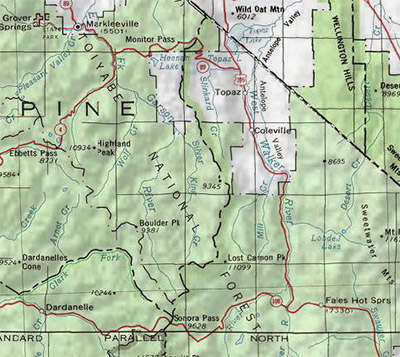 Silver King Creek. At junction of Highway 89 and 4, Turn East and continue on Hwy 89 toward Monitor Pass. Go 4 miles up steep hill and turn right onto a dirt road just south of Heenan Lake. This road will take you into Bagley Valley and reach Grays Crossing in 5.2 miles. Continuing southeast another 1.6 miles you reach Vaquero Camp and the trailhead starts from there. | |
|
| |
|
Notes: 
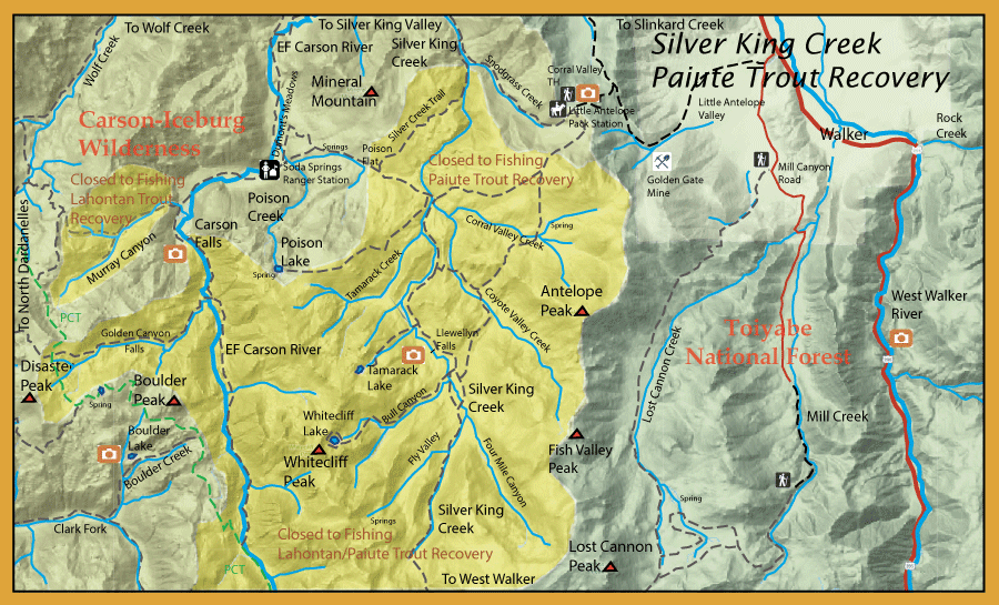
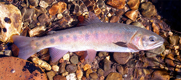
For thousands of years, the Paiute cutthroat occupied an 11 mile stretch of Silver King Creek and the lower sections of Coyote Valley Creek and Corral Valley Creek. These fish were related to the Lahontan cutthroats but developed within a entirely separate basin drainage. A natural barrier, Llewellyn Falls, kept these fish confined to a small canyon downstream. However, in 1912, a Basque Sheepherder transplanted some of these trout above the falls and a new separate population was able to get established. The same was true for Corral Valley and Coyote Valley Creek but it is unknown when those transplanted above it's barrier falls were made. Starting in 1964, Rotenone treatments were used above Llewellyn Falls to eliminate the hydrids and reestablish the Paiute natives. This had mixed results as hybrids seem to always appear years later. In 2013 to 2015, a concerted effort was made to chemically treat all of Silver King Creek and it's tributaries down to Silver King Canyon, where a series of waterfalls created a natural barrier. A three year moniter of the streams found no further fish and CDFW began reintroduction of the Paiutes from the pure strains that resided in Fly Valley and Four Mile Canyon creek. So, that's why it is closed and you can't fish there....yet.
Mill Creek: Treated with Rotenone in 1988 and 1989 to eradicate non-native Brook Trout. Lahontan Cutthroats were transplanted from By-Day creek in 1992, the only endemic population within the Walker Basin. Now, open to fishing with barbless flies, catch & release only. EF Carson: The EF Carson from Hangmans Bridge to Carson Falls is open to fishing from last Satruday in April to Nov 15th. The stretch from Carson Falls to the confluence of Wolf Creek is designated as Wild Trout water. Downstream of the confluence with, Wolf Creek CDFW will plant rainbow trout periodically. A fish survey was conducted in 2008 be CGFW in which they found that above Carson Falls they only observed Lahontan Cutthroats which were mostly under 6 inches in length. The fish density was estimated at 230 fish per mile and the water was classified as mostly flatwater with some pools and riffles. The avg depth was 1.1 feet and the avg width about 18 feet.The stretch below Carson Falls has a mixture os Rainbows, Lahontans, Brook Trout, and Brown Trout. Most of the fish are small, less than 6 inches. Mostly flatwater with a 1.4 feet average depth and an avg width of 22 feet. The density of fish was determined to be about 578 fish per mile.
| |
Fishing Regulations (Effective March 1st, 2021)Mill Creek (Mono Co. tributary to West Walker River) and tributaries upstream from confluence with Lost Cannon Creek: Open all year. Artificial flies with barbless hooks. 0 trout. West Walker River (Mono Co.) from the confluence with the Little Walker River (Hwy. 395 bridge at mile marker 96) downstream (north) to the inlet of Topaz Lake: From the last Saturday in April through November 15, 5 trout daily bag limit, 10 trout in possession; and, from November 16 through the Friday preceding the last Saturday in April, 0 trout bag limit, artificial lures with barbless hooks only and trout must be released unharmed and not removed from the water. Coyote Valley Creek and tributaries (Alpine Co.): Closed to all fishing all year. Silver King Creek and tributaries (Alpine Co.) upstream of the confluence with Snodgrass Creek: Closed to all fishing all year. Corral Valley Creek and tributaries. (Alpine Co.): Closed to all fishing all year. Coyote Valley Creek and tributaries (Alpine Co.).: Closed to all fishing all year. Murray Canyon Creek and tributaries (Alpine Co.) upstream from the falls located about 1/4 mile above the confluence with the East Fork Carson River.: Closed to all fishing all year. All other Lakes and Reservoirs: Open all year. No restrictions. 5 trout per day. 10 trout in possession. All other creeks and tributaries: From the last Saturday in April through November 15, 5 trout daily bag limit, 10 trout in possession; and, from November 16 through the Friday preceding the last Saturday in April, 0 trout bag limit, artificial lures with barbless hooks only and trout must be released unharmed and not removed from the water.
|
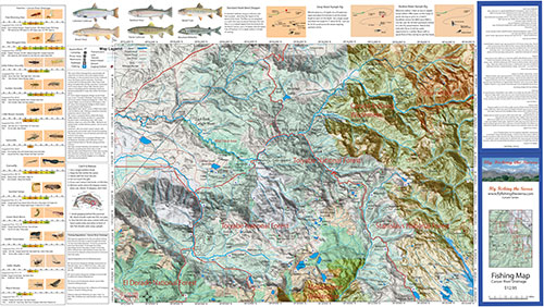
Fishing Map AvailableCovers the watershed areas of the Carson River within the Sierra. Shows topographic relief, GPS Long./Lat., camping areas, road access, and Trailheads. Special Features are Suggested Flies, Nymphing Rigs, Fishing Season and Regulations, Fish Identification, Catch & Release Procedures, and Stream Etiquette guidelines. Printed on Rite-in-the-Rain Paper that will allow you to write those special notes. Waterproof and Durable. |
Carson Drainage
|
$12.95 eaPurchase Here |
 Paiute Cutthroat