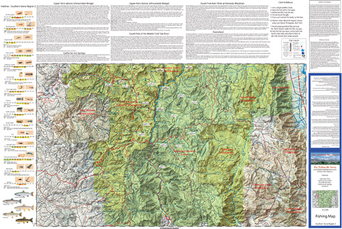
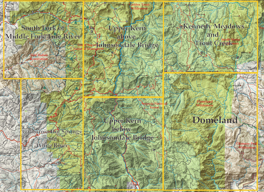
 Click the map or the link for a detailed map of the area: |
||||
|
1. South Fork of the Middle Fork Tule River
2. California Hot Springs and White River
|
3. Upper Kern River above Johnsondale Bridge 4. Upper Kern River below Johnsondale Bridge
|
5. Kennedy Meadows and Fish Creek 6. Domeland |
||
|
| |||
Fishing Map AvailableCovers the South Fork of the Middle Fork Tule River, California Hot Springs, Upper Kern River from Kernville to Kern Flat, South Fork Kern through Kennedy Meadows and Domeland Wilderness. Shows topographic relief, GPS Long./Lat., camping areas, road access, and trailheads. Special Features are Fishing Season and Regulations, Fish Identification, Catch & Release Procedures, and Stream Etiquette guidelines. |
Southern Sierra Region 2
|
$12.95 eachPurchase Here
|
|